|
Project Name: 3D Geographical Modeling
By: Erik Laberge & Qasim Asad
 Description: Description:
This is a 3D
Geographical Modeling program that allows a user to take geographical data
from a text file and display the information contained within in a 3 Dimensional
Visual format.
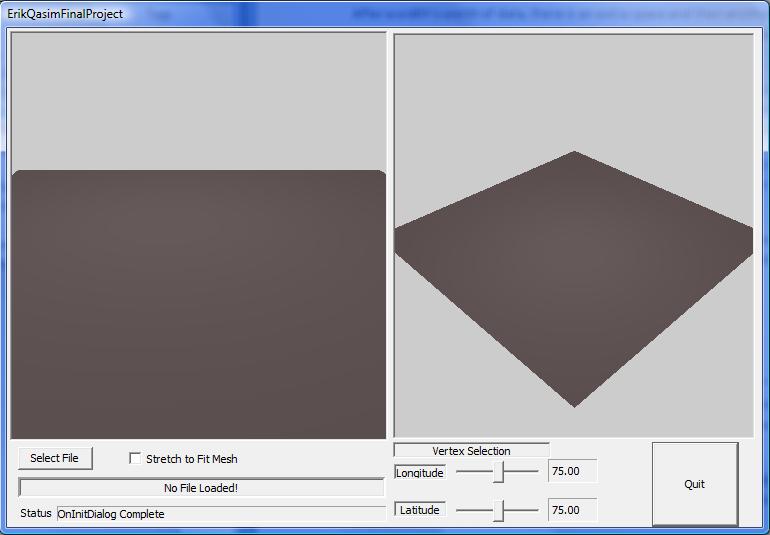
At the start of the
program, the user is presented with a blank 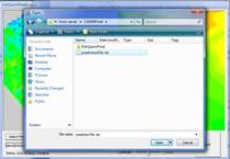 mesh
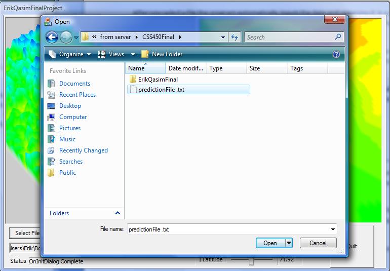
containing now visual data. The user must select a data file that has been
properly formatted in a specific way so that the program will be able to read
and interpret the data. We have included a data file that contains
geographical data as an example called “Prediction.txt” that will work with
the program. mesh
containing now visual data. The user must select a data file that has been
properly formatted in a specific way so that the program will be able to read
and interpret the data. We have included a data file that contains
geographical data as an example called “Prediction.txt” that will work with
the program.
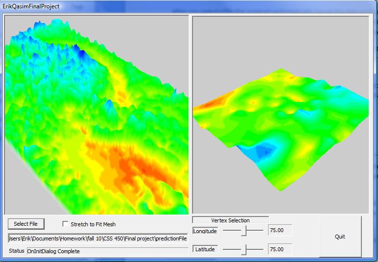
After selecting the
prediction file, the program will begin to 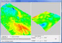 read
the data within the text file. It will take about 10-20 seconds depending on
the speed of your machine to read and interpret the data. Once the process
has finished, the program will convert the data into a 3 dimensional mesh
that represents a terrain and the temperature of the terrain determined by
the color (Blue are cooler areas, and red are hotter areas). The view on the left provides an overview
of the entire geographical area within the text file, while the view on the
right contains a more detailed look at a specific point on the map being
displayed on the left, which you can scroll through with the Latitude and
Longitude scroll bars. The user can zoom in and out of the left and right
map, by clicking on one view first, and then using the mouse scroll. read
the data within the text file. It will take about 10-20 seconds depending on
the speed of your machine to read and interpret the data. Once the process
has finished, the program will convert the data into a 3 dimensional mesh
that represents a terrain and the temperature of the terrain determined by
the color (Blue are cooler areas, and red are hotter areas). The view on the left provides an overview
of the entire geographical area within the text file, while the view on the
right contains a more detailed look at a specific point on the map being
displayed on the left, which you can scroll through with the Latitude and
Longitude scroll bars. The user can zoom in and out of the left and right
map, by clicking on one view first, and then using the mouse scroll.
Download
Proposal
Download
Report/User Manual
Download Executable
|