MASS WASTING MODULE HOMEPAGE
By Abigail Hook and Jennifer Shiu
Contents:
INTRODUCTION
The purpose of this module is to develop information, which leads to the rating for mass wasting for geographic zones of the Washougal watershed. Although landslides and delivery processes occur naturally, we attempted to isolate human activities related to forest practices that contribute to unnatural mass wasting. We then compared models which alter these activities to prevent such occurrences.
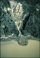
Increased landslide rates are attributed to many factors. Road building disrupts and concentrates subsurface drainage, often creating points of water concentration. Road sidecast can overload and oversteepen already steep slopes. Tree removal increases the amount of rain that reaches the soil because of the loss of canopy interception, and also increases the rate at which snow melts during both rain-on-snow events and spring snowmelt. Soil strength is reduced by the decay of anchoring roots in the years following tree harvesting. Yarding operations can disrupt natural drainage pathways and can result in gullies infilled with woody slash, increasing the potential for or magnitude of debris torrents.
There are three landslide-related issues to be considered. The first issue is the potential for slides to occur in a particular area. This can be assessed on the basis of the number of events that has occurred both in natural settings and in association with forest development activities. The more slide sites there are, the greater the potential for future mass wasting events.
The second issue is that of delivery. Delivery is defined as the potential for the slide debris to enter a stream. The highest risk sites are those where there is a continuous slope to the edge of a stream. In these situations, opportunities to prevent a slide from impacting the stream are limited. The least risk sites are those where the stream is separated from the slope by a broad valley flat.
The final issue is the potential for transfer of material down the stream after it has entered a watercourse. Sediment transport, particularly of coarse material, is a function of stream gradient. The steeper the gradient, the more material moved and the greater the distance of travel. Low gradient sections of channel are typically braided (multi-channel) as a result of sediment deposition.
For our purposes, we used ArcGrid, a Geographic Information System (GIS) program which converts data coverages provided by the state Department of Natural Resources (WSDNR) and into 30 m by 30 m grids of average values. This program is excellent at watershed analysis as it provides general values for large areas which more specific coverages may be laid over. A few of the GRID functions, coverages and grids used as a basis in the mass wasting analysis included slope, curve, other modules, such as Soils, Surface Erosion, LULC, and Hydro, and the digital elevation map (dem). With this information, we were able to write AMLs (Arc Marcros) which calculate high risk areas of mass wasting based on commonly used equations such as the Shaw Johnson Model and the Infinite Hillslope Equation.
Back to Top.
The following maps have been generated by writing Arc Macro's (AMLs) and utilizing the WSDNR coverages, which interpret the mass wasting processes relative to areas of sensitivity. We chose these particular methods and models because they utilize different characteristics that affect mass wasting, such as soil type, slope, precipitation, and harvest conditions.
The first map created is based on the Infinite Hillslope Equation which analyzes slope (degrees), vegetation cover weight, friction angle of soil, soil cohesion strength, root reinforcement, soil thickness and weight of saturated soil. In estimating the stability of a designed structure, it is frequently helpful to compare the magnitude of the forces acting to resist failure to those forces acting to initiate failure. This ratio of stabilizing to destabilizing forces is called the Factor of Safety (FS). To find unstable areas, all grid cells with a factor of safety less than one are mapped. To compare different methods of harvesting, we attempted to create maps for both a total clearcut and a 50% thinning.
![]() FS < 1 Unstable Areas (Clearcut)
FS < 1 Unstable Areas (Clearcut)
For a 50% stand thinning, we used half (100 pcf) of the normal root reinforcement. This is a very conservative assumption as a well done thinning actually increases root reinforcement. We found that there were no areas which had a Factor of Safety < 1 which does not allow us to create a map. This means that thinning will not affect mass wasting in the Washougal watershed.
![]() FS < 1 Unstable Areas (50% Thinning) CODE ONLY
FS < 1 Unstable Areas (50% Thinning) CODE ONLY
The next map is generated through the Shaw-Johnson approach which is based on an analysis of slope and concavity which results in the following table:
|
Slope (%) |
|||||
|
0-15 |
15-25 |
25-47 |
47-70 |
70+ |
|
|
CONVEX |
Green |
Green |
green |
Green |
yellow |
|
PLANAR |
Green |
Green |
Green |
Yellow |
red |
|
CONCAVE |
Green |
Yellow |
Red |
Red |
red |
Red indicates high risk, yellow indicated moderate risk and green indicates low risk for mass wasting.
Another important factor related to slope instability is flowing water. Precipitation on the surface of a hillslope either runs off the surface or infiltrates into the soil. While run off is an important factor in surface erosion, infiltration is an important factor of mass wasting. The rate at which water moves through the surface is called the infiltration rate. Mass wasting is most likely to occur when the infiltration rate is higher than the rate at which water passes through the soil's water table. This can be seen in Map 3, using the Pcrit equation, where the critical point is the point where precipitation falling is higher than the infiltration rate.
The fourth map analyzes the probability of failure for the given sub-basin. This is represented by the equation of Pfail. Pfail is an equation that uses management factors, such as treed, harvest, and fires, to predict the probability of a mass wasting. Because instability is a progressive process, the probability that management affects mass wasting is high.
This next model deals with landslide delivery. To identify which slopes will deliver sediment to streams, we need to identify at what slope delivery ceases. According to the Washington Forest Practices: Standard Methodology for Conducting Watershed Analysis Manual, slopes that are less than 3% will not contribute to sediment movement. This map identifies all slopes that will not contribute sediment to a stream even if they fail and also includes streams that may be in the path of a mass wasting.
![]() Non - Landslide Delivery for Slopes < = 3%
Non - Landslide Delivery for Slopes < = 3%
Mw7 maps areas for three different critical height classes of cut slopes. This is so roads can be built with confidence that the cut slope will not fail into the road.
This map can be used in conjunction with a map of tributary junction angles to compute the areas where a landslide can transform into a debris flow. Areas of debris flow occur where channel slopes are greater than 3.5° and the tributary junction angle are less than 70°. We attempted to create and aml that identifies all reaches in which a debris flow will stop (when gradients are less than 3.5 and tributary angles are greater than 70°). A model created by Lee Benda and Terrance Cundy analyzes the prediction of a debris flow. It uses two criteria for predicting a debris flow: channel slope and tributary junction angle, how much the landslide has to turn when it reaches the channel. Unfortunately, we were unable to produce a working aml code because of the difficulty in merging the directional units of channel slope and slope angle.
Back to Top
Map 1: Infinite Hillslope Equation
As you can see in Map 1, the areas susceptible to mass wasting (FS < 1) are generally those of steep slope and low soil cohesion. This, in combination with zero root reinforcement from clearcutting, provides for a more hazardous situation. When thinning root reinforcement levels (Root Reinforcement, R = 100 pcf - 50% of the original root reinforcement) were applied to the Infinite Hillslope Equation, there were no resulting unstable areas.
Map 2: Shaw Johnson Model
The Shaw Johnson Equation identifies many of the same unstable areas as the Infinite Hillslope Equation. It is important to note that these two equations did not share any of the same inputs except slope. The map shows much like Map 1 that the areas of concern are primarily located in the southwest region of the watershed where slopes tend to be steeper.
Map 3: Critical Precipitation Model
According to the Critical Precipitation Map, the areas most susceptible to failure, due to precipitation, are those that have steep slopes, low saturated conductivity, and/or high soil friction angles. This equation is primarily based on the soil type and the steepness. These areas of hazard are predominantly found at the top of ridges and near the edges of stream channels.
Map 4: Probability of Failure
The Probability of Failure map represents the probability that soil thickening since the last fire will push the soil beyond its critical thickness. As you can see, the areas of black are areas of NODATA. For some soil types, the values for soil cohesion and conductivity were zero. Unfortunately GRID does not execute any equation where zero values are present, which result in a NODATA value.
Map 5: Non-Landslide Delivery
Once we have identified areas of probable mass wasting, it is important to identify the slopes that will deliver sediment to streams. The map of Non-Landslide Delivery for Slopes <= 3% shows that the areas of importance are primarily the ridge tops and side slopes. In addition to showing areas of delivery and hazard, the map includes stream location and areas of potential hazard.
Map 6: Critical Height for Cut Slopes
The areas unstable for large cut slopes are most likely near to large streams
Map 7: Channelized Debris Flow
In addition to predicting areas of probable landslides, we attempted to predict areas where a landslide can transform into a channelized debris flow. A channelized debris flow forms when a shallow rapid landslide moves through steep, confined channel. It can then continue downstream a long distance, resulting in hazardous environmental impacts. Using map 8, we can assume those streams with a channel gradient less than 3.5° have a low probability of transforming into a debris flow.
Back to Top
The Factor of Safety is an efficient means of predicting areas of mass wasting due to harvest conditions. The reason for this is that the Infinite Hillslope Equation utilizes a majority of the soil data available into consideration. However, root reinforcement variables in this equation may not be accurate. There is very little chance that root reinforcement will ever reach 0 pcf. On average, it takes harvested Douglas fir roots six years to completely rot and thereby providing no root support. We assume in this six years that germination of pioneer species has occurred and added stability to the soil. Studies show that thinning actually increases root reinforcement over time when healthy trees are left. We can there draw the conclusion that thinning will not affect mass wasting when done properly.
The Shaw Johnson model cannot be compared to the Infinite Slope Equation directly as they use different inputs and serve only as separate indicators of potential mass wasting. This map is useful as it is our only analysis of mass wasting based on curvature. Not surprisingly the two maps show similiar areas of high risk thereby increasing the credibility and usefulness of both models.
The Critical Precipitation model utilizes a different theory of mass wasting. It is most applicable in areas that have the potential to be fully saturated, where an increase in throughfall is directly related to the amount of canopy cover that is removed. This is a factor that must be considered when logging, for it will increase the amount of precipitation which reaches the soil. Once again root reinforcement is assumed to be zero and implies a clearcut, which is not necessarily a realistic value.
Although the map of the Probability of Failure is not completely accurate, it can still be used in making predictions of possible failure. Because the Pfail equation is based on the friction angle of the soil and the soil angle slope, it is safe to assume that the probability of failure in these NODATA areas are moderate to high. We can base this prediction off of the Soils data and other related maps, Map of Potential Hillslope Equation. This map is similar to the Factor of Safety map. The reason for this correlation is that both equations are based on soil type and soil characteristics.
Within the Non-Landslide Delivery equation, The Landslide Delivery map is important because it can be combined with high areas of failure, channel sensitivity, and fish bearing streams to predict where mass wasting may seriously affect stream habitat. As seen in the Non-Landslide Delivery map, knowing the location of the streams can allow you to see the streams that are in danger of experiencing sediment delivery. The Non-Landslide Delivery map is also useful in showing roads that may not be prone to fail, but may be in the path of uphill failure, thus being washed out.
The Critical Cut Slope Heights map shows areas that are more susceptible to mass wasting if it were cut into. The model that specifies the cut height and degree of hazard was found in the Watershed Management Field Manual: Road Construction in Sensitive Watershed. This model utilizes an assumed road width, cut width and height, slope, and soil type. This map provides a basis as to where roads can be placed and how much can be cut done so as not to induce a failure.
Back to Top
CONCLUSION
In completing our mass wasting analysis, we can conclude that the entire Washougal Basin is not prone to failure. According to the models and maps produced, we can identify and assign areas a relative degree of hazard. Currently, the Washougal Basin is most unstable in the southwest region. This can be attributed to forest conditions, topography and soil type.
Within our analysis, we were able to identify conditions that can be hazardous to the watershed. Soil type is an important aspect in mass wasting. We have found that the most unstable areas seem to follow one specific soil type, Kinney. This is expected because this soil type has no cohesion strength, a low friction angle and a high saturation conductivity. We also found that harvesting can be detrimental to the stability of our watershed. The lack of root reinforcement, canopy cover and soil disturbances due to heavy equipment, are key factors in increasing the probability of mass wasting.
These assumptions and predictions can now be applied to the other watershed analysis modules. For instance, the channel module will use the predicted mass wasting and sediment delivery to identify channel sensitivity. The fish module may use the same information to analyze where fish bearing streams may be affected. The surface erosion module can use our predictions to analyze areas susceptible to erosion.
By using the ArcGrid method to perform a watershed analysis, this model can be useful in the future. Over time, as the watershed is harvested and experiences environmental changes, the watershed can once again be analyzed using amended data in this model. As new methods and models are created, the model can be easily updated. We found that this method of analysis proved to be accurate and efficient.
Back to Top
REFERENCES
Benda, Lee and Cundy, Terrance. Predicting Deposition of Debris Flows in Mountain Channels. Canadian Geotech.
27 January 1990, p. 409-417.
Food and Agriculture Organization of the United Nations. Watershed Management Field Manual: Landslide
Prevention Measures (13/4). September 1988.
Food and Agriculture Organization of the United Nations. Watershed Management Field Manual: Road Design and
Construction in Sensitive Watersheds (13/5). March 1989.
Hurvitz, Philip. Personal Interview. 18 January to 11 March 1998.
Krogstad, Finn. Personal Interview. 13 January to 11 March 1998.
Schiess, Peter. Personal Interview. 18 January to 11 March 1998.
United States Forest Service. Level 1 Stability Analysis (LISA) Documentation for Version 2.0. April 1992.
Reference Links:
Back to Top