Chapter 1 INTRODUCTION
The transportation plan for the Toutle Unit was developed by the senior forest engineering class at the University of Washington (spring, 1997) for trust lands managed by the Washington State Department of Natural Resources (DNR). The plan is meant to provide an analysis of road reconstruction options following a number of road failures and washouts in the preceding two winters. This analysis and the recommendations contained in this report are as extensive as allowed by the existing data, but further analysis may provide a higher level of detail once FRIS data becomes available for this unit.
1.1 Site Characteristics
The Toutle unit has been largely characterized by land exchanges with Weyerhaeuser and by the eruption of Mt. St. Helens. The intensive management associated with the first and the high levels of salvage resulting from the second have led to high road densities throughout the unit. Presently, a number of roads have been either orphaned or abandoned, and as many of these roads were not constructed to current forest practices standards it is predictable that the failures of recent years will continue into the future. A further disturbance in the road network is the dynamic nature of the river channel. As a result of the large debris flows and deposition of materials that occurred after the eruption, the main channel of the river shifts frequently across the width of the flood plain. This has resulted in washouts along the 4100 road, as well as cutting away the bank below the 4100 and other roads.
1.1.1 Location / Access
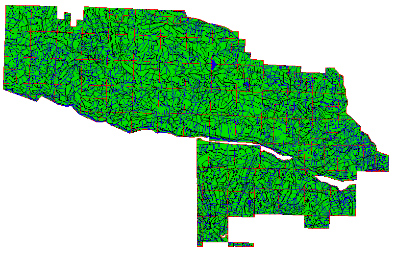
The Toutle Unit is located in the south-western region, just to the east of the city of Toutle. The general location of the Unit is shown in Figure 1 on the previous page. The unit area is XXXX acres. The area is accessed by the Spirit Lake Memorial Highway. Within the unit, the road system is oriented primarily West to East, with the road system dominated by the 2730/3000 road network at the ridge and the 4100 road in the valley bottom. The washouts and failures that precipitated this study are located largely along the 4100 road, although there are a number of mid-slope road failures associated with heavy debris flows.
Figure 1.1 DNR and Weyerhaeuser Ownership on the South Fork of the Toutle.
1.1.2 Neighboring Ownership
The forested located immediately across the South fork of the Toutle is owned largely by Weyerhaeuser (Weyco). To the North and East of the DNR ownership is a mixture of National Forest and the Mt. St. Helens National Monument. In the past, the road networks of the DNR and Weyco forest lands were linked through a number of bridges across the South fork. Currently no bridges remain in the East end of the unit. Figure 1.3 shows the areas of private ownership within the watershed. The absence of these bridges requires far longer haul times from the East end of the Weyco ownership due to issues of both grade and horizontal alignment. Access to the National Forest and Monument lands is primarily through other portions of the federal ownership and not through the DNR ownership.
1.1.3 Topography
The Toutle unit is located along the ridge between the North and South forks of the Toutle river. This unit varies in elevation from XXXX’ up to XXXX’ above sea level. The topographic relief ranges from mild in the flood plain and in some areas directly upslope on both forks to more extreme side slopes for the majority of the unit.
1.1.4 Timber Resources
The stands within the Toutle unit are either predominantly Douglas-fir (Pseudotsuga menziesii) or Noble fir (Abies amabilis). These are arranged in large blocks, with the Douglas-fir located in the lower elevation western end of the unit, while the Noble fir is dominant in the upper elevations of the east end. The majority of the Douglas-fir stands are either currently or will soon be eligible for thinning, while many of the Noble Fir stands originated following the post eruption salvage sales. A large number of stands in the unit were site indexed by the DNR as non-commercial forest land, and these stands were not included as sources of timber volume for the road network analysis. Field interviews and observations would indicate that the region is managing a number of these stands for timber, however. This should result in higher volumes of timber being removed through the road system, decreasing the costs per harvest for road construction and maintenance. Stands along the river bottom contain Red Alder (Alnus rubra) but the soil conditions in these stands make management for timber impossible. There are a few stands of old growth left from the previous harvest which include Douglas fir, western redcedar, and western hemlock. These old growth stands are not being managed as a timber resource, and were not considered as sources of timber volume in our analysis.
1.2 DNR Goals
The overall goal of the DNR in this project is to develop a revised transportation plan that allows for access to both DNR and Weyerhaeuser (Weyco) lands straddling the south fork of the Toutle River . More specifically, this transportation plan is to provide a new bridge linking the road networks on the north and south sides of the south fork, as well as providing access for ongoing DNR thinnings, a DNR final harvest in fiscal 1999, and ongoing thinning, bough harvest and final harvest on Weyco lands. The mainline road designated in the transportation plan and other added roads should be secure from stream and river related disturbance, and the design should minimize the use of adverse grades while providing for the most economically viable solution. An economic justification of the new route will be necessary in order to secure Federal Emergency Management Agency (FEMA) funding for the road replacement or reconstruction that is developed.
1.3 DNR Planning Guidelines and Constraints
A number of guidelines and constraints on the project were developed to meet the needs of the users of the roads as well as regulations arising from either the FEMA funding or the DNR’s Habitat Conservation Plan (HCP) that is to be implemented in 1999. These constraints and guidelines are detailed in the following paragraphs, according to the sections of the transportation plan that they impact.
1.3.1 Silvicultural and Management Constraints
The silviclutural and management constraints used in formulating the transportation plan came largely out of the DNR HCP for the DNR timber lands, while those applied on the Weyco lands came from the Washington State Forest Practice Act and from a letter to the DNR giving rough estimations of their management regime for their timberlands in the Toutle River area.
DNR management constraints
Weyerhaeuser management constraints
1.3.2 Road Layout and Design Constraints
The road layout and design constraints on this transportation plan arise from FEMA regulations on how disaster relief funds can be spent and from Fisheries due to stream and river habitat concerns. Some additional constraints are imposed by the DNR HCP.
1.4 Summary of FEMA Damage Survey Report
The FEMA damage survey report, dated May 9, 1996, details fourteen debris flows and road and bridge washouts, primarily on the 4100 mainline road. This report estimates that slightly greater than $300,000 worth of road repairs and replacements will be necessary, and that the states share of this cost will be slightly greater than $126,000. The groupings of the points in this sections in part reflects the proposed solutions later in this report.