This chapter has been designed to give an overview of the transportation system in the Toutle Block of the Washington State Department of Natural Resources. We will discuss some of the problem areas and different goals we had for this project. To finish off the chapter, we will discuss the different proposals as to what transportation systems to use, different options that are present, and how these options were developed.
- Current Road Systems
- The 4100 Main Line Road
- Ridge-top Road
- The 2730 Road
- The 4600 Road
- The 5100 Road
- Current problems
- SNAP
- SNAP Variables
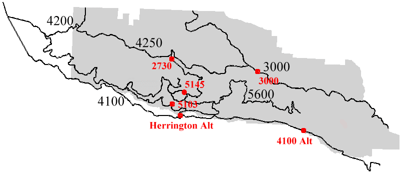
The Toutle block has been heavily roaded from past harvests in the area. This has left a well defined system of roads traveling in and out of the unit. The major routes travel east/west and are linked by various sub roads. There are basically five main routes in the area and these are what will be focused on. These routes consist of the 4100 which is the mainline, 4200/4250/3000 commonly known as the ridge-top road, 2730, 4600, and the 5100. The last three are mid-slope roads that are used to route the harvest to either the Ridge-top road or the 4100. Figure 4.1 shows a graphical view of the roads.
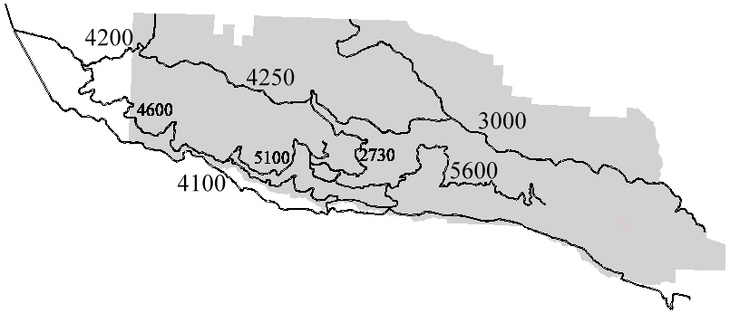
Figure 4.1 Overview of main roads in Toutle Block.
The 4100 is the mainline traveling in and out of the Toutle Block. It has been build along the South Toutle River and is well graded and has moderate grades and curvature. This road is administered jointly by DNR and Weyerhaeuser. In the floods of 1995 and 1996, a substantial amount of damage was sustained to the east end of the road including the loss of the Herringotn Bridge which basically isolates the Weyerhaeuser unit and major portions of the DNR unit from using the 4100 main line, historically the preferred and most economical route.
This road is travels along the ridge and consists of three roads. These roads are the 4200, 4250, and the 3000. This road accesses the north side of the ridge and the upper higher altitude portions of DNR’s lands. The 4200 and 4250 are currently being used for access thinnings.
Connects the top ridge road to the 5605 and the bottom of the hill. This is the alternate of choice connecting the east portion of 4100 past the Herrington Bridge washout to the west side of the 4100 in the event that the Herrington Alt is not built. This road has portions with grades near 15%.
Mid-slope road that connects the west section of DNR lands to the Ridge-top road and the 4100. Currently being used for thinnings and is in pretty good condition.
Mid-slope road connecting the 4600 to the 5140, 5145, and 5103. The west side of the 5100 has been washed out by the Toutle River and can not be built in the same spot due to a rock cliff (see Figure 4.2 and 5.2). The 5103 is proposed as a link down to the Herrington Alt Bridge site. The 5140 and 5145 are of interest as links to the 2730 in case the bridge is not built.
In the springs of 1995 and 1996, flooding on the Toutle and various other tributaries to the Toutle caused large scale damage to the 4100 and other roads within the Toutle Planning Area. The types of damage included slides, road washouts, blocked culverts, and road slumps. The areas that we were most interested in were the 5100 and the 4100.
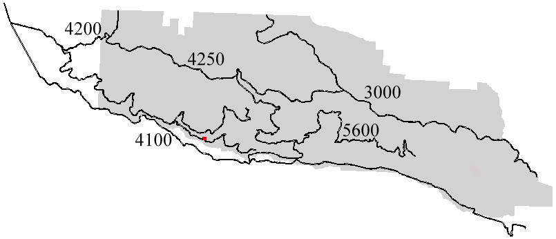
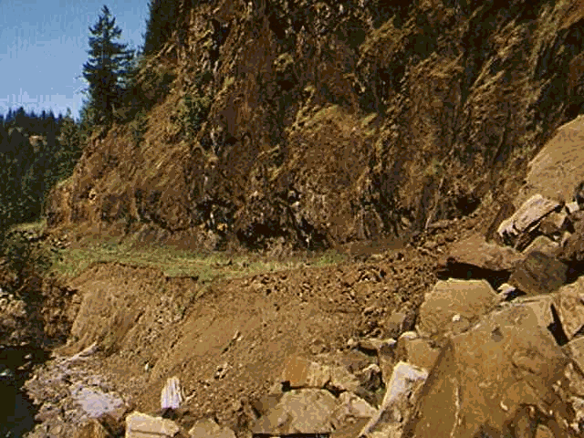
Figure 4.2 Location of 5100 Washout at base of rock cliff
The 5100 road washed out in two places, at the 14 Mile creek (culvert failure and washout) and just west from it where the road washed away at the base of a rock cliff from actions by the Toutle (Figure 4.2 and 5.2). The road was built as a full bench cut into the face of a cliff. We looked for an alternative route that would connect the 5100 to the 4600 further up 14 Mile creek.
The 4100 main line sustained significant damage. The first thing that we looked at was the Herrington bridge washout (Figures 4.3 and 4.4). The Herrington Bridge actually consisted of three bridges that spanned the Toutle on a large flood plain. It was determined that the bridge could not be built in the same location so an alternative site was found west of the original location (Figure 4.4).
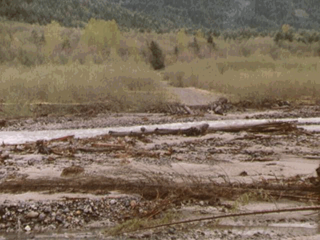
Figure 4.3 Old Herrington Bridge Crossing, viewed from south looking north, across the washout.
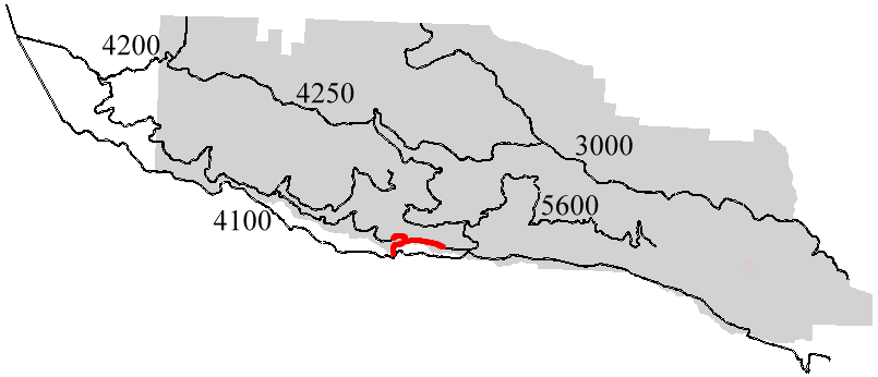
Figure 4.4 Herrington Bridge Alternative Location.
There are also large portions of the 4100 east of the Herrington Bridge that sustained major damage (Figure 4.5). Damage includes being washed out by the Toutle and other tributaries. These various damages are discussed in Chapter 6 in more detail.
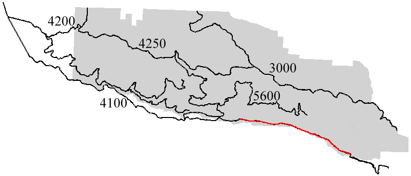
Figure 4.5 Damage to the 4100 east of the Herrington Bridge.
When analyzing the road system it became apparent that some additional road links required careful assessement. These sites are the washouts on the 5103, 5140, and the 5145 (Figure 4.6 and 4.7). These three crossings are on the same stream and were all washed out at the same time. Currently the DNR is preparing to put a culvert onto the 5140 which is the middle washout.
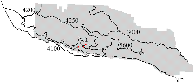
Figure 4.6. Locations of culvert failures and road washouts on the 5103 (lowest crossing), the 5140 (midslope crossing) and the 5145 (highest crossing). All crossings are on the same creek.
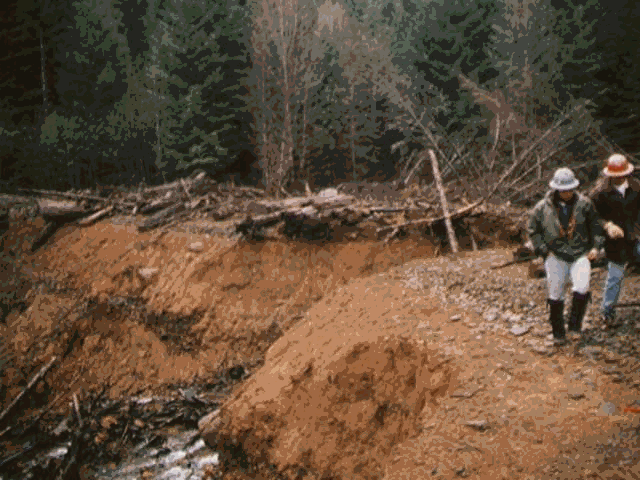
Figure 4.7. 5140 washout, viewed from east side of road looking west.
Weyerhaeuser land in the back end of the Toutle has been isolated by bridge washouts in the back end, the same flood event which also took out the Herrington Bridge. The upper reaches of the South Fork of the Toutle form large flood plains, up to one mile wide. In the past, stringer bridges crossed the main or side channels with the access roads build on approaches in the flood plain. Current view held it that no construction activity could take place within the flood plain itself. The only option would be to follow past practices with a temporary approach in the flood plain and a temporary bridge across the channel which would be removed each winter. However, such an approach would require road construction in the flood plain itself. No feasible crossing was found in the upper reaches that would span the river and/or flood plain.
The Silviculture and Network Analysis Program, also known as SNAP, was used to do an analysis of the transportation system within the Toutle Planning Area. SNAP uses a set of polygons that are set up as harvest units and the transportation system to an analysis of the best routes of travel between the harvest site and the mill.