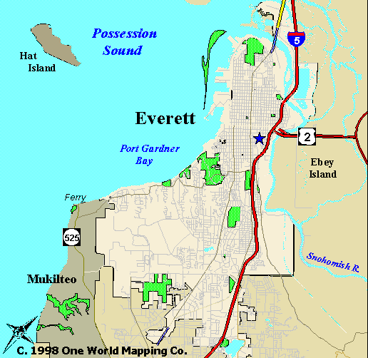
Geography of Everett, Washington:

Everett, Washington is located north of its sister city, Seattle. It has established itself as the major city in the Snohomish County. The city itself is very unique in that a lot of the city’s surroundings are water. This makes it ideal for shipping areas, and many areas of Everett’s industries rely on the Port for different reasons. There is water not the north as well as the east of the city. Over the years the borders of Everett has grown outward to support the increasing population. Over the past 40 years, the boundaries that are included in the Everett Census have moved farther south. As the border stands today, it is right next to the northern border the smaller city of Mill Creek and to the east it is on the border of Mukilteo. According to the Census Bureau, Everett has a total area of 42.7 mi2 and 15.1mi2 of that is water area. The total area is about 31% water. The Census also reported that the coordinates of the city are at 47°57'48" North, 122°12'2" West (47.963434, -122.200527).
Encarta Online Encyclopedia 2001:
Everett, city, seat of Snohomish County, northwestern Washington, a port
at the mouth of the Snohomish River on Port Gardner Bay (an inlet of Puget Sound),
near Seattle; incorporated 1893. Major industries include the shipping of lumber,
aluminum ore, and other cargo; commercial fishing; tourism; and the manufacture
of aircraft and pulp and paper. A community college, a symphony, and a cultural
arts center are here. The city was founded (1892) as the site of the western
terminus of a transcontinental railroad (completed 1893). It was named by one
of the founders, Charles L. Colby, for his son, Everett. Population 54,413 (1980);
69,961 (1990); 91,488 (2000).