| Shoreline Rehabilitation prototypies for shoreline strategy |
background | time horizon | shoreline protection | vegetation succession | site assessment |designed prototypes |
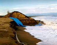
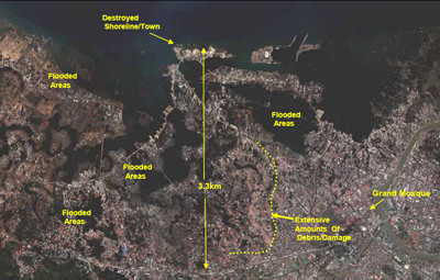
Background information The coastal margins of the islands of Indonesia are some of the most populated areas in the world. Most of the people living in Aceh Province live along a coastal ribbon within 5 kilometers of the ocean. It is said that significant damage inland from the coast for only about 1 -2 km for most of the coastline, but up to 3 -5 km in low areas and around the provincial capitol of Banda Aceh, which is located in a low lying area. Areas most significantly affected were in the heavily populated cities. The tsunami inundation and damage was not uniform. The geographic orientation of impact reflects the geomorphology of the land mass as well as the bathymetry beneath the water close to the shoreline. Some areas were hard hit such as Lho-nga, which was completely swamped by water. It appears a large mass of water pushed over the land by force and did not recede. Cities and heavily populated areas also happened to be in target areas of high impact. Unlike other types of disasters, such as hurricanes, the area impacted by the tsunami was not large when compared to the total area of the province. The total area extent of impact was 413 km 2, which is a small percent of the total provincial area. However, because of the high population densities in this narrow coastal zone the human impact was nonetheless extremely large. It is important to note that while this tsunami was unusually large, and that its magnitude contributed significantly to its heavy toll, it is also true that other factors contributed to the great loss of life. As development of the coastal margins has grown, its vulnerability has also increased. Human impacts to shoreline areas, such as over population, deforestation, and over fishing, exacerbates the damage caused by tsunami. A healthier shoreline is badly called for future relief and development. Since people will eventually come back where they were, it is necessary to have a clear vision about the shoreline rehabilitation. This workshop mainly deals with the steps for reestablishing and reconstructing the shoreline areas and its vital ecosystem in the manner of naturally friendly and sustainable. Various methods for shoreline reinforcement are suggested;three prototypes based on the current situation of Banda Aceh are generated for further remediation. The overall concept is to integrate the artificial as well as the natural methods to rehab a healthy shoreline ecosystem, and pay special attention to the spatial relationship between the human settlements and shoreline natural system. |
|
 |
|
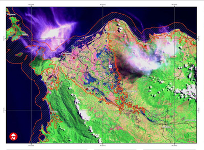
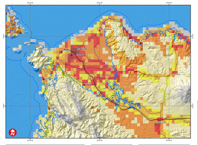
Figure: population density of Banda Aceh area |
|
|
|
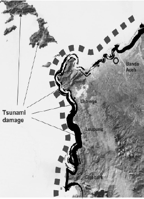
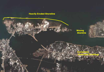
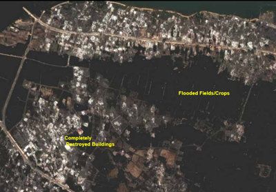
Figure: damaged are in Banda Aceh |
|
| [Back to top] |
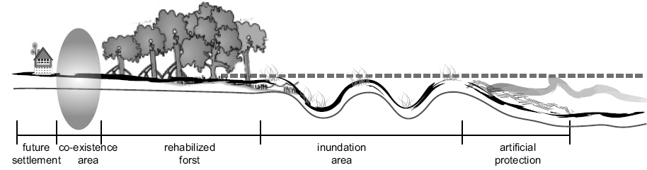
Time Horizon 0-1 yrs.... +Reinforce and reconstruct damaged shoreline using both artificial methods and natural friendly methods -
|
|
|
1-5 yrs.... +Large-scale reforestation in shoreline area according to different types of coastal ecosystem - |
5-10 yrs.... +Nurish and aggradize vegetation coverage |
 |
| [Back to top] |
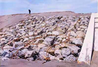
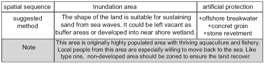
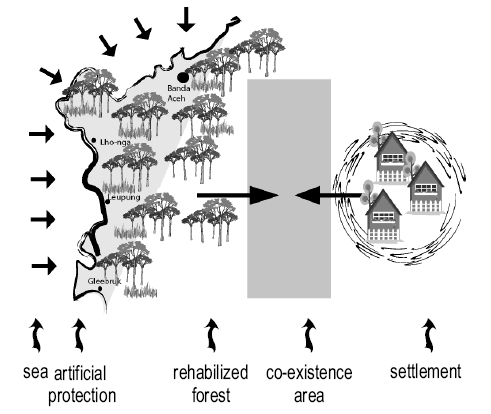
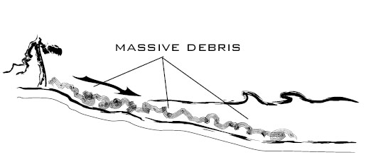
Shoreline protection After tsunami, vast shoreline areas were totally damaged left the badly eroded bare land. The first and foremost task for the local community to reestablish shoreline areas is to reinforce the coast both resort to artificial methods and natural friendly methods. Abstract
|
||||||||||||||||||||||||
| [Back to top] |
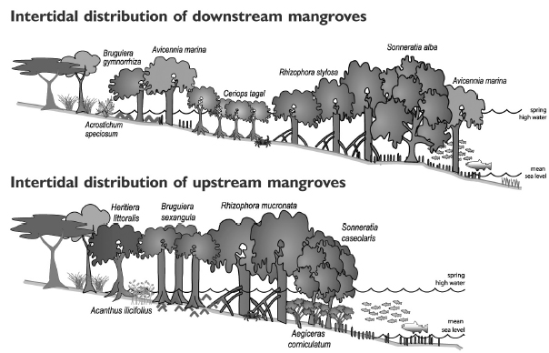
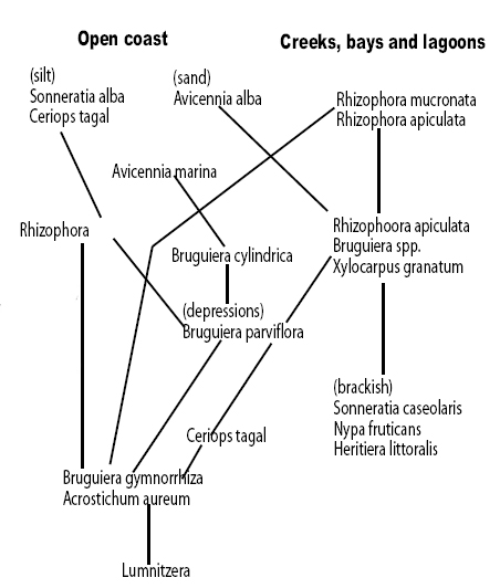
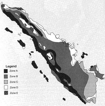
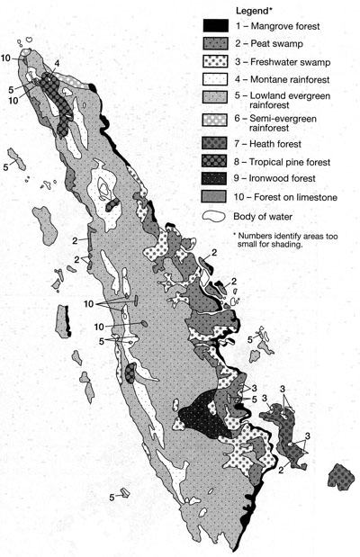
Vegetation Succession The main ecosystem modulators are temperature, salinity, chemical suitability and physical sustainability. Coastal ecosystem in Sumatra can fall in to the category of mangrove forests, beach vegetation, brackishwater forests rocky shores and coral reefs. Based on the shoreline topography and local climate, two types of vegetation succession are listed below. Each type can fit into types of the context of the spatial sequence discussed above. |
|
|
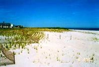
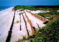
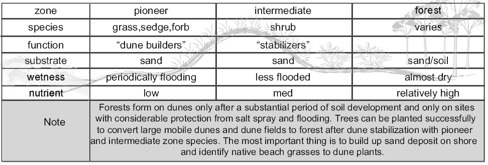
Coastal Dune Vegetated dunes can occur on sandy seacoasts to support plant growth and sufficient wind action to move sand. Coastal dunes, particularly those of the barrier type, have a value well beyond that of habitat, serving as coastal protection and preservation in several ways. Continuous barrier dunes serve as flexible barriers to storm surges and waves and are of particular value in affording protection to low-lying backshore areas and in helping to preserve the integrity of low barrier islands. Dunes provide protection more effectively and at a lower cost than a seawall. The dune complex divideds into three zones: the pioneer zones, the intermdiate or scrub zone, and the back dune or forest zone.
|
|
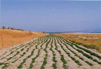
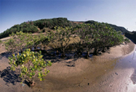
Mangrove Forest Mangrove forest is the most typical and efficient species on shore. It is reported that a large scale mature mangrove forest can reduce the wave force by 35%. It is reasonable to choose mangrove as the primary species for reforestation. |
|
source: ‘Daintree Mangroves” - January 2004, the university of Queensland |
|
 |
|
| [Back to top] | |
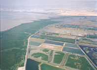
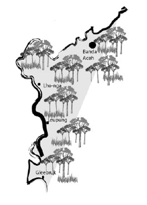
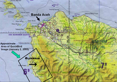
Site assessment This workshop mainly focuses on the badly damaged shorline areas in Banda Aceh The main indicator are climate zone, vegetation distribution and shoreline topography. Banda Aceh is in the dry climate zone, with relatively flat beach. The topography and the relationship between shoreline area and inland settlement determine the coastal rehabilitation type, while vegetation distribution determines different types of vegetation succession.
|
 |
|
|
  |
|
|
 |
|
 |
||
|
 |
|
 |
||
|
 |
|
 |
||
| [Back to top] | ||
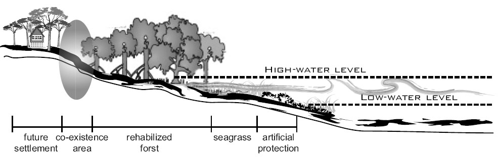
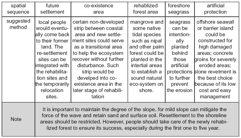
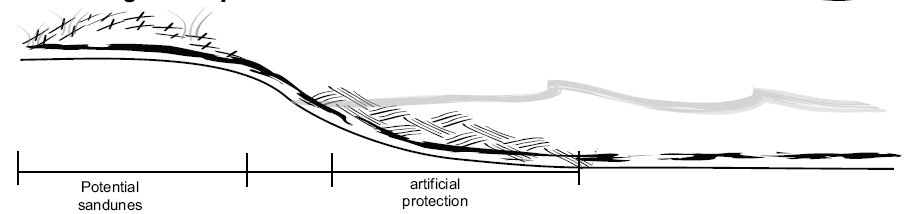
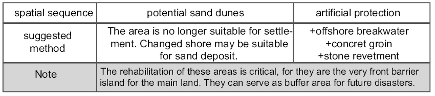
Designed prototypes
|
|||||||
| [Back to top] |
Resources: