 |
||||||||||||||||||||||||||||||||||||||||||||||||
| |TESC 431 Home| |Intro| |Methods| |Results & Discussion| | Acknowledgements| | ||||||||||||||||||||||||||||||||||||||||||||||||
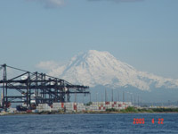
IntroductionBeginning in the early 1900's, intertidal areas and tideflats of the Puyallup River Delta were filled in and meandering streams were channelized, resulting in the creation of eight waterways. Puget Sound is an estuary, a semi-enclosed coastal body of water with a large freshwater input. Different types of estuaries have various distributions of salinity and circulation patterns. This is determined by depth of the water, the topography involved in the rivers and freshwater inflow, tidal currents and winds. The Commencement Bay section of Puget Sound is representative of a partially-mixed estuary. It is important to understand these properties in specific locations in Puget Sound to determine both the natural and anthropogenic effects on the waters there.Commencement Bay is located at the southern end of Puget Sound. Industrial and commercial activities are located on or adjacent to each of the waterways. Contaminates originate from both point and nonpoint sources. In all 763 drains (pipes), seeps, open channels, and other point and nonpoint discharges have been identified (EPA). The U.S. Environmental Protection Agency's (EPA) record of decision for the Nearshore/Tideflats Superfund has identified more than 150 potentially responsible parties for the Nearshore/Tideflats Superfund site. The EPA treats each of the contaminated waterways as a distinct unit (NOAA 2005). Map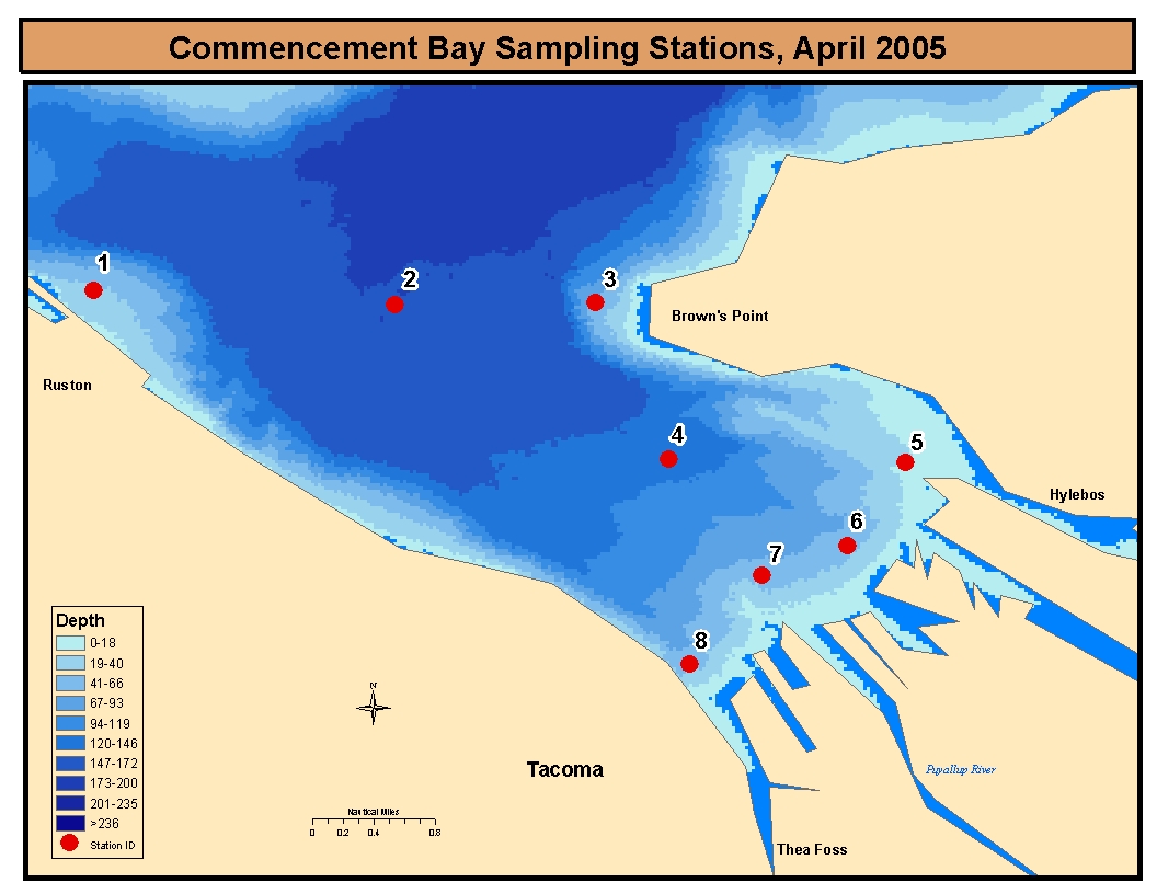
Station Locations
This study of Commencement Bay offers another look at the health of the aquatic environment. Some of the chlorophyll-a readings and plankton counts appeared high, possibly indicating high nutrient counts. The study also shows that the currents of Commencement Bay are variable in different areas, keeping some of the bay waters well-mixed helping to promote a healthy ecosystem. These areas still need more research and pollution control to regain a healthy ecosystem. ReferencesGreengrove, Cheryl. University of Washington. TESC 431; Water Resources and Pollution; Estuarine Field Studies. Lecture. April 15, 2005.NOAA; National Oceanic Atmospheric Administration. Northwest Region May 25, 2005. www.darp.noaa.gov/northwest/cbay AcknowledgementsRick Fuller. Captain of the City of Tacoma Baywatch and tourmaster.Deb Sklar, University of Washington, Tacoma teaching and learning technical support. Cheryl Greengrove, gigantic taskmaster, instructor of Water Resources and Pollution, University of Washington, Tacoma. LinksCitizens for a Healthy BayCitizens for a Healthy Bay Superfund Site City of Tacoma Environmental Services Wastewater and Surface Water Management Commencement Bay Restoration EPA National Priorities List EPA Superfund Fact Sheet NOAA Northwest Region Restoration Activities Puget Sound Action Team Washington State Department of Ecology Marine Water Quality Water Resources and Pollution; University of Washington Spring 2003 Water Resources and Pollution; University of Washington Spring 2002 | ||||||||||||||||||||||||||||||||||||||||||||||||