 Survey and Design Work in Taoping
 |
|
|
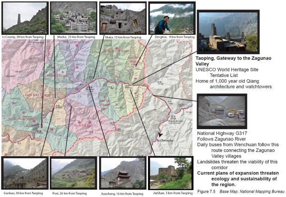
With 12 days in Taoping, the combined UW and SU BE Lab group conducted four phases of survey and design work: first, a tour of Qiang and Tibetan villages at various points along and above the Zagunao River, between Wenchuan and Li County Town (Figure 18); second, the gathering information in Taoping itself; third, a design charrette; and fourth, the presentation of charrette products to government officials and villagers. The group gathered information through tours guided by the curator of the county museum and by residents; more than [#s?] interviews with village, township and county government and tourist development officials, residents, building craftsmen and vendors; informal socializing; observation; photography; mapping and sketching. The group also experienced the inconveniences of village life: electricity was occasionally cut off, and mudslides disrupted the piped water, requiring students and faculty to carry water from a spring. |
|
| Previous Next | |
