 BACKGROUND AND CONTEXT
 |
|
|
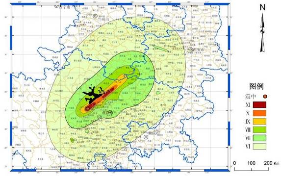
The disaster zone is characterized by steep mountains and narrow river valleys, mainly along the Min River and its tributaries. The affected settlements range from industrial cities to isolated and relatively self-sufficient agricultural villages. The population is a mix primarily of China’s ethnic Han majority, and minority ethnic Tibetans and Qiang. Indeed, the disaster encompassed nearly all of the homeland of China’s minority ethnic Qiang people, distributed throughout the Upper Min River watershed and some of the eastern slopes of the Longmen Mountains in Beichuan county (Figure 1).1 An estimated 10% of the 306,000 Qiang population died (over a third of all earthquake deaths), and most traditional housing was severely damaged.2 Even before the earthquake, development in the area – from hydroelectric power to tourism – had already added stress to complex economic, political, social and cultural relations within and among these communities and various levels of government. The earthquake exacerbated the stresses enormously; only eclipsing them temporarily with the more basic crisis of survival. |
|
| Previous Next | |
