May 25, 2007
Bermuda's climate is one of the features that attracts thousands of tourists every year. Two of Bermuda's greatest attractive features is the fact that there is minimal change in temperature from month to month, yet there is a great change in weather from day to day. This means there is very little range between the hottest and coldest month, the rainiest and driest month, and the sunniest and cloudiest month. Each day on Bermuda, a resident or guest is all but guaranteed at least some beautiful weather. A cloudy or rainy day will soon be overcome by sun, and a rare unbearably hot day will soon be cooled down, and so on. This desirable weather is due to three main factors: Bermuda's oceanic location, its geographical location, and its relief.


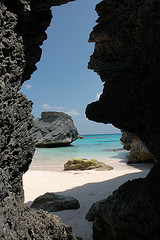
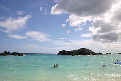
photos from www.flickr.com
1. Because Bermuda covers such a small area and is surrounded on all sides by the Atlantic Ocean, there is very little variation in temperature from month to month and from day to day. This is largely due to the fact that water takes about five times as much heat or cold to raise or lower its temperature as land, therefore the water retains heat and cold longer than land. (Strahler and Strahler 2006) Since Bermuda occupies such a small landmass, it is possible for the ocean air to flow over the entire island. These two factors contribute to the more constant temperatures experienced on the island relative to larger land areas.
| Jan. | Feb. | Mar. | Apr. | May | June | July | Aug. | Sept. | Oct | Nov | Dec |
Land | 63 | 62 | 63 | 65 | 70 | 75 | 79 | 80 | 78 | 74 | 69 | 65 |
Sea | 67 | 67 | 67 | 70 | 73 | 77 | 81 | 83 | 81 | 77 | 74 | 68 |
(information for both graphs from Watson, et al., 1965, prepared by Cassie Falvey)
2.The geographical location is also a contributing factor to the desirable climate of Bermuda. Located at about 34 degrees North of the equator, Bermuda is situated in the Mid Latitude Region. Most places located in this region experience lots of seasonal change influenced by air masses which pick up stagnant air and carry it along the jet streams. Bermuda is an exception to this rule. Though the island is situated between the Northeast Trade Winds (Tropical Easterlies) to the south and the North Westerlies (Temperate Westerlies) to the north, the high pressure system, which is typical around 30 degrees north and south of the equator, tapers off near Bermuda. (Watson, et al., 1965)
The ridge of high pressure gets broken up, either by ‘waves' that bulge out from the tropical easterlies as they travel west, or by sweeping disturbances from the temperate westerlies as they advance off North America, traveling east…The ridge is broken up into smaller high pressure "cells". One cell occurs to the east of Bermuda and one to the west. In between these two high pressure cells [over Bermuda], there is a low saddle or col which invites air to converge on it. The area of convergence in between becomes an area…with rapid cloud building, quick movements of air and sudden and fierce showers of rain. (Watson, et al., 1965)
3. The last factor that contributes to the climate of Bermuda is its relief.
Bermuda's relief is very gentle and therefore does not provide any barriers to wind or rain. Due to minor differences in relief as well as inland locations, there are slight differences in temperature at different points of the island. For example, "locations in the center of the island, especially around the internal depressions or at the heads of sounds, are both warmer in summer and cooler in winter than those on the coast." (Watson, et al., 1965) Hilltops also tend to be slightly cooler than valleys, but not by a significant amount.
Jan. Feb Mar Apr. May June July Aug. Sept. Oct. Nov. Dec. Hamilton 63 63 64 68 74 79 83 85 83 77 71 66 South Shore 67 67 67 70 73 77 81 83 81 77 74 68
Last modified: 5/24/2007 7:44 PM