|
TESC 243 Geography Dr. Peter Selkin |
|
Web Page Research & Design Minnha Tran and Paris Rogers |
|
Land of Wood and Water |
|
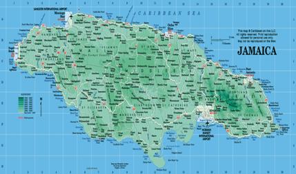
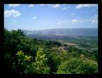
Jamaica is an island in the West Indies and its name originated from the word “Xaymaca,’ which means land of wood and water. (Sibley 1978) Jamaica’s coordinates are Latitude: 18º 15´ North of the Equator and Longitude of Jamaica: 77º 30´ (Wikipedia 2007) Jamaica’s size is the same as that of the state of Connecticut. The island is made up of three landform regions; coastal lowlands, which include a limestone plateau, central valleys and the Blue and John Crow mountains, which is a group of volcanic hills on the east side of the country. (Wikipedia 2007) Jamaica along with the other islands of the West Indies evolved from an “arc of ancient volcanoes that rose from the sea millions of years ago.” Demets states, “During periods of submersion, thick layers of limestone were laid down over the old igneous and metamorphic rock.” (Demets et.al.) Jamaica Sustainable Development Network tells us that, “The island is susceptible to watershed degradation and has approximately 80 percent of the land surface is hilly or mountainous with more than 50 percent having slopes of greater than 20 degrees.” What watershed degradation does is that it weakens hydrological behavior in a river system causing poorer water flow and that reduces its capability. This not only causes the water flow to be inferior, but reduces the quantity and timing of the river as well. (JSDN 2005) We also find out through JSDN that there are two sectors of Jamaican agriculture that shows topographical features. “Large-scale farmers practice mono-cropping.” Here year after year these farmers plant the same crops, never giving the land a rest. This has caused many people to be concerned about this type of farming which causes depletion of nutrients in the soils. These soils, which are the most rich, are found on the coastal plains and the interior valleys. “Small-scale farming,” here the farmers occupy the upland of the central parishes and the hilly areas as well. (JSDN 2005) JSDN also tells us that; “About two-thirds of the country is covered by limestone and the other third by igneous and metamorphic rocks, shale and alluvium.” The four main groups of soils located in Jamaica are 1. Soils of the upland plateau.2. Alluvial soils found on flat land. 3. The highland soils found in the eastern and central region. 4. The remaining soils. (JSDN 2005) |


|
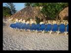
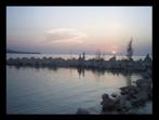
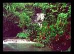
Jamaica’s Geography |

|
Pictures from www. SouthTravels.com |