MIDTERM
ESRM430: Remote Sensing of the Environment
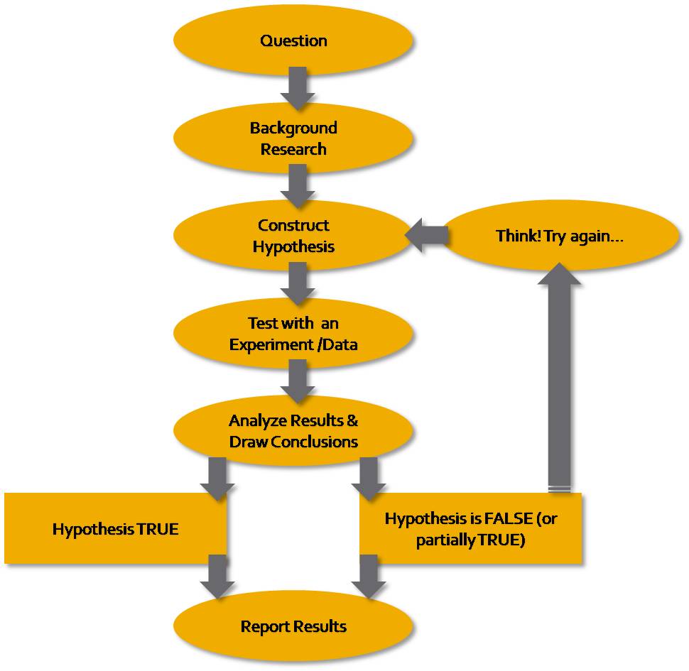
The objective of this midterm is to help you think about high spatial resolution image interpretation and the applications of this techniques to the scientific method, and research. Above is the scientific method diagram that we discussed in class. Based on this concept explore and choose one of the four options of imagery available below (you can download high resolution image by clicking on it). Make sure that in your answers you identify the option you chose, write this option next to your name on the materials you are handing in. Explore the following options:
| Option 1 | Option 2 | Option 3 | Option 4 |
 |
 |
 |
 |
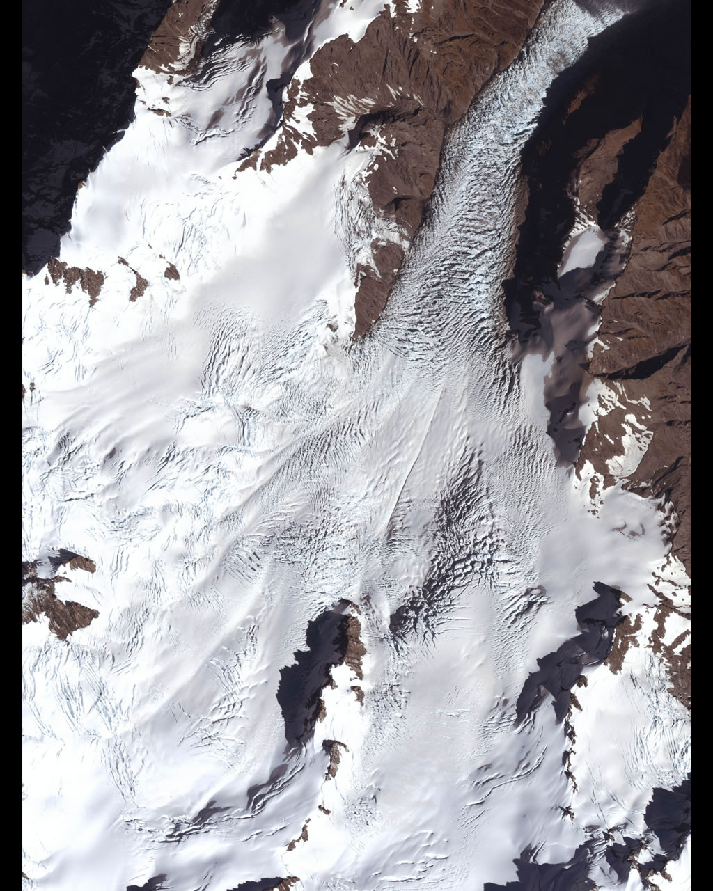
Fox Glacier, New Zealand |
Copper Mountain, CO |
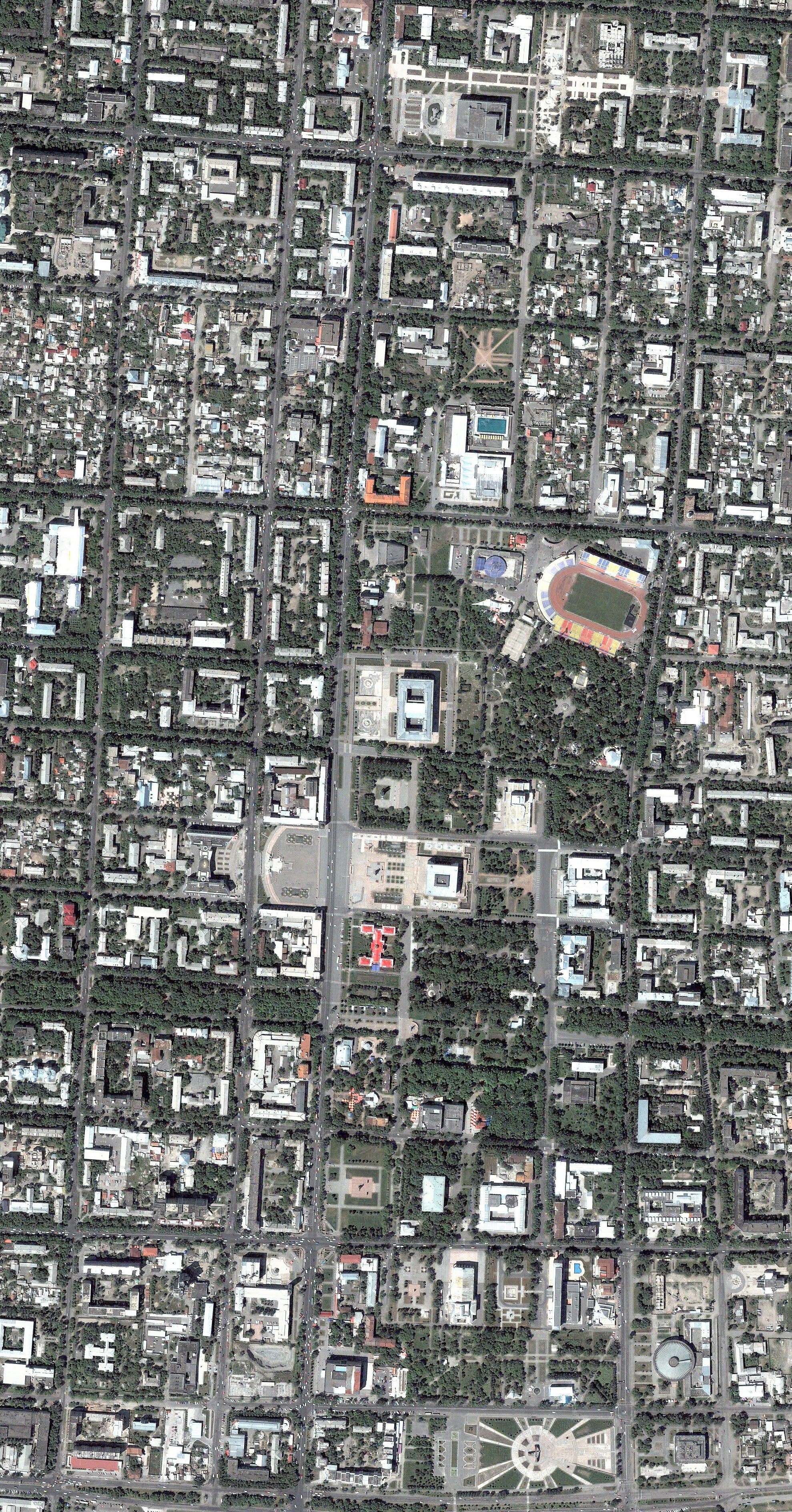
Bishkek, Kyrgyzstan |
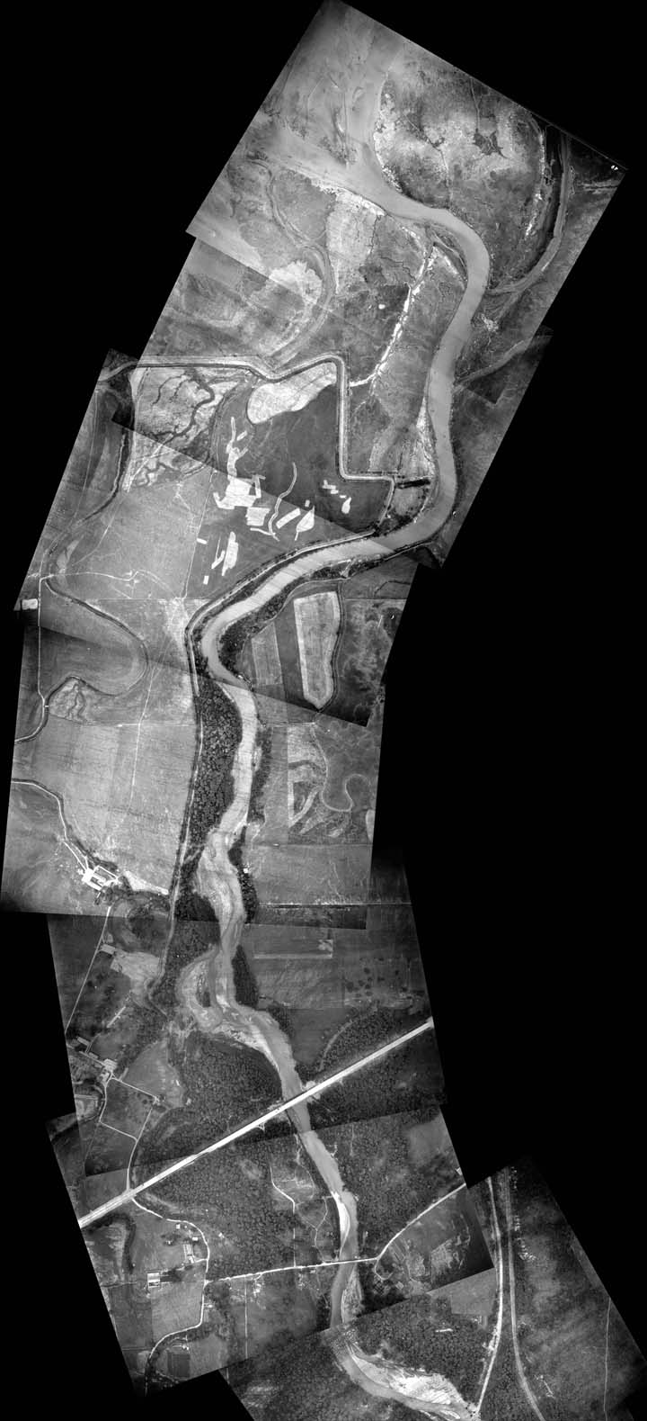
Nisqually River, WA |
Above is an example of glacier imagery as seen by GeoEye’s IKONOS satellite from 423 miles in space, traveling at an average speed of 17,500 mph, from January 2004. Fox Glacier is one of the most easily accessible glaciers in the world, with a terminal face just 5 kilometers (3.1 miles) from the township. Fed by four alpine glaciers, Fox Glacier is roughly 13 kilometers (8.1 miles) wide, making it the largest glacier on the west coast of New Zealand’s South Island. Source: GeoEye merged with DigitalGlobe |
This four-meter resolution, false color, near-infrared image collected on October 12, 1999, shows the mountains and ski runs near Copper Mountain, Colorado. The areas depicted in red highlight the differences in vegetation of the forest with the darkest shade of red being the healthiest. GeoEye has a wide-variety of forestry-application related imagery covering forestry health, clear-cutting and wildfire damage assessment and recovery strategies. Source: GeoEye merged with DigitalGlobe |
The above image was collected May 23, 2003. This is a natural color, 60 centimeter (2 foot) high-resolution QuickBird satellite image featuring downtown Bishkek. Bishkek is the capital and the largest city of Kyrgyzstan, the city is laid out on a grid pattern, with most streets flanked on both sides by narrow irrigation channels that water the innumerable trees which provide shade in the hot summers. Source: Digital Globe http://www.digitalglobe.com |
High resolution, historic aerial photography from 1937. The Nisqually River is a river in west central Washington in the United States, approximately 81 mi (130 km) long. It drains part of the Cascade Range southwest of Tacoma, including the southern slope of Mount Rainier, into the southern end of Puget Sound. |
Based on the image selected answer the following, number your answers on the materials you are handing in:
Your answers should not exceed 3 single spaced pages in 12 point font and 1 inch margins. Citations should be included.
NOTE: Please remember you are not required to carry out a research project, just describe the proposed project.