PUBLIC WORKS/WATER SUPPLY MODULE
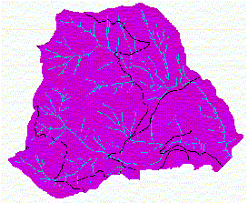
The critical questions and answers for the Public Works Module: What public works are present in the watershed? There are some roads present within the watershed (see Figure 1). There are no other public works within the watershed.
Figure 1. The trans coverage overlaid on our stream system. What public works are sensitive to changes in one or more of the three input variables? Road segments that cross streams may be sensitive to peak flow changes, depending on the design of the road. Most likely the roads have been designed to allow enough water to pass for a 50-100 year flow, but without a ground check, it must be assumed that there is potential for a peak flow to damage the stream crossings. Other segments will have low vulnerability to peak flow changes. To do this, I identified stream crossings using peak_flow.aml. I decided that only the cells that corresponded to a crossing had a high vulnerability. Originally, I had planned on identifying roads within a distance of around 20 feet of the crossing, but since our cells are 32 feet in size, it made sense to just limit it to a single cell at the stream crossing. The resulting grid of stream crossings can be seen in figure 2. Figure 3 shows a portion of figure 2, zoomed in.
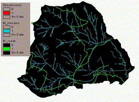
Figure 2. Red cells correspond to stream crossings. Blue cells are streams. Green cells are roads. Notice that there are not many high hazard areas (the stream crossings). All other road segments have low vulnerability to peak flow changes.
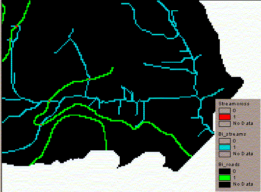
Figure 3. A zoomed in image of the stream crossings near the mouth of our watershed. Which are sensitive to mass-wasting events? This step uses Susan's results to the mass wasting module. She identified the factor of safety for mass wasting within our watershed. I then determined which roads are downslope from these areas. I identified these roads using a flow accumulation weighted by mass wasting factor of safety (all slopes with an FS > 1 were set to zero). Any area with a true result is downslope from a mass wasting zone. Then, I identified roads with true values. I was worried that some roads near the bottom of the watershed may have a true result but be a long way from the mass wasting zone. I did not find this to be a problem in this watershed. You can see the results of these operations in figure 4. You can view the code in mass_waste.aml.
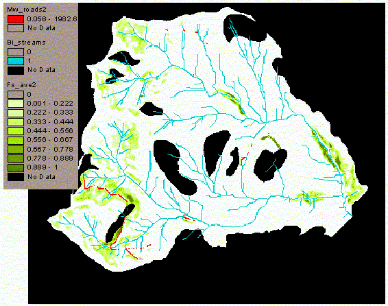
Figure 4. Red cells are road segments that are downslope from mass wasting hazard zones. The green cells represent the factor of safety for mass wasting. Black cells are null. Which are sensitive to coarse sediment inputs? Roads that cross streams or are within the floodplain will have a high vulnerability to coarse sediment. All other roads will have a low vulnerability. This is basically the same as the peak flow analysis discussed above. Due to the steepness of our terrain, floodplains will be limited in size, so most of the hazard to coarse sediment inputs will take place at stream crossings.
Water Supply Module
The critical questions and answers for the Water Supply Module: Is water being diverted out of the watershed? No. Are there irrigation diversions? No. Are there domestic water supply diversions? No. Are there other diversions? No. There are no diversions of water within our watershed, therefore, the Water Supply Module is completed.
|