WATER QUALITY MODULE
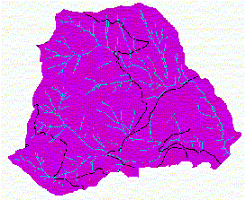
The objective of the Water Quality Module is to (1) identify waterbodies within the WAU or waterbodies outside the WAU that may be directly affected by watershed proceses within the WAU, and (2) to assess the potential for their characteristics to change with forest management. There are 5 parts to the Water Quality Module: Stream Temperature, Wetlands, Nutrients, Dissolved Oxygen, and Acidity and Alkalinity. The analyses were performed with waterQ.aml, using grid. Each of these analyses is discussed below. Stream Temperature There are 4 steps in the stream temperature vulnerability assessment. The procedure used to perform these steps is outlined below, along with the results of the procedure. Any aspects of the assessment that have not been completed are explained as such. Step 1. Minimum Potential View-to-the-Sky The first step is to determine the potential view-to-the-sky (VTS) from our streams, based on estimates from mature vegetation. The result will be the minimum possible VTS, yielding the lowest temperatures. The following equation is used to determine the minVTS: View to the sky(%) = 100 - (10 / 9) * alpha h = tree height (Mature tree height assumed to be 100 feet) An estimate from Figure G-1 suggests that the minVTS should end up being around 5%. The result of the above equation is a minimum VTS of 3.2%. See Figure 1.
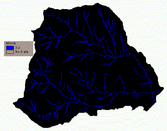 Figure 1. Potential View-to-the-Sky. This was hand calculated to be 3.2 for all reaches. Step 2. Maximum Allowable View-to-the-Sky. Using table G-8, I developed a relationship between elevation and Maximum Allowable VTS. You can see the results in Figure 2. Basically, as elevation increases, the maxVTS can increase while still allowing the max temperature to remain below 16.0 C. This temperature was chosen because it is the cutoff point for class AA waters.
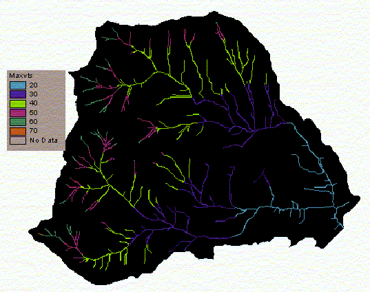 Figure 2. Maximum Allowable View-to-the-Sky. This was based on Table G-8. It was created with a con statement. Step 3. Determination of Reference Temperature. The reference temperature is the difference between the potential minVTS and the allowable maxVTS. This is then converted to an annual maximum temperature based on the relationship in Figure G-2 in the watershed analysis manual. The resulting annual maximum temperatures can be seen in Figure 3, below. D = V - S V is the potential view-to-the-sky from step 1. S is the max allowable view-to-the-sky from step 2.
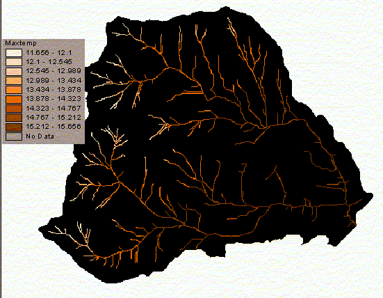 Figure 3. Annual Maximum Temperature (Celsius) based on Figure G-2. The annual max. temp. is based on the reference temperature (D) Step 4. Determine Temperature Vulnerability The temperature vulnerability is based on Figure G-4 in the watershed analysis manual. It is based on the reference temperature (D) found in step 3. It appears that there is likely to be a high vulnerability everywhere. However, when riparian buffers are included in the analysis, it is not likely that any of these streams will lose so much cover due to management activities that their temperatures will be altered. If the buffers were destroyed somehow (by fire, for example), then the stream temperatures would probably be affected. Figure 4 shows the temperature vulnerability for streams in our watershed. Notice that almost every area has a high vulnerability. The only exception is in the very high elevations where stream temperature doesn't depend much on shading.
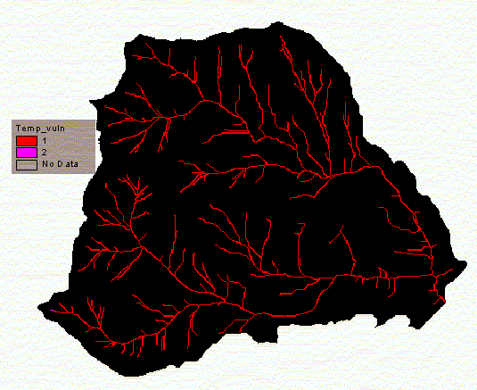 Figure 4. Temperature Vulnerability, based on figure G-4. Sediment Accretion in Wetlands: This assessment was not completed, due to the lack of availability of a wetlands coverage. Nutrient Assessment: There are no lakes within our watershed. Therefore, no further analysis is necessary. Dissolved Oxygen Assessment: Streams that are very slow-moving, low gradient, and warm with fine organic debris are vulnerable to dissolved oxygen. All low discharge streams with less than 1% gradient are probably sufficiently slow and deep to meet the above criteria. After performing a grid analysis on stream gradients, I found that there are no streams with a sustained reach of less than 1% gradient. Therefore, there is low vulnerability to dissolved oxygen. I used dissolved_o.aml to determine this. The results are in figure 5, below.
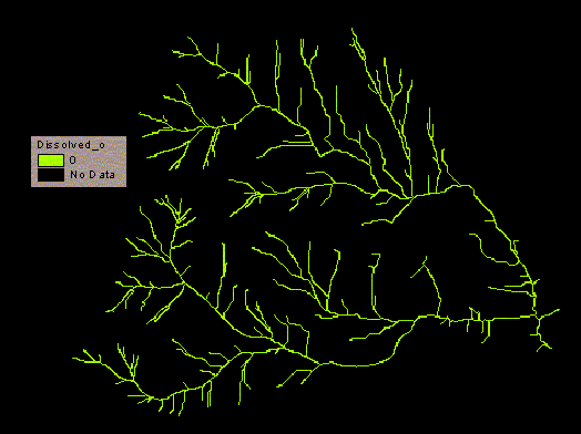 Figure 5. Stream reaches with less than 1% gradient. There are no such stream segments in our watershed. Acidity and Alkalinity: All streams are assumed to have low vulnerability to pH, unless there is evidence suggesting otherwise. We have no such evidence, so we assume that there is a low vulnerability to pH in our watershed.
|