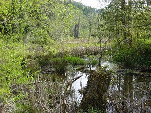
This study was conducted on the Kitsap Peninsula at Big Beef Creek watershed. Big Beef Creek watershed covers 13.08 square miles (USGS 2003). The headwaters start in a marshland located on the Kitsap plateau. From there the creek continues north to Hood Canal through Lake Symington. This Lake is a manmade and was built during the 1960's. On the outflow side of the lake a constructed fish ladder is on the out flow side of Lake Symington. The creek meanders from the out flow of side of the lake to a diversion canal located near the mouth of Big Bear Creek. The National Marine Fisheries Service uses this for fish tagging and counting. The creek exits into Puget Sound at Hood Canal. We can monitor the physical properties of the watershed by using several measuring techniques. These measures are; pH, conductivity, turbidity, nitrate concentrations, dissolved oxygen concentrations, phosphorus concentrations, temperature, flow and macro invertebrate inventory.
Our field class took physical measurement in the Big Beef Creek watershed. Our data that we collected can be compared to against other TESC 431 classes to evaluate the any changes over time. Our concern is in the residential developments being built on the upper side of the watershed. In another study, Wahl, McKellar and Williams (1997) noted increases in flow rates of water in urbanized watersheds. Increasing water flows can alter streams by erosion and change the stream channels with silt or change from fine grain sands to cobble. Increase water flows are the result of urbanization and the placement of impervious surface from the development (e.g. roof tops, driveways streets etc.) Increased flows from these surfaces can also carry non source pollutants from lawns, surface streets parking lots and farms. These non source polluters send pesticides, fertilizers, oil, grease, heavy metals and oxygen robbing nutrients into the watershed. Most individual contributions are small, but collectively they have the potential to impact the health of this watershed. Materials and Methods A Vernier attached to a scientific calculator is a convenient way of collecting data. These data collectors are preferred for their immediate feedback in a built in screen showing the results. The drawback to these instruments arises in the calibration of the instrument and their heavy draw on battery life. Six Vernier probes provide data collection for pH, turbidity, dissolved oxygen, nitrates, conductivity, and a flow meter. In our field kits we carried one hundred foot tape and a fifty foot tape. These are used to measure of sections to be observed and to develop stream channel profiles