Settings are the puzzle pieces that will eventually combine to become harvest units and leave areas. The final setting system is a result of the PLANS analysis discussed in Chapter 7, and is prepared for use in the Scheduling and Network (SNAP) analysis, discussed in Chapter 13. This section discusses the determination of setting boundaries, the creation of the GIS settings coverage, and the final setting statistics. Figure 36 shows the settings delineated for the North Hoodsport Planning Area.
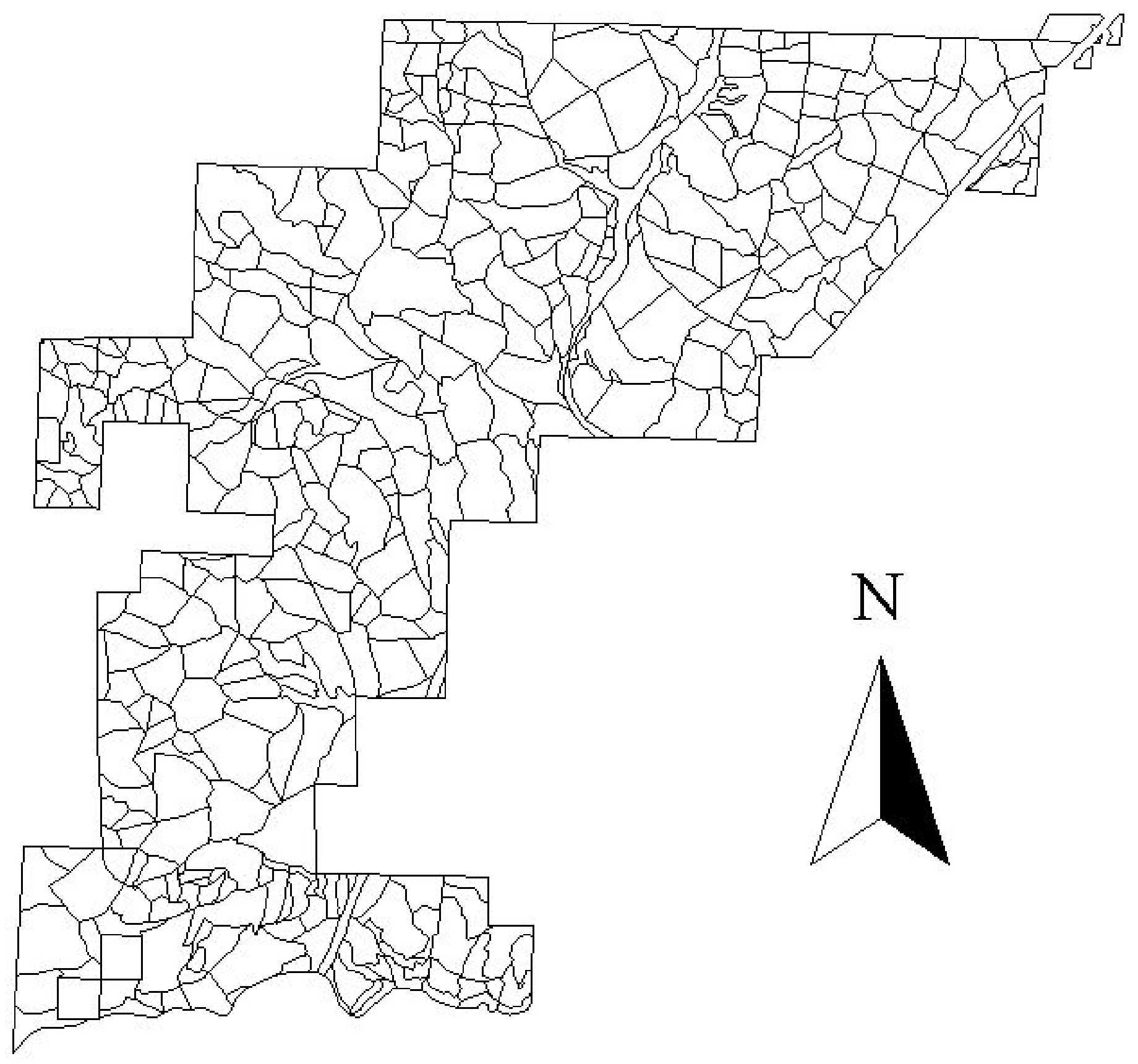
Figure 36. Final setting boundaries for the North Hoodsport Planning Area.
10.2 Determining Setting Boundaries
After the landings are located and profiles are evaluated in the PLANS analysis, the setting boundaries for each landing are delineated. These boundaries are assigned such that they form a network of polygons covering the entire planning area with no overlap, similar to a map of political boundaries. Each setting corresponds to a single landing, while a given landing may have multiple settings (See Figure 37).
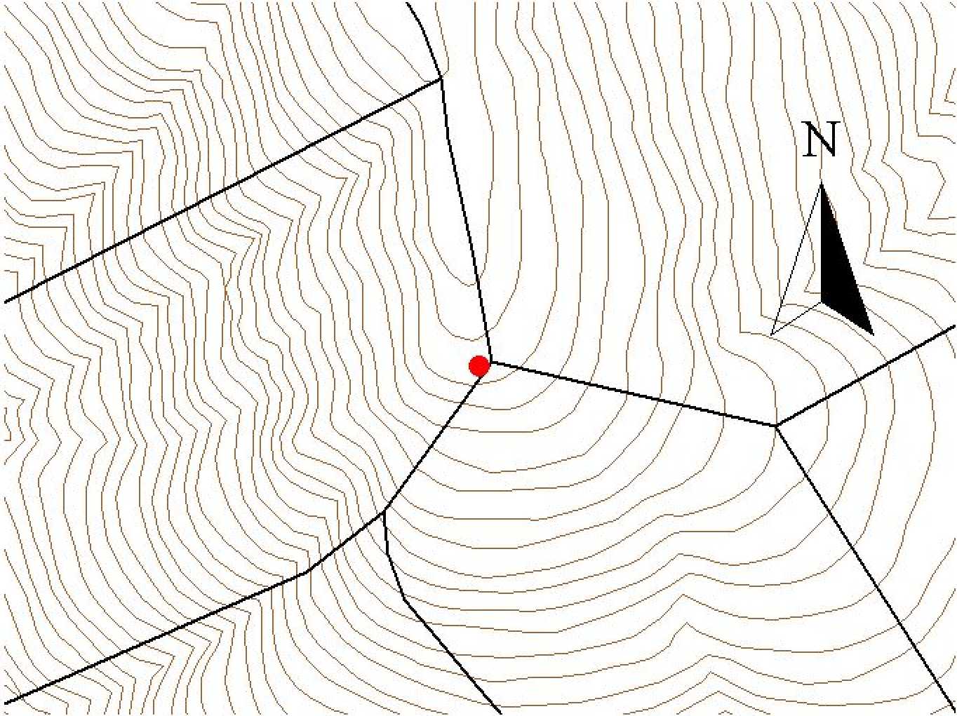
Figure 37. The landing in the center of the image (red point) has three corresponding settings. However, each of these settings has a maximum of one corresponding landing. This is possible because the landing is on the top of a ridge (notice the contours).
Many factors are taken into consideration when determining setting boundaries. These factors include topography, stand condition boundaries, political boundaries, road locations, and maximum external yarding distances (EYD). Political boundaries, road locations, and EYD tend to be fixed boundaries, while topography and stand conditions allow more flexibility. Topographic features such as ridges and draws (especially streams) are preferred over stand condition boundaries, unless there are significant differences in timber volume between neighboring stands.
Setting boundaries are further constrained by a 100-acre/setting limit. This constraint is in place because of the 100-acre maximum harvest unit set forth in the HCP. Typically, setting sizes are much smaller than this (30-50 acres). This allows more flexibility in the creation of timber sales.
10.3 GIS Setting Boundary Coverage
An integral part of the creation of setting boundaries is the creation of the setting boundary coverage. A more detailed discussion of this coverage is found in Section 4.2. However, a brief description of the process of creating the coverage is necessary here.
The first step is to draw setting boundaries onto the base maps. Next, they must be digitized into arc/info. The coverage is now built to create polygons, but before the setting boundaries can be used for growth modeling or SNAP analysis, the coverage must be attributed with items such as harvest system types and landing node id’s. Once the attributes are added, the setting boundary coverage is ready for use in the SNAP analysis.
The settings shown in Figure 38 include 364 harvestable and 55 unharvestable settings. The relevant statistics for each of these types of settings are shown in Table 9. Included are statistics for max, min, and average setting areas, and the total area of each type of setting. Also included are the average yarding distance (AYD) and the type of harvest system used for the harvestable land. Where appropriate, statistics for the entire group of 419 settings was also included. Keep in mind that some settings were analyzed for multiple types of harvest systems, so the total number of ground, cable, and helicopter units will add to more than 364.
Table 9. Relevant statistics for North Hoodsport Planning Area settings.
|
Harvestable Settings |
Unharvestable Settings |
Totals |
|
|
Area in acres |
8717.03 |
1407.44 |
10124.47 |
|
# of Settings |
364 |
55 |
419 |
|
Max setting area |
86.087 |
143.845 |
143.845 |
|
Min setting area |
0.492 |
0.494 |
0.492 |
|
Mean setting area |
23.95 |
25.59 |
24.16 |
|
Mean AYD of all systems |
893 |
N/A |
N/A |
|
# of Ground units |
99 |
N/A |
N/A |
|
Ground AYD |
674 |
N/A |
N/A |
|
# of Cable units |
268 |
N/A |
N/A |
|
Cable AYD |
580 |
N/A |
N/A |
|
# of Helicopter units |
73 |
N/A |
N/A |
|
Mean Helicopter AYD |
2340 |
N/A |
N/A |
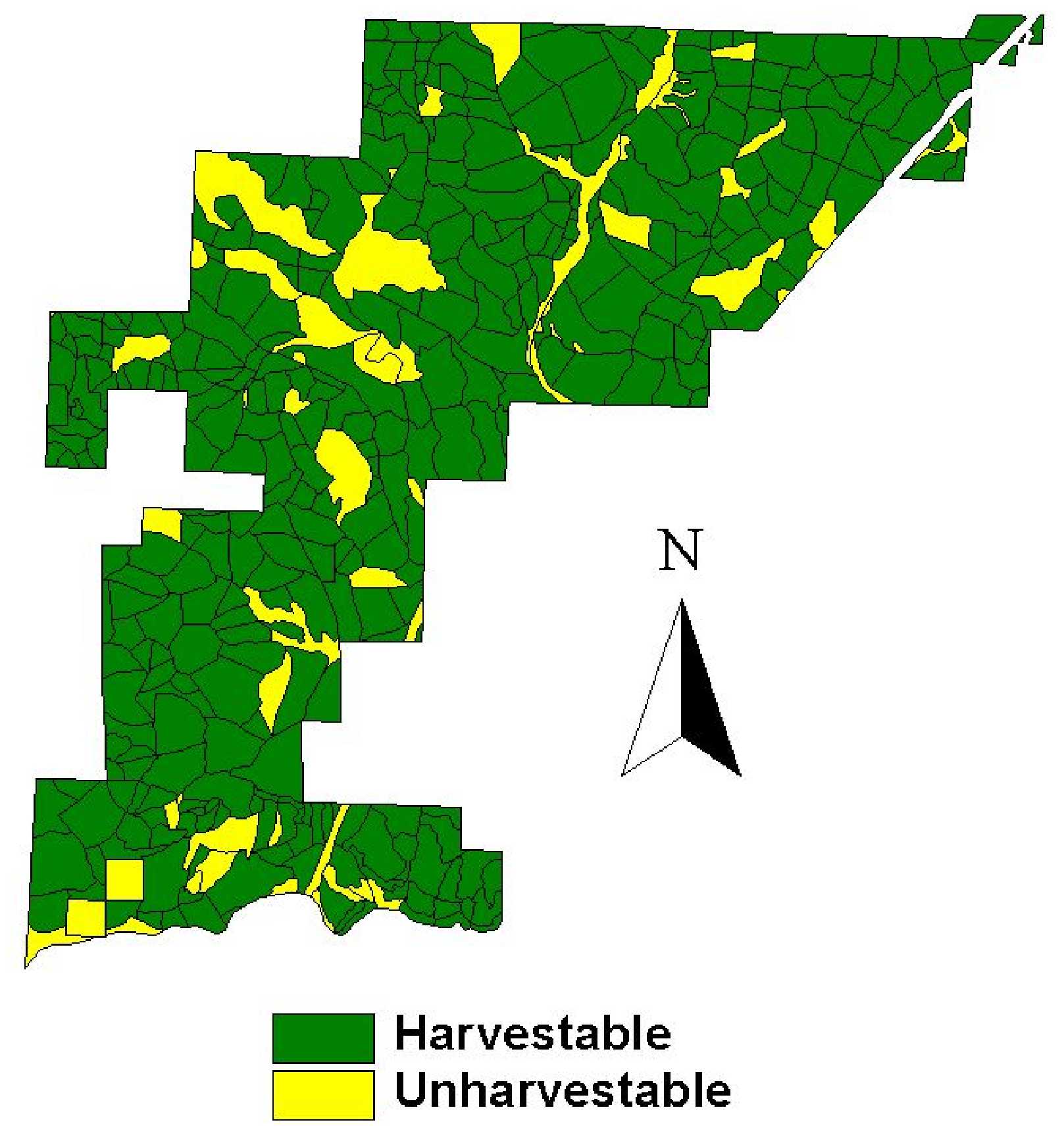
Figure 38. Harvestable and unharvestable settings in the North Hoodsport Planning Area.
These settings, along with the harvest system options, AYD, and several other factors, are now input into SNAP. A detailed discussion of the SNAP analysis is located in Chapter 13.