| TESC 431 Home | QMH Intro | Methods | Results | Plankton | Sediments |
| |
| |
Vashon Island was named during the Vancouver expedition of 1792; he considered Vashon and Maury Islands to be one island. Maury Island was named after Lt. William L. Maury of the 1841 Wilkes expedition and Quartermaster Harbor was named to honor the expedition's quartermasters (Vashon-Maury Timeline 2004).
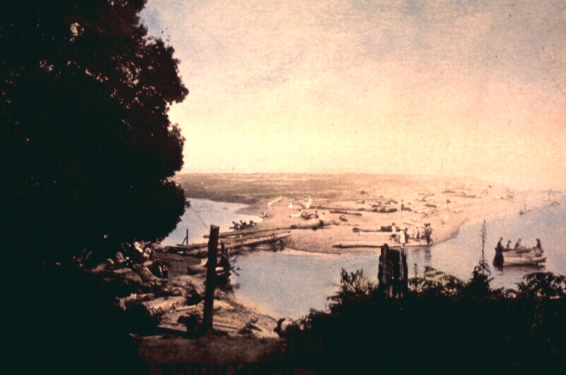
Historically water flowed into Quartermaster Harbor during high tide at the harbor entrance and at a location known as Portage, a narrow opening between Vashon Island and the north end of Maury Island. In 1916, (Historical photo from Vashon-Maury Timeline 2004) the opening was filled and a road was constructed between the islands reducing circulation (Department of Natural Resources 2004).
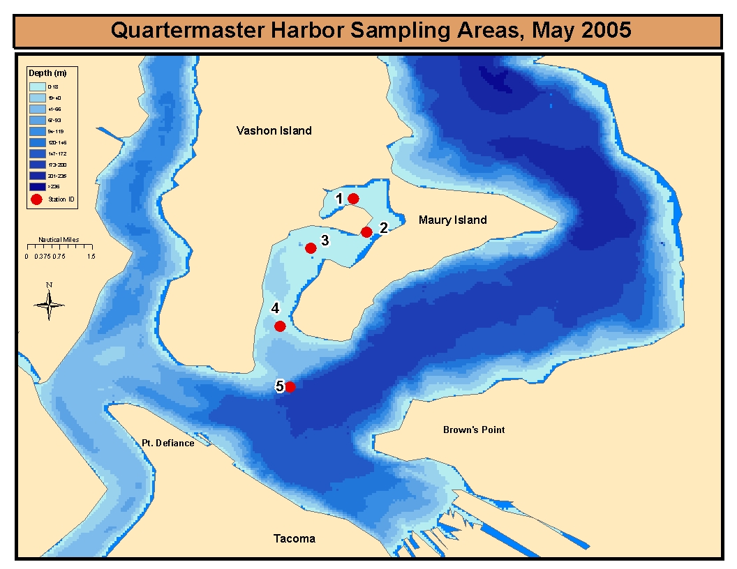
Quartermaster Harbor is a shallow bay covering an area of 1,234 ha. The inner harbor has an average depth of 5 meters while the outer harbor averages 22 meters with a maximum depth of 31 meters. The harbor is influenced by the input of freshwater from several small streams and a relatively low flushing rate. The main inputs of freshwater into Quartermaster Harbor are Judd Creek flowing into the inner harbor and Fisher Creek flowing into the outer harbor (Department of Natural Resources 2004).
The Washington Department of Natural Resources has created an Environmental Aquatic Reserve (Link to report here). The reserve includes 2,238 ha of state owned aquatic tidelands in Quartermaster Harbor and along the east and south shore of Maury Island that extend to a depth of 21.4 meters below mean lower low water or one-half mile from the line of extreme low tide, which ever is farther waterward. The reserve was established to protect: herring spawning habitat, Chinook salmon migratory corridors and rearing areas, bottom fish rearing habitat, and an important migratory stop for wintering birds (Department of Natural Resources 2004).
Quartermaster Harbor recently experienced contamination from an oil spill that occurred October 13, 2004 in Dalco Passage near Maury Island and spread into the harbor due to tidal influences (Eklund 2004).
The goal of this website is to provide public access to data collected during spring 2005 in Quartermaster Harbor, eventually accumulating a historical record of water quality parameters in this area. An overview of field sampling methods, results and discussion are also present, as well as a data repository presenting actual data collected.
Link to References and Acknowledgements
This website created by Andy Campbell and Kyle Sorensen in
Spring Quarter 2005 at the University of Washington, Tacoma.
This website is dedicated to the memory of the lost Ponar sampler.
| TESC 431 Home | QMH Intro | Methods | Results | Plankton | Sediments |