Introduction to Geographic Information Systems in Forest Resources
| Introduction to Geographic Information Systems in Forest Resources |
|
|||||||||||||||
|
|||||||||||||||
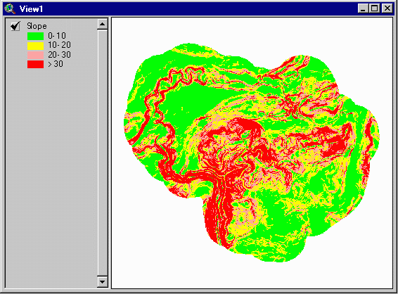
The following graphic displays 10% slope classes. These were generated by a simple process performed on a digital elevation model.
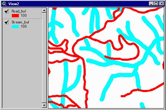
Here is a section of the road and stream buffers. Stream and road buffers are created easily within the software.
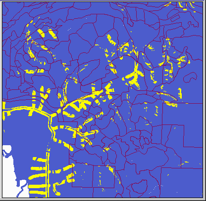
These three datasets are merged; all properties of each dataset are stored in the final output. Each yellow polygon is coded for its status in each buffer type, as well as its slope class. Here is a display of a selection of polygons meeting our specified criteria:
Although these criteria are somewhat arbitrary, what other types of complex questions would you like to answer about the landscape you will manage?
|
|||||||||||||||

|
The University of Washington Spatial Technology, GIS, and Remote Sensing Page is supported by the School of Forest Resources |
School of Forest Resources |
