Introduction to Geographic Information Systems in Forest Resources
| Introduction to Geographic Information Systems in Forest Resources |
|
|||||||||||||||
|
|||||||||||||||
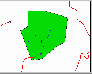
Conceptually, calculating the distance of a point to a polygon is simple. It is the distance from every place within the patch to the nest. Here is a simplified view of a stand, its landing, and several lines representing that distance. When you consider that there are really an infinite number of these distances, the problem becomes operationally quite a bit more complicated to solve.
It takes more than a little work to get the computer to do this, especially for an entire forested area.
What we will do is create a group of cells that represent each stand. We than calculate the distance from the nest to each cell center, and then take the mean of all these distances. This is done on a stand-by-stand basis. Each stand's average nest distance is recorded, and along with the size of the patch can be used to help generate an understanding of how birds select nest locations in different patch types.
Here we see the cells along with a road and the nest for a single forested patch.
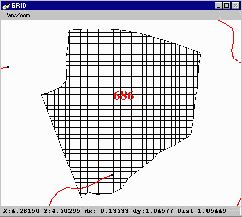
This patch has an average distance of nest to patch of 686 ft. Using a custom looping program, this distance is easily calculated for each patch within a planning area.
A glimpse at the code which calculated the distance.
|
|||||||||||||||

|
The University of Washington Spatial Technology, GIS, and Remote Sensing Page is supported by the School of Forest Resources |
School of Forest Resources |
