Introduction to Geographic Information Systems in Forest Resources
| Introduction to Geographic Information Systems in Forest Resources |
|
|||||||||||||||
|
|||||||||||||||
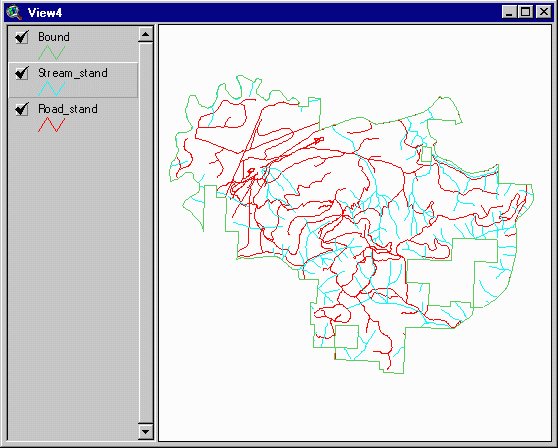
First, we eliminate roads and streams that are not within the forest area. This image shows streams and roads clipped to the administrative boundary of Pack Forest.
Then we summarize the forest area (in square miles) and summarize the stream and road length (in miles).
The quotient of (stream length / forest area) is the stream density, and
(road length / forest area) is the road density:
|
|
|
|
|
| forest |
|
||
| roads |
|
|
|
| streams |
|
|
|
|||||||||||||||

|
The University of Washington Spatial Technology, GIS, and Remote Sensing Page is supported by the School of Forest Resources |
School of Forest Resources |
