Learn how to open ArcGIS on-line documentation ("help")
ArcGIS 's online documentation system should become your best friend while
you are learning to use ArcGIS. The documentation is extensive and quite well
written, in comparison to most other software applications' documentation. As
you are leaning ArcGIS, you should automatically open Help and keep it
open until you are finished with your ArcGIS session. One of the biggest differences
between those who learn GIS quickly and those who take longer to learn, or never
learn, is that the fast learners use Help extensively. The fast learners will
be able to teach themselves a tremendous amount; the slow learners will struggle
a lot, attempt a lot of things through trial-and-error (mostly error) and learn
relatively little.
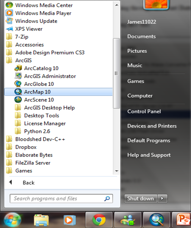
Start by finding ArcGIS, by navigating through the Start Button on the Windows Task Bar.
You should see a structure something like this:
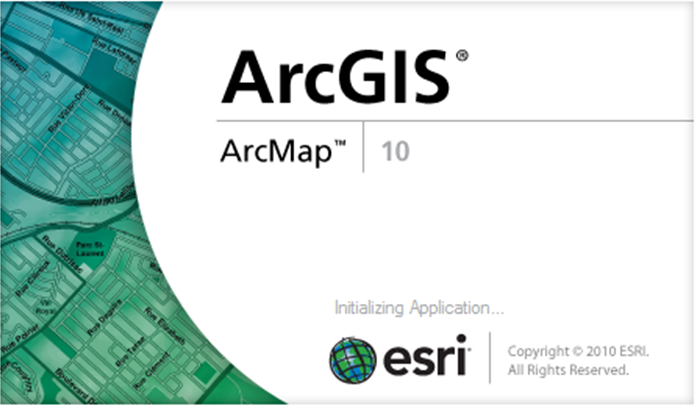
Open ArcMap by selecting the ArcMap shortcut.
A banner will appear showing that ArcGIS is opening..
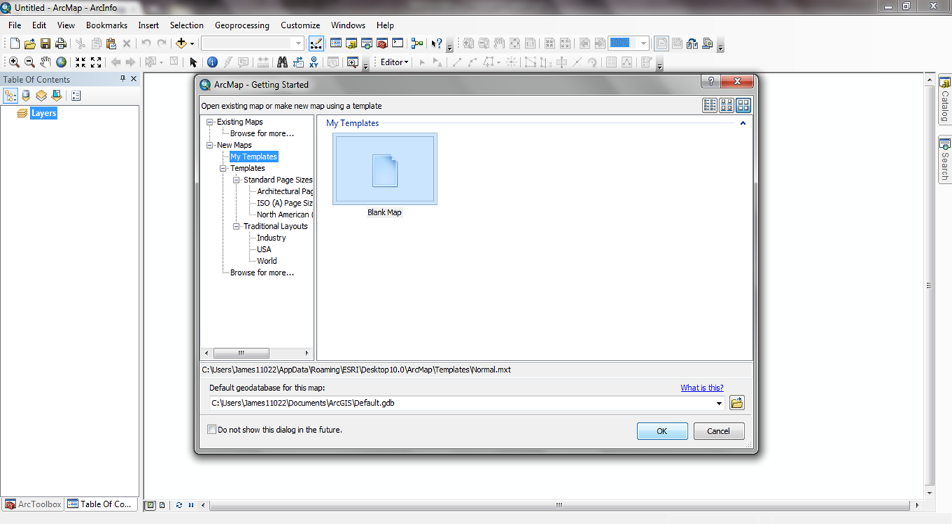
ArcMap will start with a dialog prompting you to either create a new empty
map, a map template, or open an existing map (if you have been using maps
previously, they will be listed in the dialog). We won't be working with maps
today, so cancel the dialog.
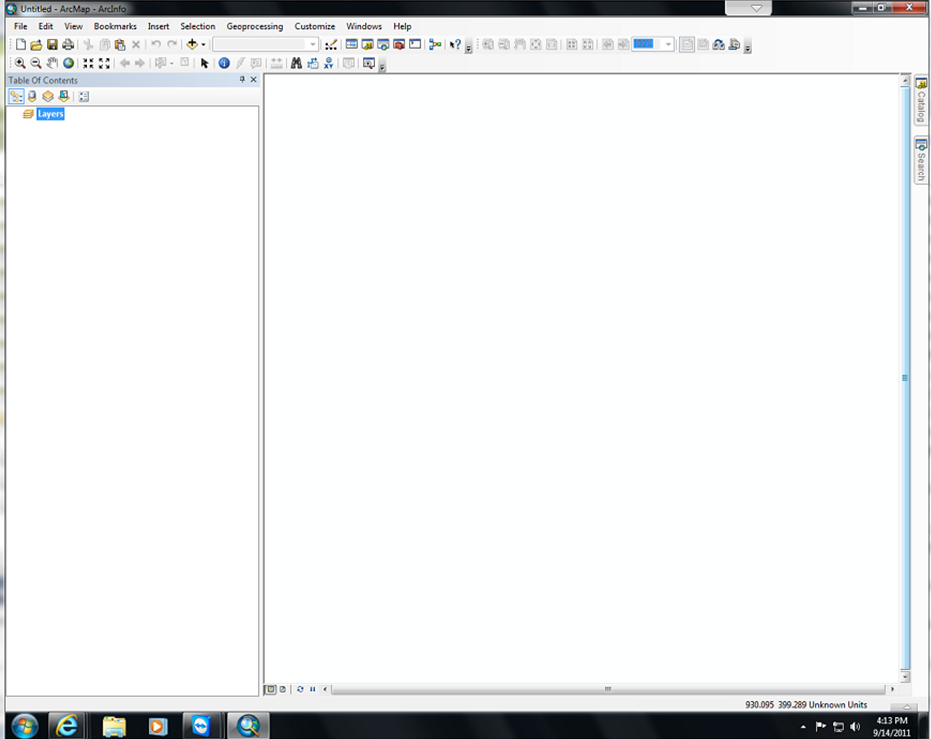
You will see the ArcGIS application window that contains a single window (the
Project Window) containing a few icons, a few menu choices, and a few buttons.
Start & use ArcGIS help
There are several ways of starting ArcGIS 's on-line documentation ("Help")
system:
Open ArcGIS Help by selecting the shortcut for ArcGIS Desktop Help
(in the same Windows Start menu location as ArcGIS ).
ArcGIS help functions like any other Windows help system for other software
applications.
The second method is to click the Help menu, always the rightmost
menu on the ArcGIS graphical user interface.
The third method is to use context-sensitive help, described below.
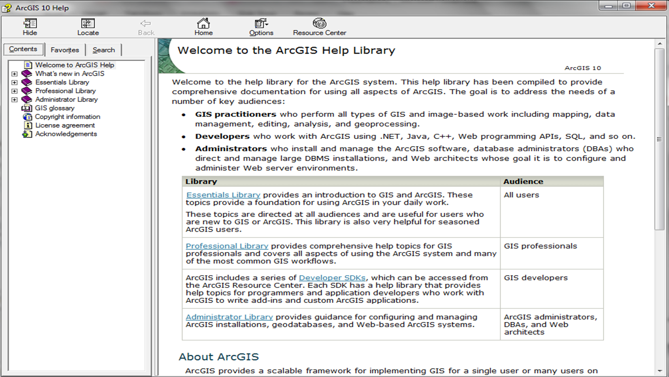
When Help opens, you will see an application with 4 tabs. The first tab
is the Contents tab.
The Contents tab contains all of the main topics in ArcGIS Help.
The contents are arranged in a hierarchical order. Each book icon
represents an upper-level subject in the documentation. As you open these
books, you will see other book icons, which represent subordinate subjects.
Each subject contains topics and/or subordinate subjects.
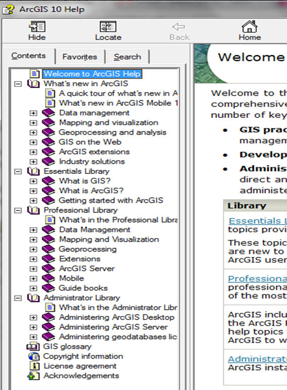
Click the ArcMap subject. You will see the book icon change to look
like the book is open
, and a dropdown list of other topics will open (topics with explanations
have a page icon ;
topics with lists of how to perform an action have a list icon ).
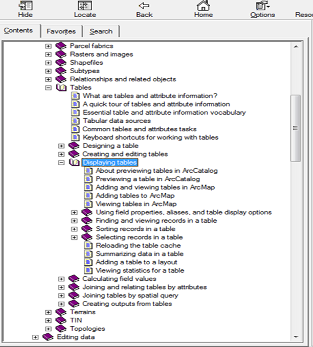
Click on the Tables subject, and you will see a dropdown
list of specific topics. Click on the Displaying tabular data topic. The help topic will open
in the right-hand pane of the help application.
The window at right hand side will show the introduction of that topic. In this exercise, you will see the topic: Displaying tables and know how to operate it within ArcMap.
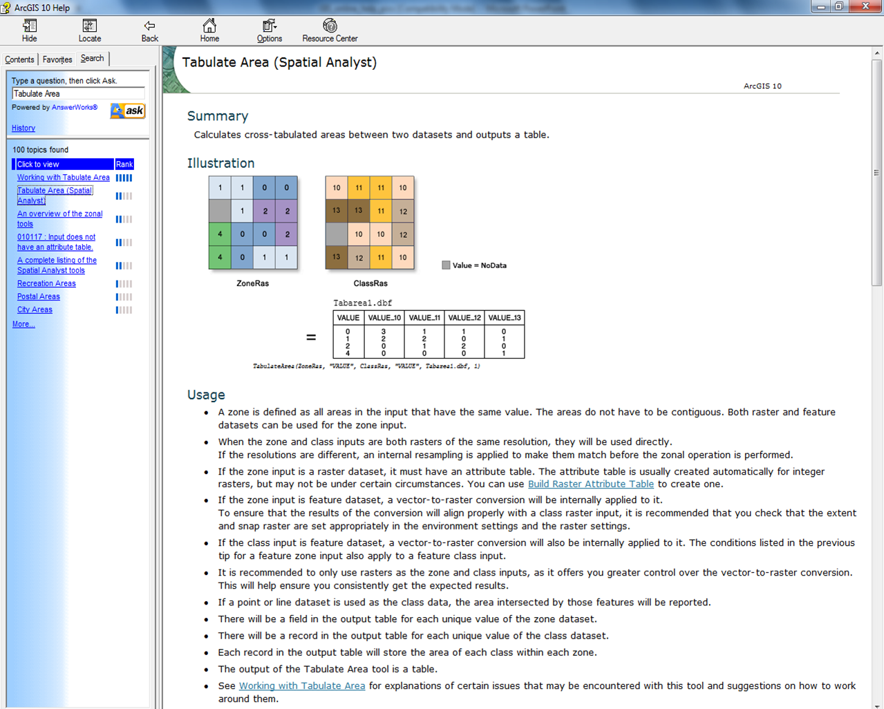
Click the Help Topics button, and then click the Search tab on the main Help application. Type "tabulate area" in the text
entry control. You will see a list of help topics that contain the search
string. Open and peruse the topic Tabulate Area.
The usage portion will explain how to use this tool to achieve your purpose of analysis.
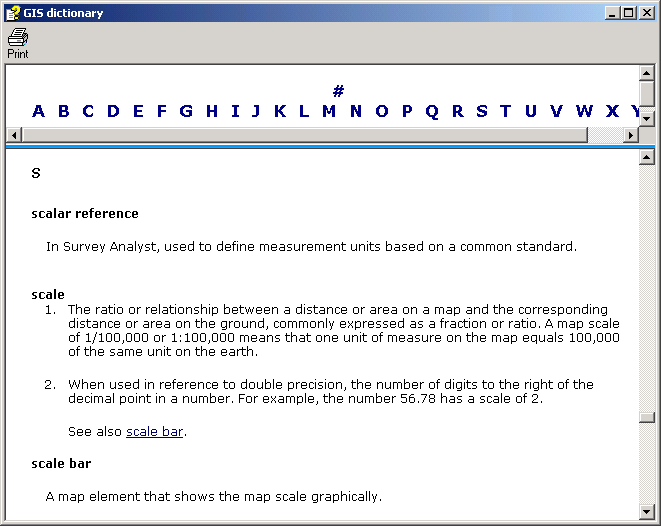
Using the GIS Dictionary
ArcGIS help comes with a Glossary of terms. The dictionary is linked on the
left-hand pane of the help application.
Open the GIS Glossary by clicking on its link. The application will open.
Find the definition of scale by clicking on the S.
You can find the definition of many different terms by using the GIS dictionary.
Browse for a few more terms.
Summary
You have just learned how to open ArcGIS help, and how to search for help
on a specific topic. The difference between those of you who learn a little
or a lot about ArcGIS and GIS will be determined by those of you who learn
to use and consult this on-line documentation. If you learn nothing else
this quarter, you should learn to use ArcGIS 's Help. You will use online
help more in the next lab exercise.