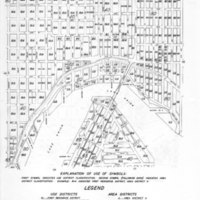
Plate 23 / Zoning maps of City of Seattle as of August 1, 1947
Dublin Core
Title
Plate 23 / Zoning maps of City of Seattle as of August 1, 1947
Subject
ZONING, WALLINGFORD, UNIVERSITY-DISTRICT, PORTAGE-BAY,
Description
A zoning map of Seattle as of 1947
Creator
City Planning Commission
Source
Seattle Municipal Archives
Publisher
Seattle: City Planning Commission, 1947
Date
August 1, 1947
Contributor
City Planning Commission
Format
Digital Photo
Language
English
Type
Paper Map
Still Image Item Type Metadata
Original Format
Paper Map
Physical Dimensions
28 x 22 cm. Paper.
Files
Citation
City Planning Commission, “Plate 23 / Zoning maps of City of Seattle as of August 1, 1947,” University District Stories, accessed December 16, 2025, http://courses.washington.edu/hstaa208/items/show/689.

