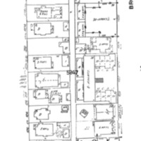
Block 14 Seattle Sanborn Insurance Map
Dublin Core
Title
Block 14 Seattle Sanborn Insurance Map
Subject
Block 14: NE 42nd to 43rd Streets between 12th Ave and Brooklyn Ave.
Description
Map depicting building units with information about number of apartments in each
Creator
Sanborn Map Company
Source
ProQuest's Digital Sanborn Maps http://sanborn.umi.com.ezproxy.spl.org:2048
Date
Originally published in 1919, revised in 1946 with new building units included.
Format
PNG screenshot from PDF document
Files
Citation
Sanborn Map Company, “Block 14 Seattle Sanborn Insurance Map,” University District Stories, accessed December 27, 2025, http://courses.washington.edu/hstaa208/items/show/938.

