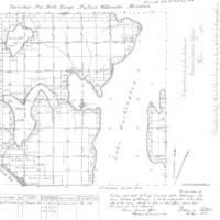
Georeferenced General Land Office Plat Map, Cadastral Survey 25-4e-A, Township 25 North, Range 4 East, Willamette Meridian, WA
Dublin Core
Title
Georeferenced General Land Office Plat Map, Cadastral Survey 25-4e-A, Township 25 North, Range 4 East, Willamette Meridian, WA
Creator
Phillips & Strichler
Source
Puget Sound River History Project
Publisher
Department of Earth & Space Sciences, University of Washington
Date
1856-01-24
Format
JPEG
Files
Citation
Phillips & Strichler, “Georeferenced General Land Office Plat Map, Cadastral Survey 25-4e-A, Township 25 North, Range 4 East, Willamette Meridian, WA,” University District Stories, accessed January 28, 2026, http://courses.washington.edu/hstaa208/items/show/563.

