Introduction to Geographic Information Systems in Forest Resources
| Introduction to Geographic Information Systems in Forest Resources |
|
|||||||||||||||
|
|||||||||||||||
You have already seen how to download and import grid data from USGS-format Digital Elevation Models (DEMs).
You have already seen how to create point layers from tables or text files containing X and Y coordinates.
There are a number of other different geospatial data file formats we will cover in this lesson:
Arc Interchange Files
Arc Gnereate
SDTS Data
DEM
Vector data (DLG)
DRGs
ArcInfo has been the de facto industry leader in GIS software, so many organizations that have built GIS databases have used ArcInfo. Therefore, a large amount of GIS data exist in ArcInfo format. Data from ArcInfo are most commonly distributed in the Arc Interchange File format, also commonly called the ArcInfo Export File, or the e00 ASCII format. These files can be imported using ArcToolbox. Arc Interchange Files are used to transfer ArcInfo data across multiple file systems, across multiple computers, and across multiple computer architectures. Because of the complexity of the ArcInfo file storage model, it is necessary to export data sources from ArcInfo before they can be imported to ArcInfo or ArcGIS running on other systems.
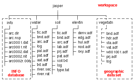
The ArcInfo workspace file storage model works as indicated in this diagram. In this example, the workspace jasper contains data sources for the layers water, soil, elevatin, and vegetatn. These directories contain coordinate and geometry data files for each individual layer.
For each ArcInfo workspace, an info directory exists containing all tabular data for the layers, including layer attribute tables, boundary, and tic location tables. Without both layer directories and the info directory, the workspace or layers will not function.
The EXPORT command in ArcInfo Workstation exports a layer's directory and any tabular data from the info directory associated with that layer. This results in a single interchange file that will completely recreate the coverage, grid, TIN, or INFO table when imported.
Arc Interchange files always have the file extension .enn, where the nn is the number of the individual part of the interchange file. A single coverage, grid, or TIN can be exported into an interchange file that spans multiple files. This option can be used to save an interchange file in parts on several floppy disks. Now that floppy disks are on their way out, supplanted by either the Network or by larger removable devices, such as CD and DVD media, you will almost always encounter single interchange files, with an file extension .e00.
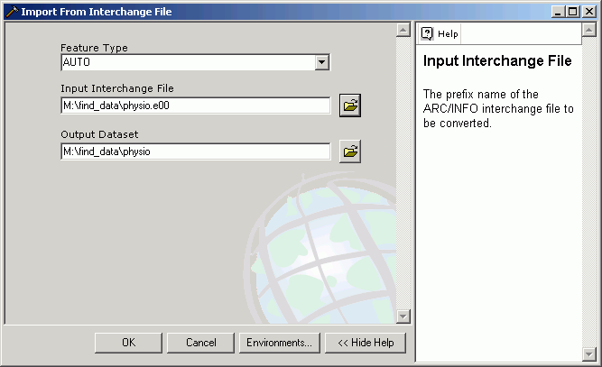
Importing Arc Interchange files
The interchange files are created on a machine running ArcInfo Workstation, and then copied to another system and imported. Frequently data available on the web are posted in this format. After downloading, ArcToolbox is used to recreate the original data sets.
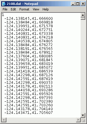
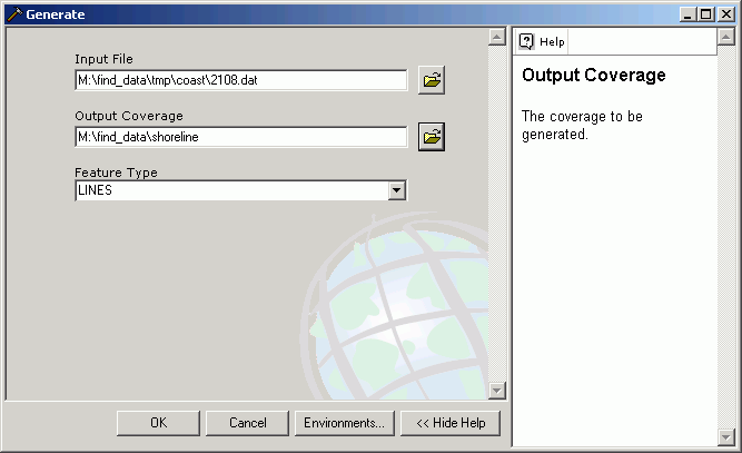
ArcInfo generate files were introduced in the lesson on Project and Data Management. Files that are stored in Generate format can also be imported using ArcToolbox.
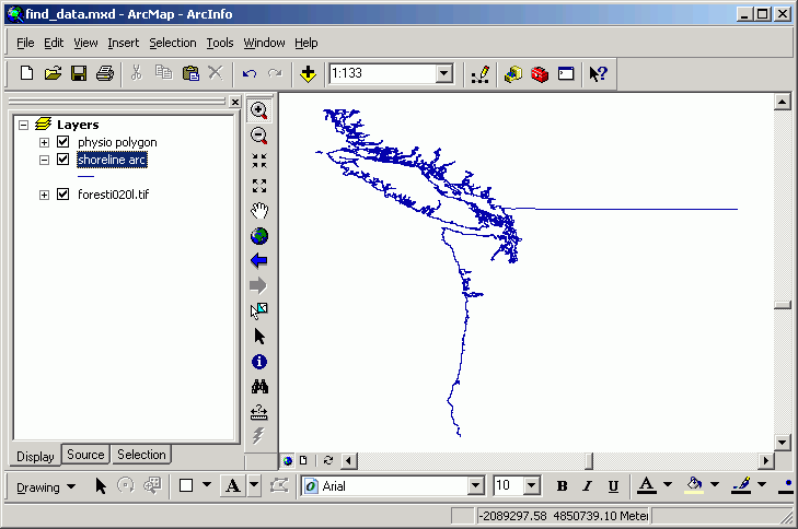
Here is a generate file of the coastline of the Pacific Northwest:
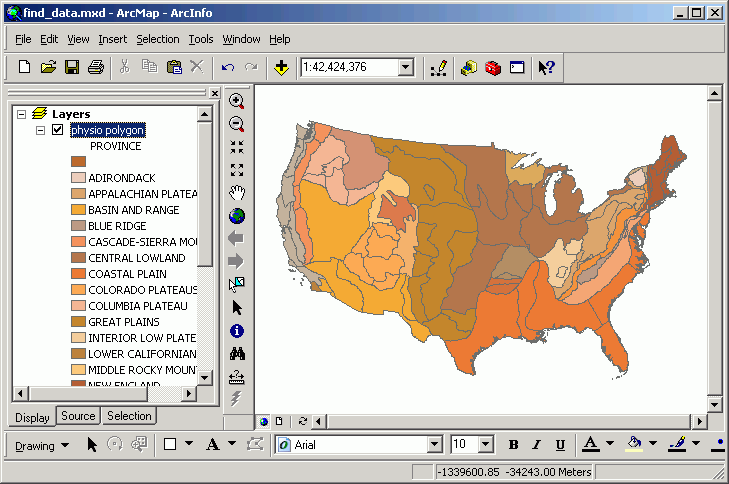
Imported:
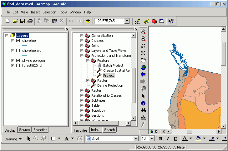
And projected and integrated with other data sets:
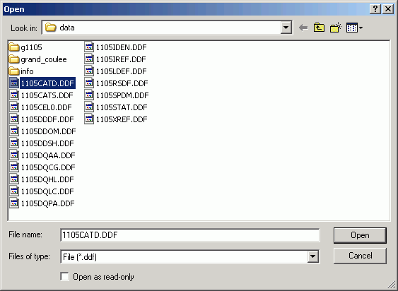
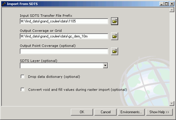
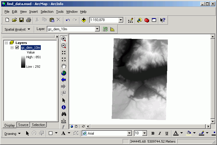
The Spatial Data Transfer Standard (SDTS) is a file format the USGS uses for distributing geospatial data. The file format is complicated and generally handled well only by advanced software. The DEMs we used in the exercises on Raster Analysis were provided in USGS DEM format. SDTS format consists of multiple source files for a single layer data source. ArcGIS can import SDTS DEM data directly from the source files.
Here, an SDTS format DEM is imported as a raster grid.
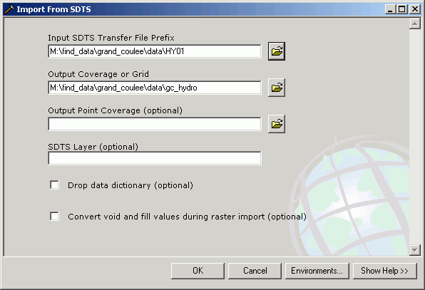
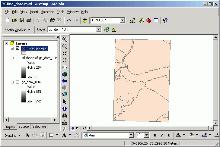
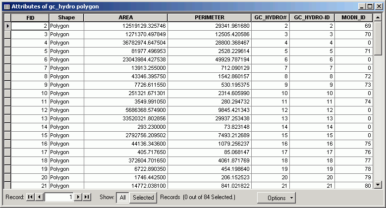
SDTS is also used to distribute vector data. ArcToolbox has a routine that does a limited import of the vector data (full attribute information is not imported).
Note the limited number of attributes:
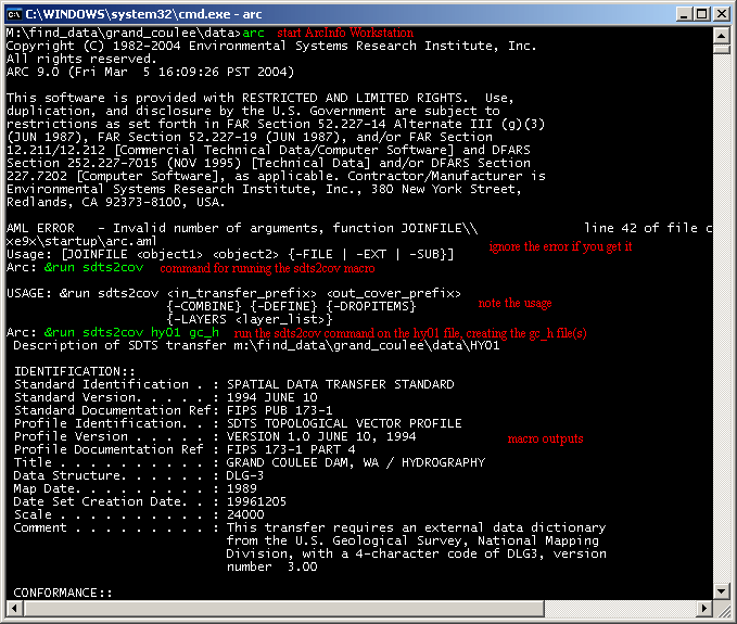
To do a full import of SDTS vector data at ArcGIS 9.0, recreating the data attribute structure, it is necessary to use ArcInfo Workstation and the sdts2dem macro.
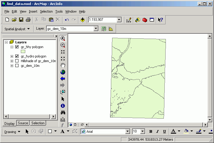
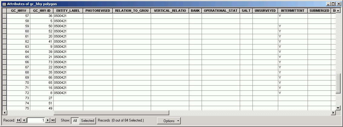
While the data look identical in the ArcMap display, the table shows the ArcInfo macro imported the complete list of attributes.
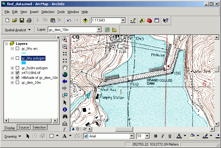
Digital Raster Graphics (DRGs) are simply high-resolution scanned and georeferenced USGS topographic quadrangles in TIFF format. They do not need any special import routine; they can just be added to an ArcMap session.
Here is the DRG for the Grand Coulee Dam. Zoomed in, you can see the detail is the same as what you would expect on a paper map.
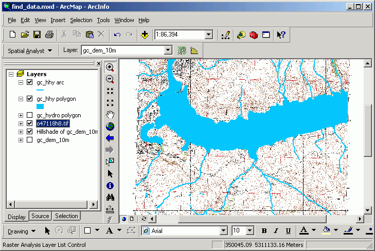
But because this is a scanned image that is georeferenced, it is possible to use it in conjunction with other GIS data. Here is the same DRG overlain with the DLG hydrography data for the same area:
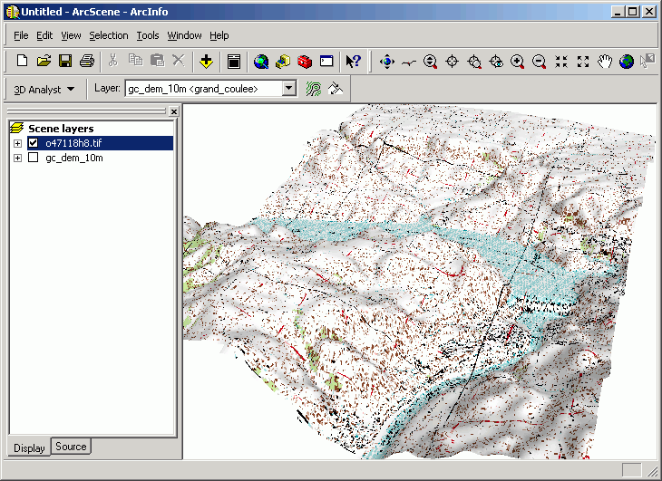
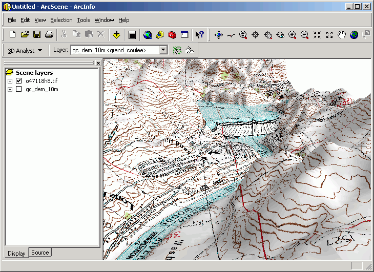
And in an ArcScene document, draped over the DEM:
Return to top | Ahead to Help Topics
|
|||||||||||||||

|
The University of Washington Spatial Technology, GIS, and Remote Sensing Page is supported by the School of Forest Resources |
School of Forest Resources |