Hood Canal Results and Discussion
Hood Canal
[TESC 431 Home ] [Introduction] [Sampling Stations/HC Methods] [Methods] [Data Repository] [References]
Results and Discussion
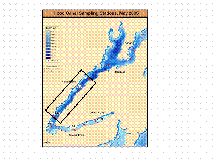
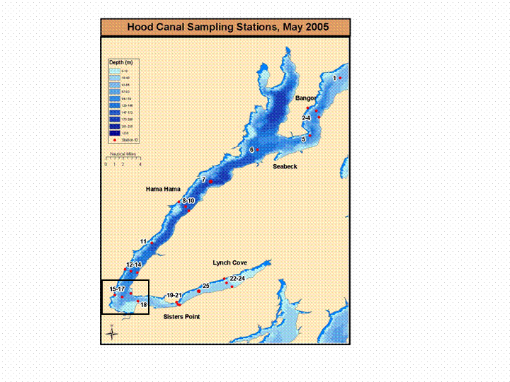
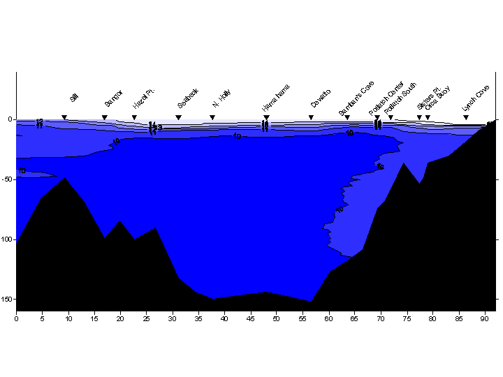
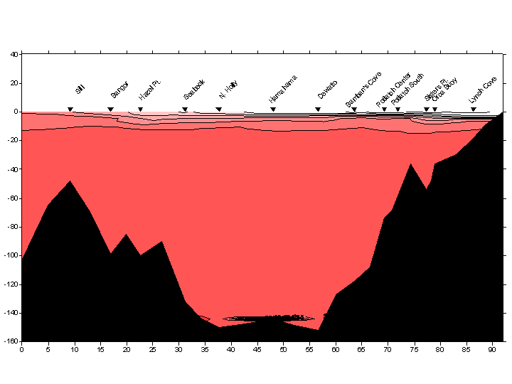
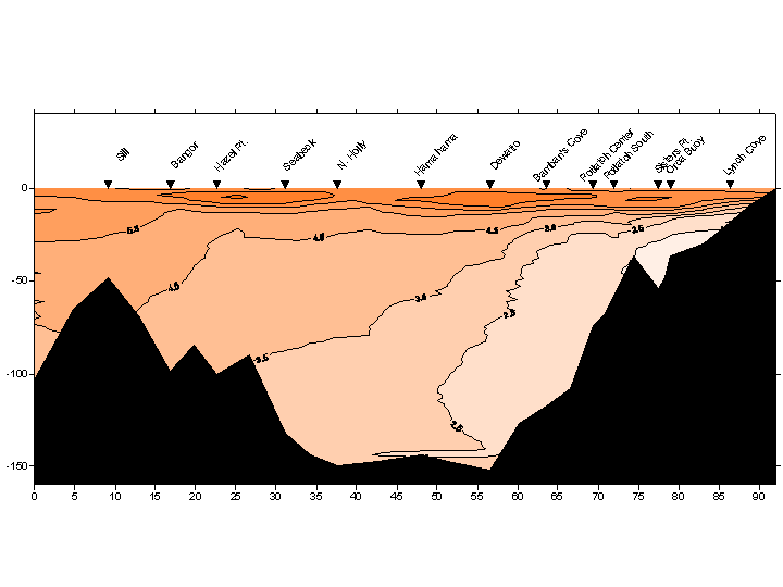
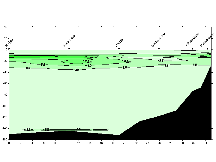
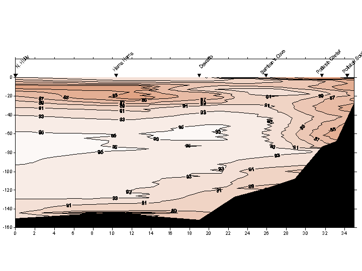
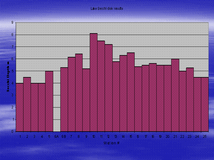
Temperature measurements are consistant throughout the water column for most sites ranging from 14 oC - 10 oC. Intrusions of 10 oC water are evident at the entrance sill and at Potlatch South, Sisters Pt., Orca Bay, and Lynch Cove. The thermocline ranges from 10-20m depth and is consistent at 10 oC below depths of approximately 20 m. Salinity distributions in the water column show expected increases with depth. Salinity profiles also suggest the presence of a halocline between 5 m and 10 m depth. Salinity profiles at South Potlatch (STA18) and the ORCA Buoy (STA25) show evidence of a fresh water intrusion at 10 m. Freshwater intrusions are not reflected in the density profiles, indicating that salinity is the dominant factor determining water density. Gradients in the temperature, salinity, and density profiles also indicate a stable and stratified water column. A hypoxic zone (<4mL/L) is evident at 75 m near the entrance sill, and as shallow as 25 m in the inner reaches of the canal. In situ and laboratory titrations of dissolved oxygen are compared for accuracy and also compared to historical dissolved oxygen levels to identify trends. Historic dissolved oxygen was measured by the Department of Ecology (DOE 2005). These CTD measurements were taken for years 1990, 1995, 2000, 2001, 2002 at Eldon, Hamma Hamma River. We chose this site for historical data because it is centrally located. It will not only show dissolved oxygen trends over a longer time, but will provide us with a normal range with which to compare our data. Fluorescence data suggest maximum primary production levels occur between 4 and 35 m. This data correlates with Secchi disk readings that indicate light attenuation between 4 and 8 m depth. CTD light transmissivity profiles show evidence of the Skokomish River plume, and the reduction in light transmission is likely caused by the river's suspended sediment load. Lake Secchi data shows light penetration to 4 - 8 m which is also reflected in chlorophyll-a profiles. The contour plots below represent a longitudinal transect of Hood Canal beginning at the entrance sill on the left (North of Bangor), and ending at Lynch Cove on the right. The contour plots for fluorescence and light transmissivity correspond to a longitudinal section of the middle canal from Holly to Potlatch (Stations 7-18) which is the area sampled by the UW Tacoma CTD. The HCSEG CTD was not equipped with sensors for fluorescence and transmissivity, making these parameters unavailable for the northern stations (1-6) and the great bend stations (19-25). Contour irregularities at depth in the center stations are the result of sensor values recorded when the CTD accidentally hit the channel bottom.
Temperature
Salinity
Density
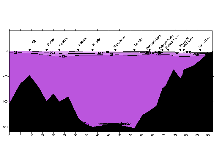
Dissolved Oxygen
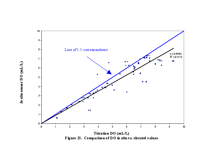
In Situ vs Laboratory Titration Dissolved Oxygen
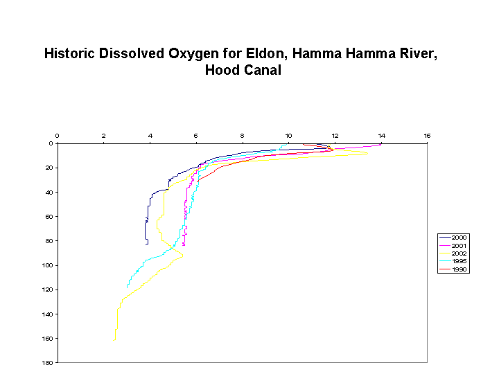
Data courtesy of WA Dept. of Ecology
Fluorescence
Note: The following contour plots represent the middle section of the canal surveyed by the UW boat equipped with fluorescence and transmissivity sensors. The stations depicted on the maps below were combined into one longitudinal transect.
Light Transmission
Lake Secchi Disk Data for All Sites
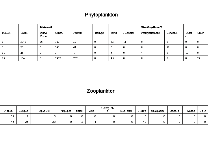
Phytoplankton and Zooplankton
 [TESC 431 Home ] [Introduction] [Sampling Stations/HC Methods] [Methods] [Results/Discussion] [Data Repository] [References]
Created by Jeff Hubert and Lee Ann Acker