Hood Canal
[TESC 431 Home ] [Introduction] [Sampling Stations/HC Methods] [Methods] [Results/Discussion] [Data Repository] [References]
Sampling Stations
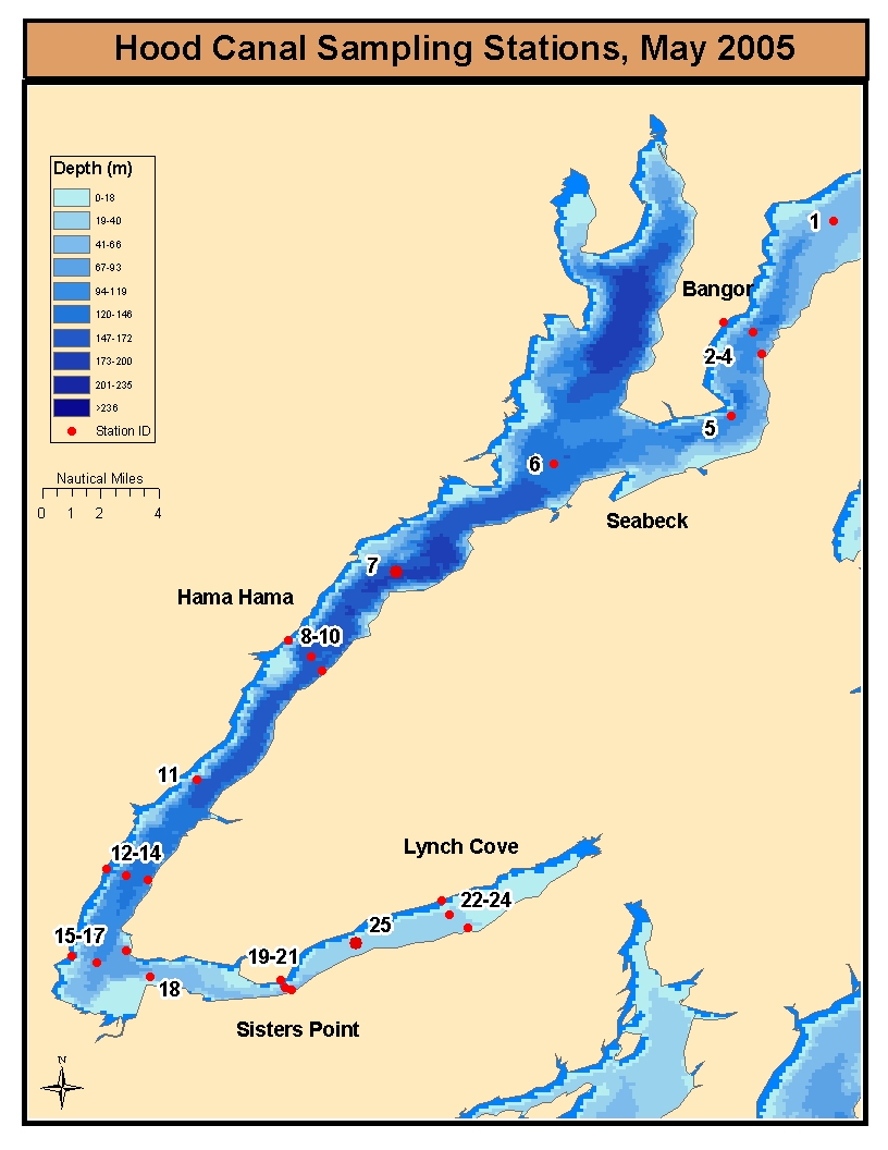
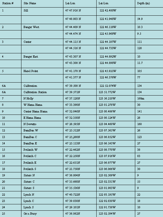
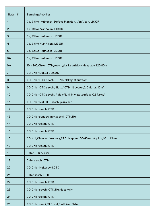
Twenty five sampling stations (Figure 1) spanning the entire length of the canal were selected. A station was selected near the entrance sill (station 1), while transects were conducted in the vicinities of Bangor (stations 2-4), Hama Hama (stations 8-10), Hoodsport (stations 12-14), the Skokomish delta (stations 15-17), Sisters Point (stations 19-21), and Lynch Cove (stations 22-24). Additional stations were selected in the channel center halfway between the transects (stations 5, 6, 7, 11, 18, and 25). Station coordinates were determined with nautical charts and Global Positioning Systems (GPS) with accuracies of better than 5 meters were used to position the vessels at the station coordinates. We used two boats to sample the entire length of the canal. One vessel was provided by the College of Oceans and Fisheries Science - piloted by Dave Thorsen. The second vessel was provided by the Hood Canal Salmon Enhancement Group - a volunteer monitoring organization that routinely samples Hood Canal waters. Boat #1 was assigned stations 1-6 and 19-25. Boat #2 was assigned stations 7-18.
 [TESC 431 Home ] [Introduction] [Sampling Stations/HC Methods] [Methods] [Results/Discussion] [Data Repository] [References]
Created by Jeff Hubert and Lee Ann Acker