SOILS LAYER
|
 |
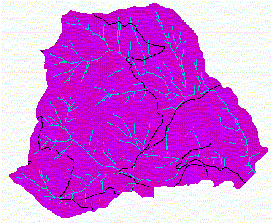
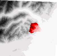
The soils layer is the basis of the Mass Wasting Module and the Surface Erosion Module. The project area for the FE 450 Senior Capstone Project is near Hoodsport, WA next to the Hood Canal. The greyscale Digital Elevation Model (dem), figure 1, shows the majority of the Capstone project area. The red portion in the image is the watershed that the Watershed Analysis will be conducted. For those familiar with the Hoodsport area, the curving light area to the north of the red analysis area is the Hamma Hamma river emptying into the Hood Canal.
 |
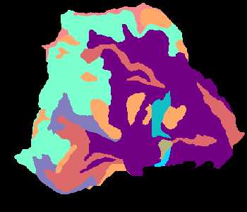
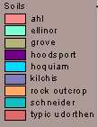
The soils layer for the hoodsport project area was lacking some important information necessary for some of the equations to be used in the analysis. There has not been an updated soil survey done in this area since 1939 which made the search for specific soil properties a little harder. The soil coverage was converted to a grid using ArcView in order to isolate the soil types within the analysis area.The soil types that were present in the analysis area can be seen in the figure 2 below.
|
|
 |
The Official Soils Series Descriptions-USDS-NRCS Soil Survey Division and the Soil Texture Triangle: Hydraulic Properties Calculator websites were consulted for soil properties. The Soil Series Descriptions site was where we were able to get some general information about our soils from the name. At this site you can type in the name of any soil and it will return a soil description, a general description and a description broken up into separate horizons, and location information including temperature and slope. Based on the soil description from the Soil Series Description site and the small description from the soil coverage, we were able to choose an appropriate %Sand and %Clay to put into the Soil Triangle Calculator website to obtain more specific information about our soil types including Field Capacity, Bulk Density and Saturated Hydraulic Conductivity.
With this information, we can now proceed to the analysis within the modules.