Site Report #2
Developments for my block began in the early 20th century, with land being plotted at the start of the 1900s. However, when construction on the block began, it was finished quickly. Within five years, the block has seen impressive growth in buildings and it soon becomes acclimated to the growing University District community. This analysis was mainly accomplished by observing maps from as early as 1903. Unfortunately, maps from the 19th century were unavailable for my block, but from what I’ve gathered, development did not begin until 1905-1906. Once the earliest, physical map was obtained, I’ve compared it to current topographical maps, to determine changes in environment features. Interestingly, the block from the 20th century looks very similar to what the block is today.
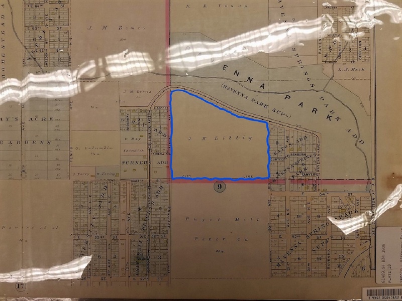
1903 map depicting the area where the block would've been. Baist's Real Estate Atlas of Surveys of Seattle. University of Washington Special Collections. February 2, 2017.
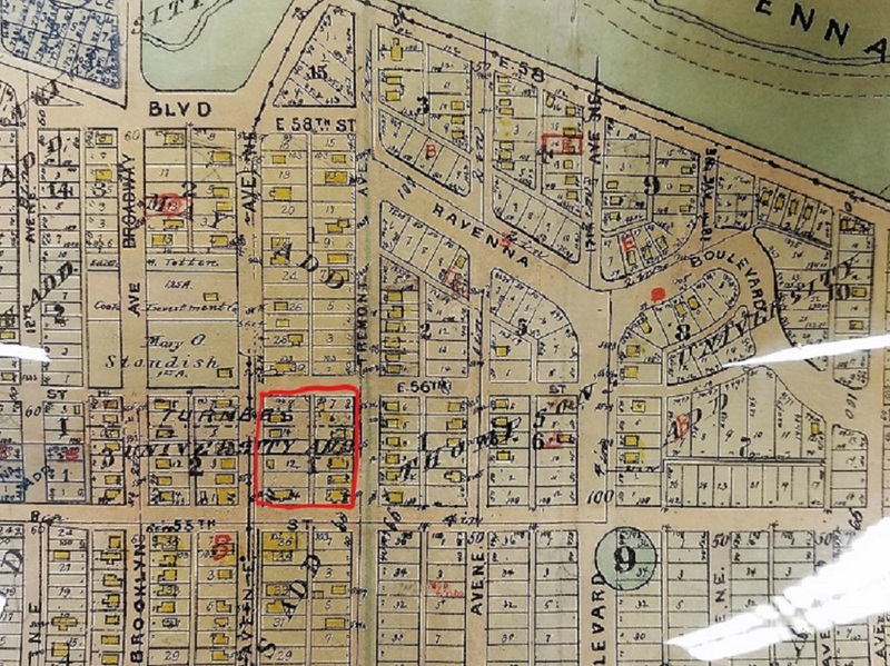
Block designated by red square, buildings have begun development and at that time there were 10 buildings on the block. Baist's Real Estate Atlas of Surveys of Seattle. University of Washington Special Collections. February 2, 2017.
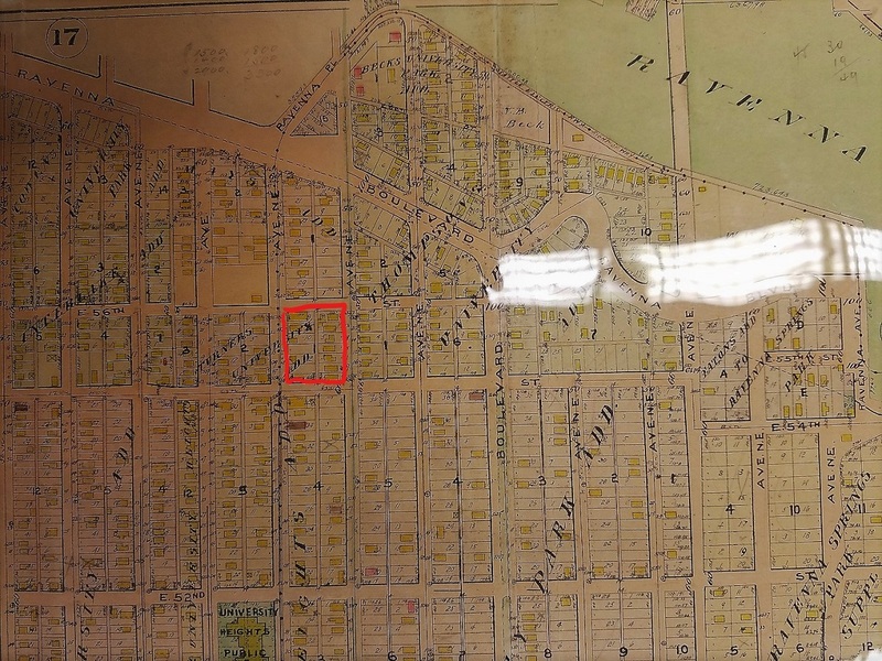
U-District in 1913, developments have come to a finish with 12 buildings on the block. Baist's Real Estate Atlas of Surveys of Seattle. University of Washington Special Collections. February 2, 2017.
The designation of land for my block began at the dawning of the 20th century. By this time, areas around the block have already seen construction and settlement. Water from Green Lake, U-District’s northern neighbor, was often allowed to naturally stream down into the U-District and acted as a water source. The land which the block is on apparently belonged to J.M. Littig, one of the directors of the United States Fidelity and Guaranty Company, an American insurance company mainly situated in Baltimore, MD that existed from 1896-1998. The land could’ve been owned by Littig, which he later developed into a block. More research into Littig’s influence on U-District has to be done. It was, however, inevitable for the block to be developed. The nearby blocks have been plotted for construction and there was a railway track in close vicinity. By 1908, the block catches up to its neighbors and is integrated into the U-District society. In addition, by that time, most of the block becomes occupied with construction, and by 1913, the block looks similar to what it is today.
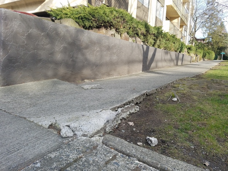
Sidewalk erosion from nearby tree. Seattle, WA (University District). David Kook. February 2, 2017.
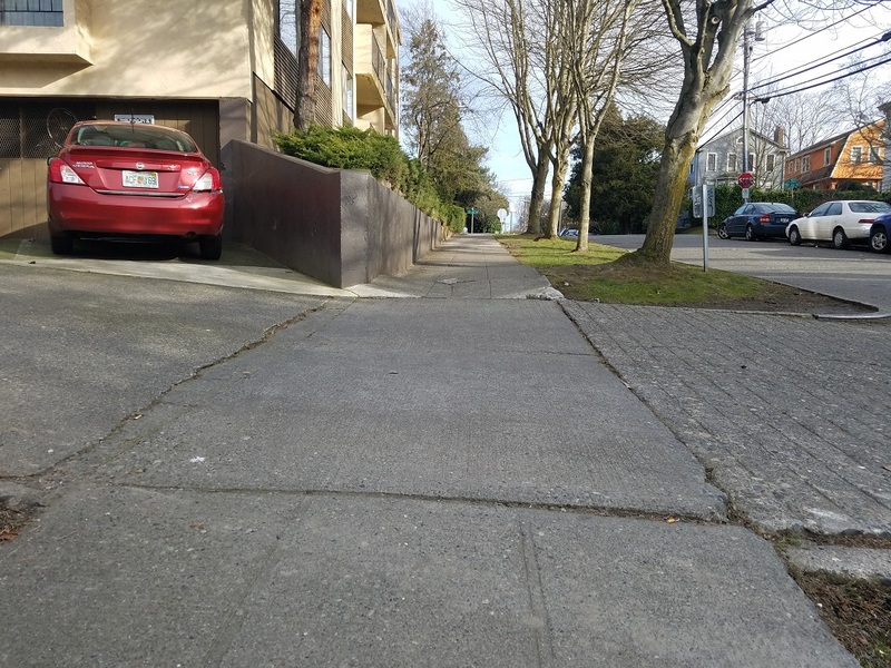
A difference in sidewalk pattern from the right to the center. Seattle, WA (University District). David Kook. February 2, 2017.
By 1913, the block has completed its development with 12 buildings. The map shows that the placement of the buildings is exactly how it looks today, which may suggest that the current residential homes in the area may have been around since then. One can notice a few oddities when strolling around the block. When walking up NE 55th St., there is a patch of sidewalk that has cracked with the sides lifting the concrete into a parabola shape. The cause can be traced to the nearby tree and its roots affecting the condition of the sidewalk. In addition, a few feet before the uprooted concrete, one will also notice a clear difference of sidewalk pattern. There is a patch of sidewalk that leads into the alleyway with a different appearance from the rest of the block.
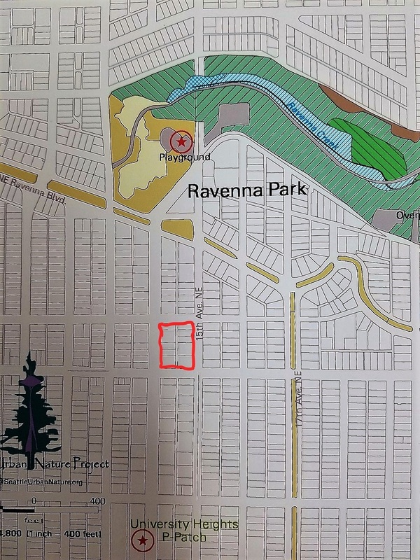
Environment map of the block in 2000. Seattle, WA (University District). Seattle Urban Nature Project. University of Washington. February 2, 2017.
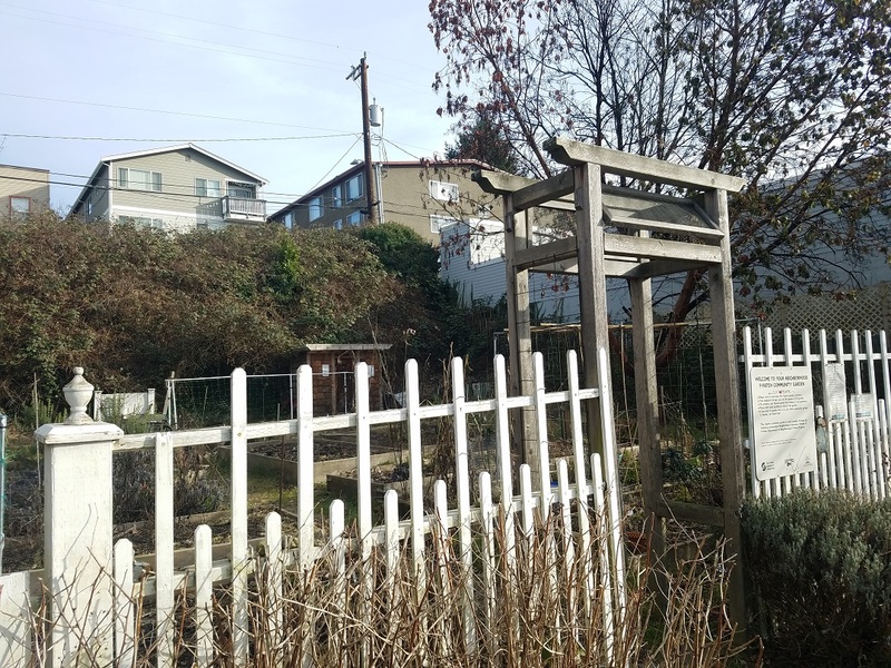
Community garden on the block. Seattle, WA (University District). David Kook. February 2, 2017.
Today, the block lacks any significant difference in structure from the early 20th century. It wasn’t until recently that a new addition to the block occurred. When looking at an environment map in the year 2000 from the Seattle Urban Nature Project, which designates nature, parks, and water systems, the block did not have Shiga’s P-Patch Community Garden. In fact, this community garden is a recent development, a community effort that sparked it since 2010. More information about the block's history will be evident from researching into specific areas of the land. For example, I hope to look into the history of the residential buildings and how they developed in relation to each other, since the buildings from previous maps appear to be placed at the same time. I do also want to look into the sidewalk patterns and if it does have historical significance. It's possible that the rightmost part of the sidewalk with the different pattern may have been used as an entry way into the alley. With no cars in the alley now, the city may have covered it up.
