Site Report 2: Environmental History
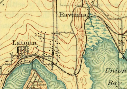
A topographic map from the U.S. Geological Survey of Seattle. University District (Seattle, WA). 1894. USGS.
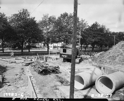
Sewer and pipe installation on 8th Ave NE. University District (Seattle, WA). Taken on August 28, 1959. Seattle Municipal Archives, Photograph Collection.
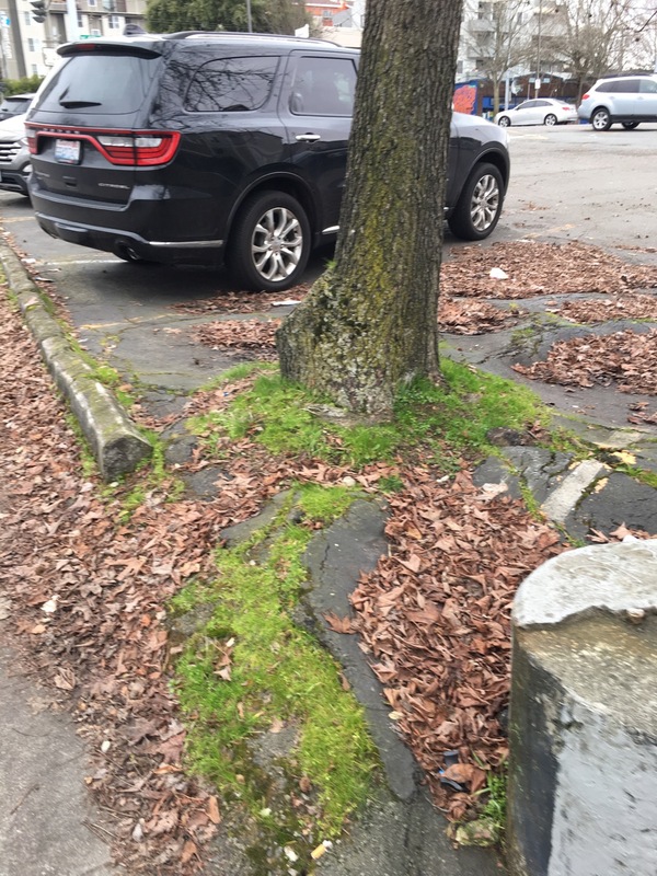
A tree growing through the asphalt in a parking lot off of NE 45th St. University District (Seattle, WA). Taken on January 30, 2017.
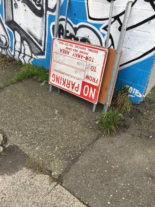
Weeds growing through the asphalt off of 8th Ave NE. University District (Seattle, WA). Taken on January 30, 2017.
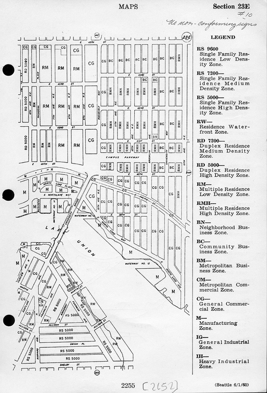
Zoning map of the block from 1960. University District (Seattle, WA). Seattle Municipal Archives.
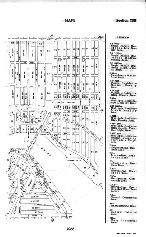
Zoning map of the block from 1973. University District (Seattle, WA). Seattle Municipal Archives.
The University District in the 1800s was relatively undeveloped. The area that is now the University District was mostly forest and the area surrounding Lake Union and Union Bay was a swamp. Specifically, on Block 1, NE 45th Street used to be a stream that the pioneers had to cross to settle the land. As there is no stream there today, this stream was redirected and part of it can still be found today under a trapdoor in the basement of the First Interstate Bank (Neilsen 1). The first real estate transaction that included this block was by Christian Brownfield on July 1, 1873. He purchased 173.57 acres of land that includes much of what is now the University District (Neilsen 2). Documentation of the land prior to 1900 is very hard to find as it was owned by private citizens and was so under developed. The environment consisted of forestation and small streams. According to the topographic map the United States Geological Survey published in 1984 (pictured at left), the University District is not situated on a major hill. Its elevation is lower than other parts of Seattle due to its close proximity to Lake Union and Union Bay. However, it is not entirely flat. It is situated on the side of a hill, adding a slight uphill to the topography but nothing steep enough to constitute extreme environmental reconstruction.
One of the major developments on Block 1 was the relocation of the sewer system and installation of pipes on 8th Ave NE that is pictured to the left. This required the manipulation of the environment as workers had to dig into the earth to install the new pipes underground. According to zoning maps from 1960 and 1973 (pictured at left), Block 1 has always been a low-density residential housing block. For a brief period, the side of the block that parallels 45th street was zoned for general commerce, yet did not stay this way. One of the distinguishing characteristics of Block 1 is its proximity to Interstate 5. However, Interstate 5 did not always exist, it was completed in Washington State in 1969 and prior to its completion there was a street called Pasadena Place in its place. Prior to Pasadena Place there was no major road as the area was a low density residential area and the University District in general was undeveloped and mostly forest there was no need for one. The construction of Interstate 5 and even Pasadena Place, the street before it, had major impacts on the environment. Not only did much of the natural landscape have to be displaced to accommodate for the road, but increased traffic and cars in the area lead to higher levels of pollution. While this construction project did not change the environment as drastically as the levelling of Denny Hill or the filling of the swamp that was where Pioneer Square is now, the construction of the road and Interstate suppressed much of the natural environment and displaced wildlife that once lived there.
Today, some bits of the environment can be seen beneath the urban façade. While most of the natural elements on the block are carefully manicured by professional gardeners and were planted with human hands, evidence of the previous environment can be seen in the weeds and grass growing through the cracks of the pavement. In the parking lot on the block, trees grow from the asphalt with their roots visible beneath the pavement causing bumps and cracks. As Professor O'Mara mentioned in Lecture Seven, in the city the environment is very contained. Nature is removed from daily life and confined to small planters along the sidewalk and small trees low enough to not interfere with the telephone wires. If someone living on my block wanted to fully experience nature they would have to go to a park in a different part of the city, they would not be able to just step outside of their apartment or house. In the industrial transformation of the United States, "nature" was turned into wealth (minerals, oil timber etc.) and was erased in the cities as developers flattened hills, filled swamps, and demolished forests to build infrastructure. However, despite the urban landscape, nature is still pushing to survive above the asphalt.
