Lake Titicaca and the surrounding area has many fascinating features, both man-made and naturally occurring.
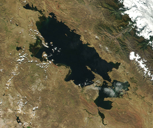
The Uros' Floating Islands
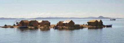
Image taken from http://www.shelales.com/images/Peru/Floating%20Islands.jpg
The Floating Islands of the Uros consists of around 40 individual man-made islands of varying sizes. Created by the Uros (not to be confused with the Quechua), they are made from the totora reeds that grow within the lake, the islands' original purpose was to be a defensive village, with some of them bearing watchtowers. Since the islands are floating and therefor mobile, they allowed for the local people to avoid the Inca who ruled much of the Andes for centuries.
Only a few hundred of the Uros maintain the islands today, while the remaining populace lives on the mainland. The reeds slowly rot away on the bottom, so the islanders must lay on new layers of reeds every few months. The islands last for a few years and can hold a couple to a dozen familes, depending on their size.
The islands are located in the waters near the city of Puno on the Peruvian side of the lake. While there are around 3,000 descendants of the Uros people, only a few hundred maintain the reed islands, while the remaining populace live on the mainland.
Isla Del Sol
One of the largest islands in the lake, this island is sacred to the Quechua, believed to be the birthplace of the Inca. There are many ruins left from the Inca Empire, on and with the lake itself, near Isla Del Sol. There have been many archaelogical studies done around the area, which resulted in the recent discovery of Incan ruins beneath the lake's surface, just off the shore of Isla Del Sol. The ruins are popular among the tourists. The island only a few miles from the Bolivian city of Copacabana.
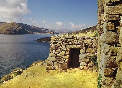
Image taken from http://americas.sas.ac.uk/newsletter/enlace/e_DIA_0121xLAKE.jpg
Tiquina Strait
This narrow strait, carved by an ancient stream during one of the lake's earlier wet periods, separates the main part of the lake from the smaller part of the lake, referred to as Lake Huiñaymarca by the Bolivians (Lago Pequeño by Peru). The way the strait slopes indicates that there was once a northwestern flowing stream. In the present, the water from "Lago Grande" flows in a southeastern manner. The steepness of the strait's walls also indicate that there is still tectonic activity in the area as the Pacific plate moves under the South American Plate.(Newell)
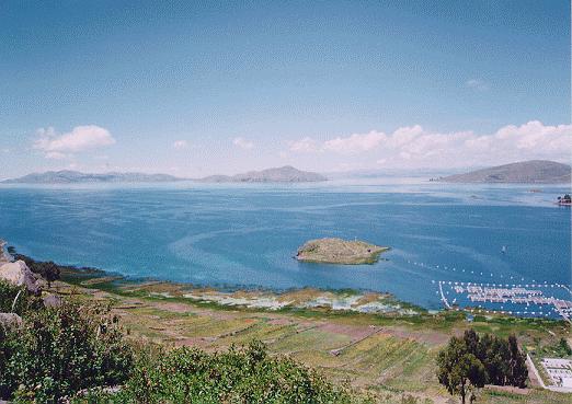
http://www.boliviaweb.com/photogallery/images/photos/tiquina.jpg
|