Site Report 2: Environmental History

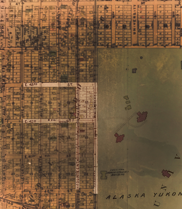
"Block 16 highlighted on the map of the University District from 1908. University District (Seattle, WA). 1908. G. W. Baist. UW Collections and Archives."

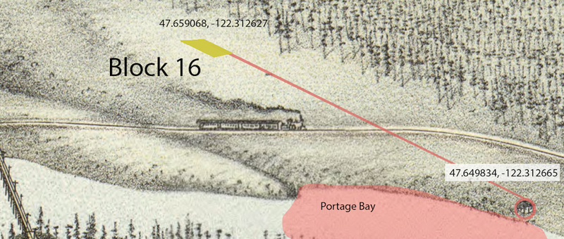
"The approximate location of Block 16 in 1891. University District (Seattle, WA). Created in 1891. G. W. Chicago. Library of Congress, Geography and Map Division.."

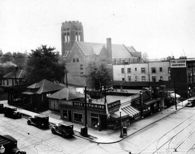
"Corner of N.E. 43rd St. and University Way N.E., ca. 1930. University District (Seattle, WA). Taken in 1930. University of Washington Libraries. Special Collections Division."
Intro: Mimicking the mild hill it sits on, the church's tower climates on the Northeast corner as building heights settle on the Southwest side of the block. Despite the landing being used for over a century, it has remained virtually unchanged. Shown on early topography maps of the University District, the land underneath block 16 continues to have a slight decrease in elevation towards Portage Bay. Other areas in Seattle experienced different forms of landscaping, such the deconstruction of Denny Hill. Leveled in the early 20th century by city planners, Denny Hill was considered an obstacle when it came to the first forms of transportation. The University District nearly escaped this topological demolition if it weren't for the trolly system installed on the Ave in 1909. Because of the technological advancements of street cars and trolleys, hills no longer became a burden for city residents. While looking through old maps of Seattle, I realized the University District was not really developed until the late 1800's. The majority of the land was either used for agricultural purposes or was untouched forest. That was until the University of Washington purchased land in 1983, influencing urbanization North-East of Lake Union.
Block 16's most distinguishable building is the University Temple and United Methodist Church. Reaching 80 feet tall at the steeple, the church was easily the tallest structure in the University District at the time of building built. Also due to its positioning towards the top of the hill, the church gained a strong presence and could be seen from virtually anywhere in 1910.
While looking at various maps, I realized the elevation in which Block 16 is location has remained the same since it was urbanized by city planners. Despite building on the land, there has been no disruption with the Earth and to this day, Block 16 remains on a slight hill. The black and white image shows how the University Temple towered over all the other buildings around it. Not only was it close to the University’s grounds, but it also the closest religious structure to the center of the University District today.
Similar to the University’s grounds which was cleared by 72 men and graded by another 21, Block 16 was likely leveled in a similar manner. With the first official structure being built in 1900, it was strictly through manual labor the forest was cut down.
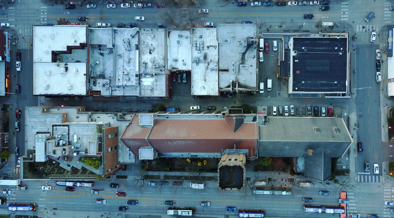
Capturing and stitching together aerial pictures via a drone of Block 16 allows you to see how developed the block is. With virtually every surface built upon, there are just two locations which could be considered naturesque. In front of the University Temple there is an outdoor playground for a preschool and on top of Russell Hall (Bottom left building), there is a man made green space on the roof. Not to say there isn’t any nature on this block, trees run along University Way NE as well as 15th Ave NE. La Plaz Apartment building (Top left building) also has a wall which is covered in a thick façade of ivy.
Conclusion: The University District has a considerable degree of complex topography and nature for being so close to downtown Seattle. Block 16 especially contains a surprising amount vegetation, whether it be on the roof, sidewalks, or small green spaces. The newest building, Russell Hall, is the pioneer of sustainability on block 16, as it is very efficient and has a green roof. Encompassing close the whole area of the roof, this building has created a garden which improves the air quality throughout the neighborhood. The trees placed along University Way are also a providing the U District with the clean air and greenery needed in an urban space. Possibly the only spot on block 16 that has noticeable land manipulation is also the only actual green space on the block. Creating a small, two-walled courtyard in front of the University Temple lies a small plot of grass with bushes. Despite small quantity of plants, a relatively large percentage of the urban plants can be found on block 16.

