Site Report 2

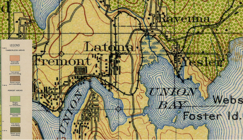
A Land Clasification and Use map for the Latona neighborhood in 1897. Washington State University Early Washington Map Viewier.
Topographical maps of the University District, then called Latona (Later changed to Brooklyn), from before 1900 were difficult to find. However, I was able to find a few maps that offer some clues into the history of my block. I found a Land Classification Map of the Seattle area from 1897 which provides not only a look at topographical elevation changes (Red lines), but also land coverage such forests and clear cuts. These kinds of maps were mainly used for logging purposes, to see what areas could be logged, what areas were recently logged, and whether or not new saplings would be planted. According to this map, in 1897, the area surrounding my block and much of the University District had already been clear cut to make way for future development. Although, looking at the sparse development of Latona and the areas of young timber to the north and east of the area, I don’t think that the area would have been clear cut much before 1897, however, I was unable to find more information on when that occurred. One thing to note is that the areas around the railroad may have been clear cut first, which then spurred development near the tracks which would have lay just south of 40th street at the southern end of my block.

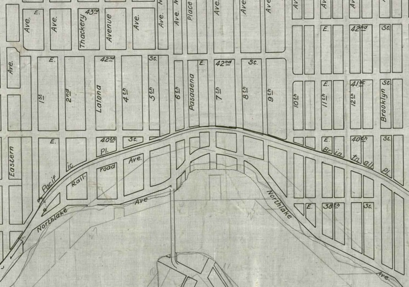
A view of the Latona area from the 1900 Seattle Road Plan map. Seattle Municipal Archives. Photograph Collection.
Unlike many other areas in Seattle, the University District did not feature the large steep hills that needed regrading to become a suitable place for development like Denny Hill. Rather it consists of a steady elevation increase from the waters of Lake Union up towards Green Lake and Ravenna. This made city planning relatively easy, and by 1900, most of the area roadways were planned out, as seen in this map from 1900 from the Seattle Municipal Archives. One thing that I noticed is that this map does not feature any signs of the construction of the University Bridge, which has a large impact on the layout of the area as new roads were constructed to compensate for the new roadway.
After the initial clear cutting of Latona, more trees and vegetation were planted as more homes were built to give the area a more suburban and residential feel. Images from the late 1920s and 1930s begin to show more trees in the area than photographs from the late 1800s.

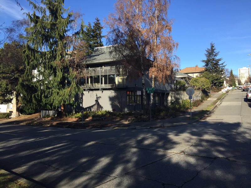
Trees surrounding University Friends Meeting Place on the corner of 40th St. and 9th Ave. Photograph by author, 01/12/17
While the vegetation on my block today pales in comparison to what may have inhabited the area prior to clear cutting and settling of the region, Due to the more residential nature of my block, it features more vegetation than other blocks along Roosevelt Way and other more developed and commercial areas of the University District. Peace Park consists mainly of blackberry bushes and a mix of deciduous and cedar trees. The block itself has some large cedar trees on the SW corner and in the middle of the block between buildings, which may have been trees planted after the initial logging in the 1800s. Besides the park, most of the block has clean landscaping. The block itself has some large cedar trees on the SW corner and in the middle of the block between buildings, besides that most of the block has clean landscaping. I looked specifically for areas where roots may have caused parts of the sidewalk to lift but didn’t see any areas where that was the case.
Overall the block has gone through multiple transitions in regards to the vegetation found in the area. Initially the area was clear cut for logging purposes and then trees and other kinds of vegetation were planted to make the area more suitable for residential homes. Since then there has only been a slight amount of change in vegetation as old buildings are torn down and new ones replace them.
