Site Report 2
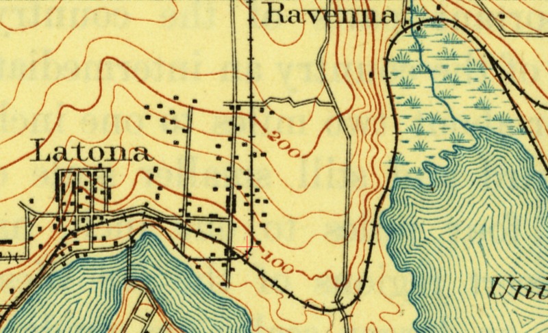
Image 1: USGS Topographic Map (1894)
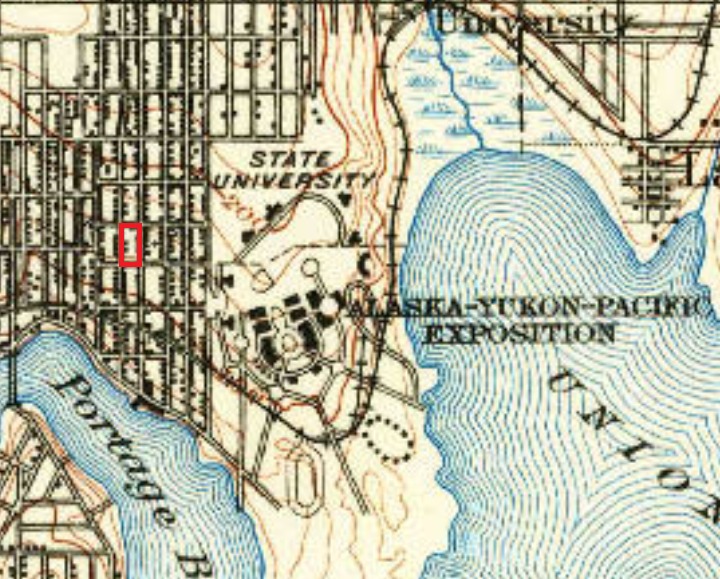
Image 2: USGS Topographic Map (1908). My block is outlined in red.
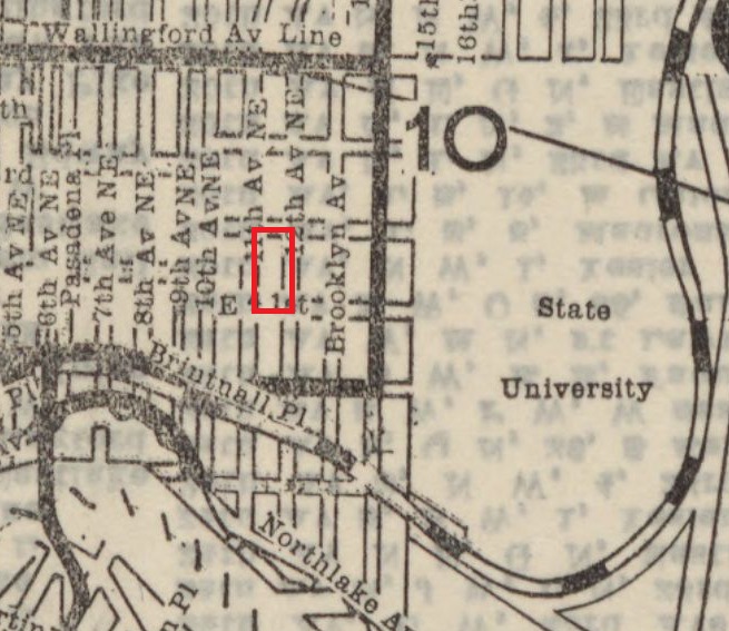
Image 3: Seattle Pioneer Pocket Guide (1913) Streetcar routes in black, railroad in dashed line. My block is outlined in red.
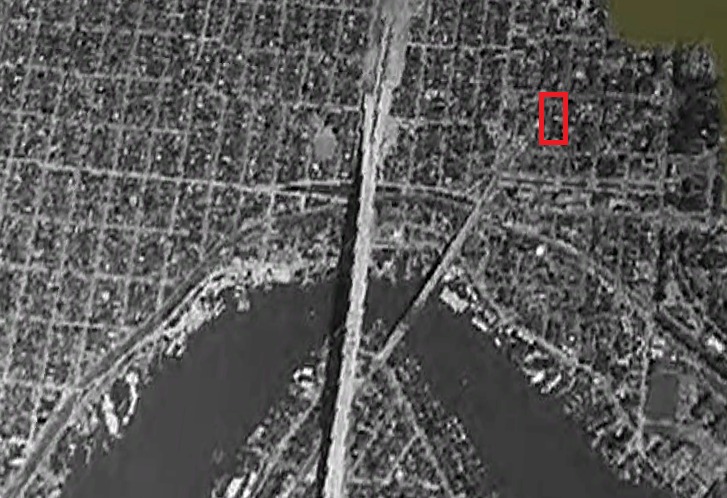
Image 4: Google Earth aerial image (1961) Bridge in center is I-5. My block is outlined in red.
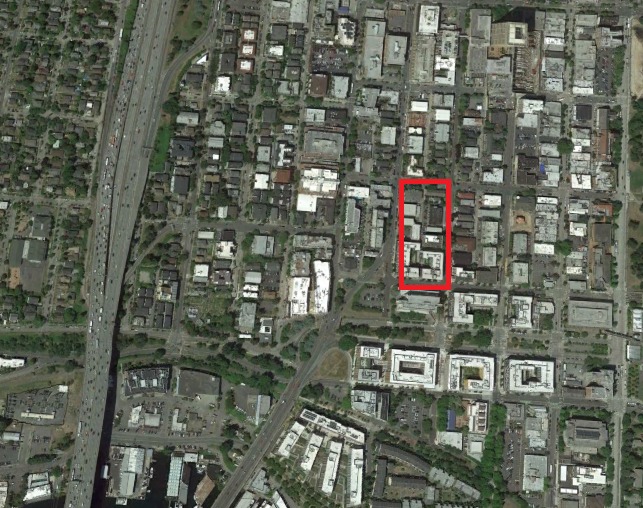
Image 5: Google Earth aerial image (2016). My block is outlined in red.
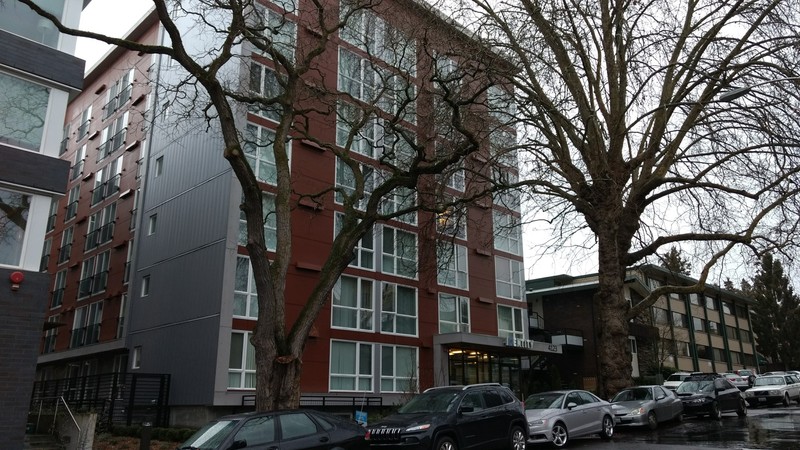
Identity Apartments. Notice the old trees in the center, but also notice the small bushes and shrubs near the bottom of the photograph. Photograph by Sean Mahoney, 2017.
Prior to 1900, my block was mostly forested land. We can see on the early topographical maps (Image 1) that there were a few scattered buildings and two nearby roads, which now are Roosevelt Way and Brooklyn Avenue. The area near the block was reasonably flat, with a small incline as you progressed north. This lack of a steep incline allowed fairly easy urbanization in this area. There were two rail lines that allowed easy access to the area. One of the rail lines cut through the present site of the university, and proceeded through the then-marshy areas of Union Bay. The other rail line cut north along what is now University Way.
After the turn of the century, we can see a significant increase in urbanization. By 1908 (Image 2), there is a much more fully developed road network around my block. Some of this increase can be attributed to the development of the Alaska-Yukon-Pacific Exposition, which was a fair held in 1909 publicizing the development of the Northwest and Alaska (University of Washington). The 1908 map is not detailed, but it appears there are only two or three buildings on my block at this time. By 1913 (Image 3), we can see that there is a network of streetcars, with the closest one relative to my block being on 40th street, just one block south. Also, the rail line along University Way has been replaced by roads.
Progressing further toward the present, we can see continuing development and urbanization of my block and the surrounding neighborhood. Using Google Earth's Historical Imagery tool, we can see that in 1961 (Image 4), the area is highly developed, including the introduction of the nearby Interstate 5 and the Ship Canal Bridge, completed in 1961.
Image 5 shows the current status of my block and the neighborhood. The former path of the railway has been replaced by the Burke-Gilman Trail, and the surrounding neighborhood is a mix of older buildings and newer University of Washington structures.
Today, if you walk around my block, you will see that it is almost fully developed with little open space. There is a mix of some older trees lining the sidewalks, along with newer bushes, shrubs, and smaller trees that have been planted and tended to as new buildings have arisen. It is still possible to see views from my block that reflect the area’s natural history, including views of the surrounding hills and the slope down to Lake Union.
The images displayed here show the tremendous changes that have taken place on my block and the surrounding area since the 1800s, moving from its initial sparsely populated state to the fully developed urban landscape of today.
