Site Report #2: Environmental History
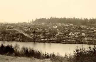
This is a view of the University area and the University District to show how much more forrested the area was before (Seattle, WA). Taken by Asahel Curtis, 1905.
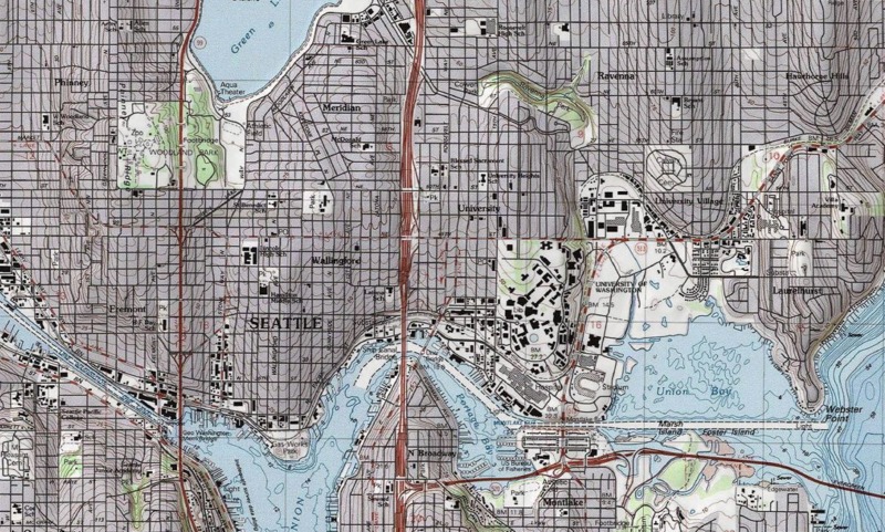
This is a topographical map from 1880 of the University District (Seattle, WA). From the Department of the Inerior and TopoView.
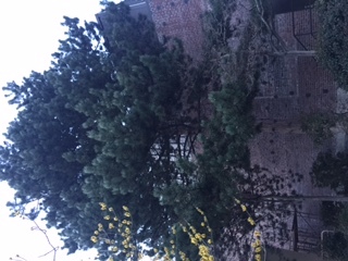
This is a picture taken from University Way NE (Seattle, WA) of an older pine tree found behind the Playhouse. Picture taken by Emily Placzek on February 2, 2017.
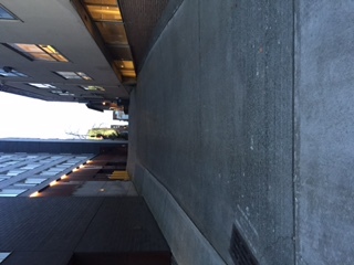
This is a picture showing the hill found on block 28 from standing on Campus Parkway NE looking up towards 41st St NE (Seattle, WA). Picture taken by Emily Placzek on February 2, 2017.
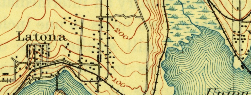
This is a section of a topographical map of where the University District would be from 1894 (Seattle, Wa). Rights held by the U.S. Department of the Interior. Found from the USGS Historical Topographic Map Explorer.
When looking to build on a plot of land, one thing that everyone must keep in mind is that no matter hard one may try to ignore it, nature will find a way in. We can try to remove all the grass, and cut out hills to make roads, but as humans, we cannot stop the birds from dropping seeds on our land or prevent the rain from falling. Block #28 is no exception to this because evidence of organic and manmade nature is present here.
The fact that block 28 does not appear to have any natural valley's at or near it, when referencing the topographic maps, also shows that this block was likely part of the heavy forested area (USGS. "USGS Historical Topographic Map Explorer."). Once the University moved to this location it took many of the trees down for the campus development and more businesses popped up in the University District. One can make this inference beyond the evidence of the maps because if there were valley’s, the amount of rainfall in this area would make the soil too loose to support the great pine trees and other plants in the forest that existed here before.
After finding the topographical map of the Seattle area, I was able to see that the University District as a whole, was likely much more of a hill around 1894. The farther north one got from Portage Bay, the steeper the area appears became. This still holds true today, even with just visually looking at the area in person; however, after looking at the map, it appears that there must have been an attempt to flatten the area a bit to make it more pedestrian friendly for the mass amounts present due to the University's proximity.
Today, one of the first things one might notice on the way to block #28 is that there is still a slight grade to the surrounding area. If coming from the south side of the University District, one will start to feel the slight uphill grade in her/his legs, while coming from the north will be a slightly more comfortable downhill walk.
The natural topography around block 28 may not have been enough to influence urban development too much other than the fact that the slope/hilly shape to the University District could have been used to the developers advantage. Making more of the streets go north and south could allow for natural drainage during the rainy season, making the water flow away from the developments and back towards the water. Streets around block 28 today are still sloped in this way, showing evidence of this “natural” state of the block. Another piece of the “natural” state of the block is the amount of plants and grasses still growing in the sidewalks and behind the Playhouse. The plants seem to be doing well and not struggling in the soil, which leads me to further confirm the idea that this land use to be rich with plants and were removed with the additions of buildings to this plot of land.
The issue of natural spaces in the U District is interesting due to the local pulls and ideas of what should happen to this land. With the University of Washington in such close proximity, the feel of a campus and wide open green spaces to think might change how the future upzoning of the U District is put into action in order to preserve this ideal. Another factor is how dense parts of downtown Seattle can be. Will the U District eventually more closely emulate this idea and become even more of a "walking city."
