Site Report #3: The Audio Tour

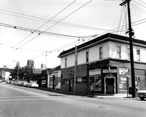
Corner of N.E. 41st St. and University Way, 1963 (Seattle, WA). Photographed and rights held by Eng, William. University of Washington Libraries Special Collections Division / Seattle Photograph Collection.

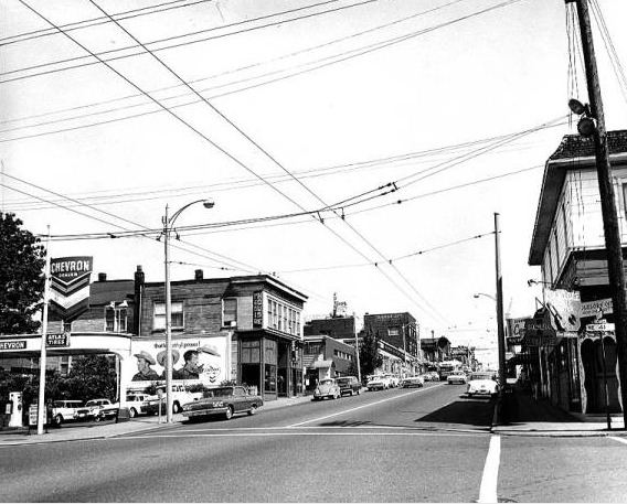
University Way from N.E. 41st Street, 1963 (Seattle, WA). Looking at a gas station. Photographed and rights held by Eng, William. University of Washington Libraries Special Collections Division / Seattle Photograph Collection.

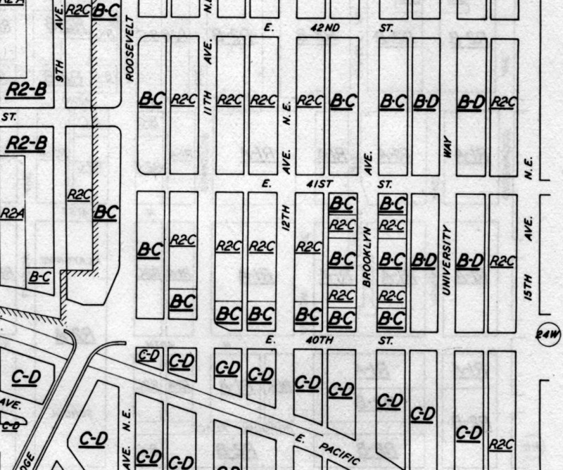
Zoning Map and Legend of the University District (Seattle, WA). 1947. Rights held by Seattle: City Planning Commission. Seattle Municipal Archives Map Index.
We will begin this tour on the corner of University Way and Campus Parkway, facing up towards the rest of the University District. You will see the very large, tarmac road of University Way. As you can tell from the size of the street and the amount of people and cars in the area, this is a popular location. And, historically, it has been for a while.
Long before University Way was an established tarmac road, it was first a wide, steeper dirt road. With the city’s expansion and modernization, the University District got paved roads and rails for street cars before the rails were removed and the roads finally become recognizable to how they are today. This area of the University District has been an ever evolving community. In the last 100 years, the change over time almost seems quite sudden. In the 1960’s, this block was the southern end of a long stretch of department stores. Then, in the 1970’s, it became the southern end of the street fairs that took place in the University District. The modern trends of the world kept changing how the district looked because it was an area where the young adults of the University would express themselves and political changes through shopping, art, and street activities.
Now as we walk north, towards 41st St., we will be able to see the current view of what is captured in the two photographs by Eng, William from the Seattle Photograph Collection (Eng, William. Corner of N.E. 41st St. and University Way)(Eng, William. University Way from N.E. 41st Street). In the photographs, there shows a cafe and a gas station in the area. From these images, we can start to see that this block specifically was developed and evolving as the University grew. The gas station and cafe were in place to serve the faculty, staff, students and visitors of the University that was and is only a few blocks East.
Turning to your left, you will now be walking down 41st St. Here we can see the old Playhouse next to the new University residential dorm, Poplar Hall. This plot of land, with its proximity to the University, has likely been affiliated with small businesses or residential places for those at the University. Plate 23, a 1989 zoning map from the Seattle Municipal Archives Map Index, labels the block as residential and business (Seattle: City Planning Commission).
By finishing up the tour by walking down Brooklyn and Campus Parkway, we can get the feeling that this block now has a dual identity as both part of the lower University District and a park of the modern campus. It is not just the University District or another part of campus. It is the quite literal intersection of school, neighborhood, and city.
MP3:
https://drive.google.com/file/d/0B0Pa3p7blULsZkJKUzNDLTRxQ1E/view?usp=sharing
