Site Report #2 Environmental History
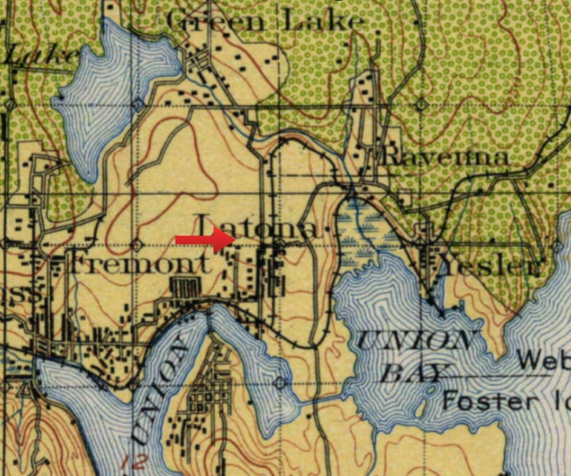
Land classification map of U district area in 1897
The arrow shows where Block44 is, which is a timber cut area with no restocking planned(yellow). The northeast area is also deforested but in process of restocking (green).
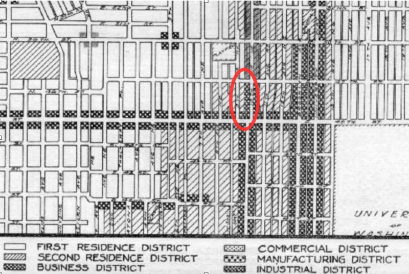
zoning map of area around block44 in 1923
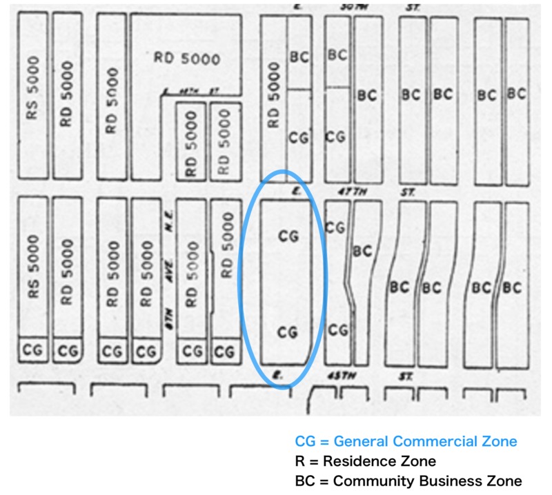
Zoning map of area around Block44 in 1960
Considering the natural environment and the geographical feature, block44 has transformed dramatically in 200 years from a indians' forest bllessed with nature to an man-made neigborhood dense with buildings.
Prior to 1850, most of the University District, including my block, used to be a lowland forest with giant trees. This area was the home of Duwamish Indians for a long time, but in 1855 the title was transferred to US government and sold to Euro-American settlers to be cultivated(Nielsen,1).
As the early topographical map shows, the land where Block 44 is now, was completely deforested by 1894(U.S. Geological Survey). All trees were cleared for the homesteads' settlement and probably culled for lumber. Unlike downtown Seattle, it seems that no extensive regrading has been conducted near my bock. The gentle slope (25ft) to the Southwest and ups and downs of the 45th street still exists today, which was obvious when I walked around my block. Such uneven ground might have made this area relatively less attractive for construction of roads and buildings and lead to a slow development.
However since 1895, when university of Washington moved in from its downtown location, U district has rapidly developed from a rural farmland to a urban city. This resulted in increase of university related population and businesses.
This fact is clearly proved in the map of 1908 where U district had already been completely platted and divided to hundreds of blocks. And by 1923, there were variety of buildings including houses for families and students, business, and commercial buildings prospering around my block. Block 44 was zoned into two parts; the "business district" on the East side facing Roosevelt way and south side facing 45th St, and a "residential district" on the Northwest part(Seattle Municipal Archives). As the zoning project has began in U district in early 18th century, many parks started to appear near my block, which represents that nature was beginning to be removed from the developing commercial/business area and contained in separate places.
I also found out that there were many automobile business buildings in 1926 concentrated on 45th St NE including where my block stands. This demonstrates the expanding use of automobiles during the 1920s, and was most likely when all the public roads were constructed along Roosevelt Way and 45th St. It can be estimated that natural environment such as plants and trees has began to disappear at this time, due to such street construction that involves huge earthworks and asphalt/concrete paving. For sure, no natural animals could inhabit near these busy streets where cars polluting the air and water by its gas emissions.
By 1960, rezoning occurred in U district, and the whole block turned into a “general commercial zone” as surrounding area greatly increased density with variety of buildings. Based on the historical evidence, this was called the “building boom” and 45th Ave experienced business and commercial expansion(University District). I assume that there was little nature remaining on blocks by this era except small parks that scattered around U district.
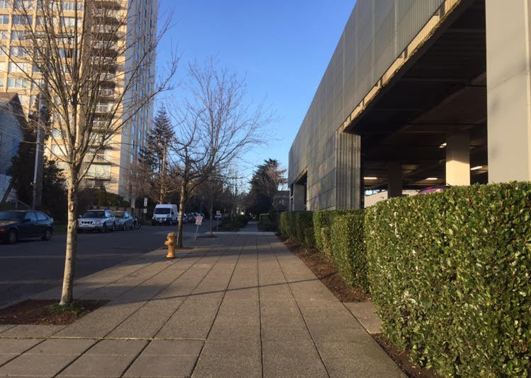
transplanted street trees & trimmed shrub along the sidewalk block44
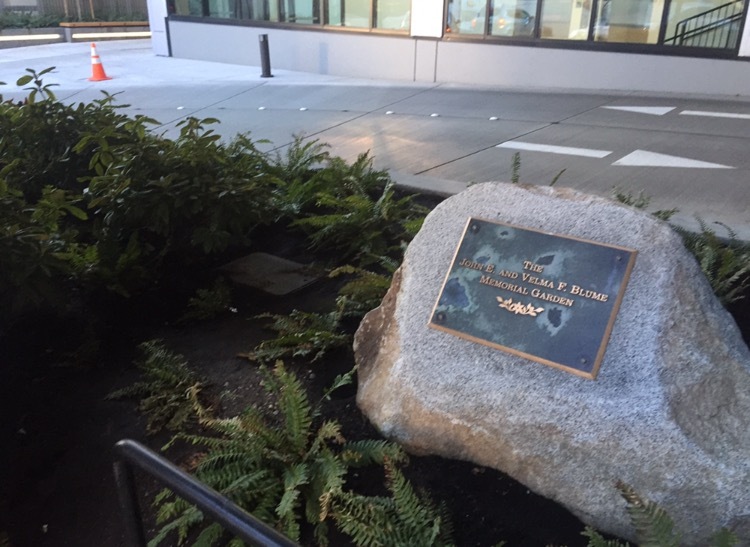
a small garden in front of UW CoMotion building
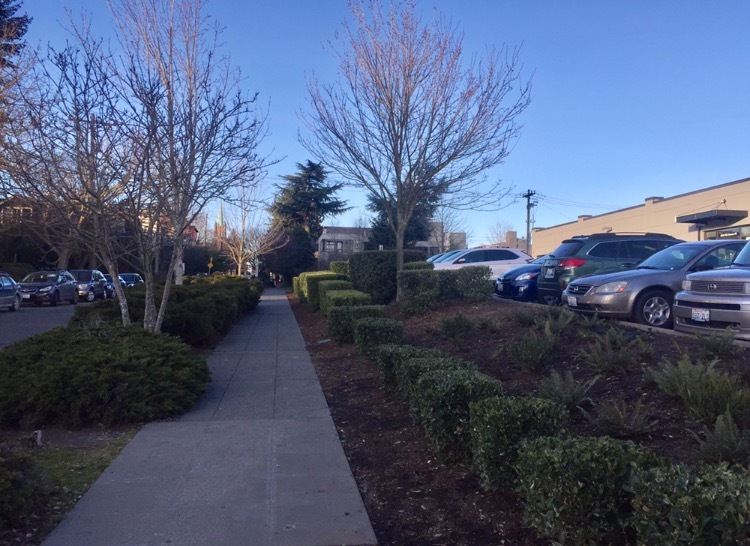
transplanted street trees & trimmed shrubs on the Northwest corner of block44
Currently, my block is all commercial buildings made with cement, and the land is mostly paved and no natural grass or forest trees remain. However, instead there are several transplanted trees (mostly about 15ft tall, one 30ft) placed along the sidewalks enclosing the block and what is more, rich in professionally trimmed shrubs, which all seem to be recently organized and constantly maintenanced. There was also a small fenced area with fashionable plants and a big stone written “memorial garden”. These plants and trees are most likely not native to the area, but rather brought from another region to be planted in these certain spaces. Such controlled nature is commonly seen in urbanized areas where people desire little room for nature in their everyday life. This may be part of contemporary urban planning in Seattle, which aims nature to coexist with the city.
I also found drains located in the lower part of my block which seems to prevent potential floods that might cause at this hilly area. Since it frequently rains trough out the year in Seattle, this might be essential for the neighborhood.
In conclusion, the relocation of UW and its development had made a huge influence on this area and erased almost entirely its original features over the past century. Block 44 today has completely changed from a part of a forest that richly endowed with nature, to a urbanized city where nature is removed and controlled by human.
