Site Report #2: Environmental History
Similar to most block within the vicinity, my block is relatively flat when considering the full scope of its location. The streets itself may be flat but very close surrounding areas change in elevation almost immediately. My block appears to be on a hill, according to topographical maps, with everything west of my block sloping down and almost everything east climbing in height. It makes sense that the west side would be the windward side of the hill since the closest body of water is on the west side as opposed to the east side.
Originally known as 10th Ave prior to World War 1, Roosevelt Way was renamed following World War I and the death of Theodore Roosevelt in 1919. The surrounding area around the block, from Ravenna to Lake City Way NE became known as the Roosevelt District and a new High School, Roosevelt High School was created in honor of Theodore Roosevelt. For a short period of time, from 1919 to 1931, “Ravenna Park” was changed to “Roosevelt Park” just to show appreciation for the fallen president, however it was changed back after much lobbying by residents. The exapansive area at one point was filled with trees and greenery but "Once the park became city property, the great trees began to disappear"(Wilma). This is when the block became the automobile hub that I was led to believe. After World War 1, automobiles became one of the most popular items for Americans to buy creating a high demand for anything related to cars. In the 1910s, “10th Ave” lacked paved roads and basic infrastructure but quickly transformed into a commercial zone for automobiles that most likely included different versions of the residual shops that exist today. This burst in commercial shops obviously did not last very long. Soon the demand for housing due to the growth of the University of Washington became too much for the space to handle. "The growth in the University of Washington after 1950 meant that many faculty, staff, and students made their homes in the district. In 1945, there were 7,000 students. That number tripled over the next 15 years and almost doubled five years after that."(Wilma). This explains why most of the U-district is residential in the present.
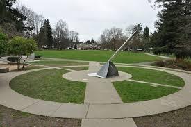
There are two public parks within a reasonable distance of my block, Froula Playground and Cowen Park. Froula Playground is a tad North of my block and directly adjacent to Green Lake Reservoir, while Cowen Park is south and leads into the much bigger Ravenna Park. Froula Playground is an extensive public park with lots of amenities to accommodate specifically children and families because of the amount of playground equipment. Cowen Park, another nice family and recreational park, geared less towards children is recognized for its sundial sculpture. The amount of folliage in these parks is good insight into what the state of nearby blocks were before they were urbanized. Although the parks may not be directly next to my block, there relatively close proximity proves that the surrounding areas of my block are flat enough to construct parks, even though most topographical maps shows escalating hills. I think these parks stand as a representations of what the area of the U-district used to be like to allow people to reminisice on the not so urban Seattle that existed a couple of decades ago.

