|
To develop an understanding of photogrammetry fundamentals and the ability to derive precise measurements from hardcopy and digital aerial and satellite imagery. Students will be presented with the most common photogrammetric processing techniques, and a firm theoretical and practical background in photogrammetric applications including integration with Geographic Information Systems (GIS). |
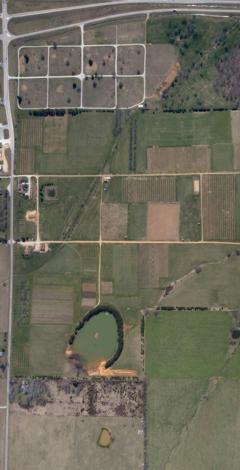
Example of aerial imagery (March 2005) of the Missouri State University-Mountain Grove Campus used in one of the class projects
|
Photogrammetry is a science based technology with more then a century of history and development, it can be defined as the ‘science of measuring from photos' and it's part of the field of remote sensing (RPL551). The techniques used in photogrammetry allow us to extract quantitative data from aerial and satellite imagery; in comparison to extraction of qualitative data form airphoto interpretation (GRY360). Thus by using photogrammetry you can determine the size and height of a house in a set of stereo aerial photographs and by using photo interpretation techniques you can asses the style of the house allowing you to determine when the house was constructed. The goal of the Digital Photogrammetry and GIS course (GRY552) is to show students how photogrammetry works through 'learning by doing'. Each year the class undertakes ‘real world' projects and problems, the students are encouraged to come up with their own solutions based on the knowledge they gained in the lecture component of the course. Below are the GRY 552 class projects, listed by year: In 2006 six class projects were undertaken:
In 2005 two class projects were undertaken:
In 2004 the class worked on one project:
|
Dr. Moskal's Office: Bloedel Hall 334 |
Phone: 206.221.6391 |
Seattle WA, 98195-2100 |
Email: lmmoskal at u.washington.edu |
© 2003 - 2011 L.M.
Moskal - Last updated on
07.01.11 20:27
|