|
The course objective was to use geovisualizations and landscape modeling techniques to effectively demonstrate landscape change. |
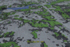
Click on the image to download the full size geovisualization, other movies are available on the JRBP geovisualization project
|
Visualizing the Forest Change in the James River Basin: Research Project by Nathan Huggins Land-use and land-cover have long been vital to monitoring and managing both urban and rural landscapes. The rise of satellite and computer technology within the past two decades has greatly increased the usability of such data and analysis. Today's remotely sensed datasets allow environmental and urban managers to quickly assess the temporal changes and act accordingly. Presently land cover change are most generally communicated through two-dimensional planar maps that represent a static snapshot of time. Although such maps are useful, they do not support analyzing multiple dates. In fact, Geographic Information System (GIS), our most powerful tool for analyzing geographic data, does not handle temporal variables efficiently. One of the objectives of this project was to integrate three-dimensional landscape visualization techniques and temporal datasets to demonstrate landscape change patterns in the Ozarks. The James River Basin is located in Southwest Missouri and contains the third largest urban population center of the entire state. Over the past 30 years this area has seen a large urban growth and a rapidly changing landscape. This change has impacted several natural features including forest size and distribution. In 2001 MoRAP, Missouri Resource Assessment Partnership, conducted a study of the area and quantified the changes taking place using six Landsat satellite images ranging from 1972 to 2000. This study looks in particular at visualizing the forest land cover change over time within the James River Basin. This will be accomplished by combining GIS, remote sensing techniques, and computer animation. The visualizations that have been created combine both real world raster and vector data along with computer animated features. The goal of the study is to examine how people communicate and comprehend landscape change.
|
Dr. Moskal's Office: Bloedel Hall 334 |
Phone: 206.221.6391 |
Seattle WA, 98195-2100 |
Email: lmmoskal at u.washington.edu |
© 2003 - 2011 L.M.
Moskal - Last updated on
07.01.11 20:03
|