Site Report 2: Environmental History

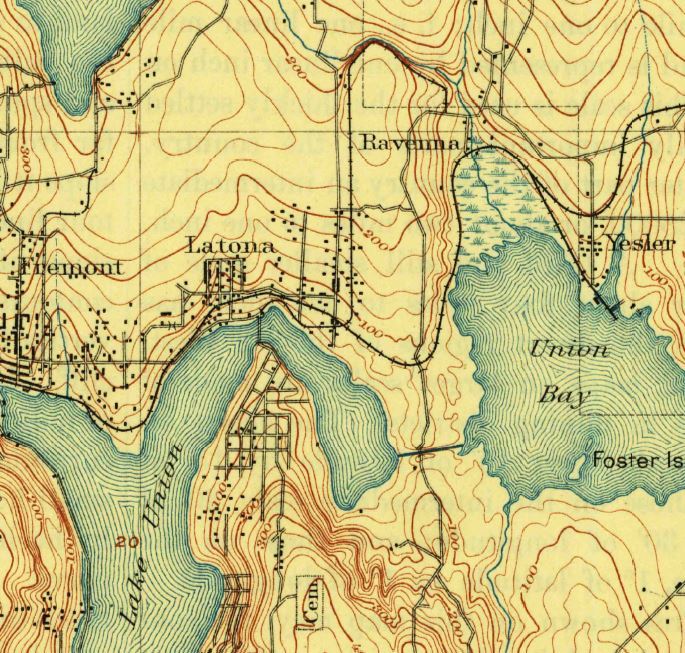
A zoomed in view of a 1894 USGS topographical map of Seattle, WA. Taken from USGS digital archives.

A close up of Plate 16 of the 1908 Baist's Real Estate Atlas. University District (Seattle, WA). UW Libraries Special Collections.
While few topographical maps show specific areas of the University District, there’s some evidence of the natural environment on Block 5 before development. A 1894 USGS map of the Seattle area, when zoomed in, shows that there was a mild-to-moderate downward slope from what is now 45th Street to 43rd Street (USGS 1). This slope was slightly higher on the side nearest present day 12th Avenue, and the highest elevation was measured at 200 feet. Although I didn’t find maps or pictures showing vegetation, photographs of the surrounding area from later dates indicate that the present day site was likely forested up until the early 20th century. The slight downhill grade likely necessitated erosion control when urban development was begun. However, it doesn’t seem to have significantly impaired the building of infrastructure, as evidenced by the presence of water mains in a 1908 city map (Baist's Atlas 16).

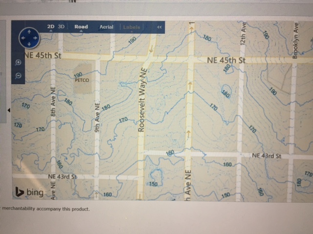
A zoomed in look at an interactive map on the Seattle City website, showing the 2017 topography of the University District, Seattle (WA). Seattle GIS.
There aren’t many trees on Block 5 anymore, and the hill seems less obvious today, but overall the natural environment of the site hasn’t been altered by much besides buildings. There were no streams to divert or bodies of water to fill. However, sometime between the 1894 survey, and the paving of the area, some processes did change the block. The maximum elevation of the area reduced from 200 feet in 1894 to 180 feet today (GIS 1). I hypothesize this is due to erosion after the trees were cut, but before the land was paved over. Because the whole area is situated on a hill, gradual erosion in the early stages of settlement seems to be a likely cause for the slight but even reduction in the grade of the site. However, the decrease in hilliness could also be due to conscious development efforts to level out the block. In addition to the reduction in elevation, the site was at least partially deforested by 1908, and was showing signs of urban development such as water mains and street markings (Baist's Atlas 16). This deforestation eliminated whatever old growth tree cover there was at the site, and permanently transformed it into the urban landscape it is now.

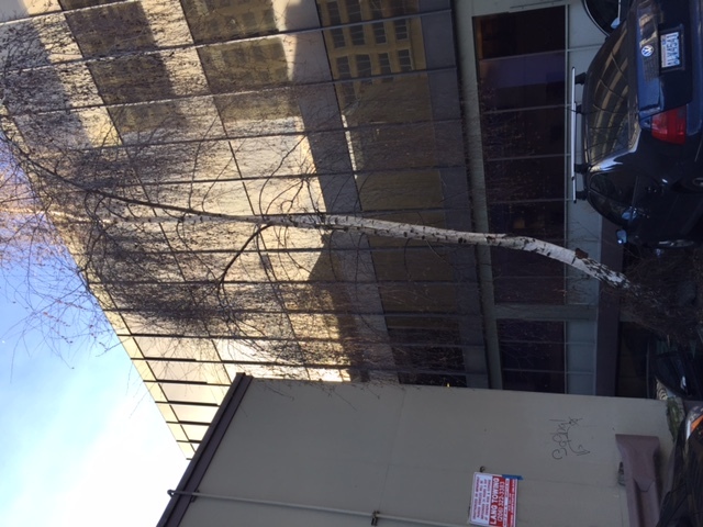
A picture of one of the larger trees growing on Block 5. University District, Seattle (WA). Photograph by author, 02/07/17.
Currently, while Block 5 is obviously a city environment, evidence of the previous natural environment is still noticeable. On the vacant lot, small shrubs and grasses are growing well. In two places on the block, visitors can see tall trees of the beech family growing in the 3 foot slivers of dirt between parking lots. The tree roots are pushing against the concrete as they grow, and they seem to be at least twenty to thirty years old. These trees aren’t primary successive species, but they do indicate that the area was once forest. If the block were suddenly abandoned, these trees would grow to dominate the landscape and the area could return to the natural forested environment. The natural hillines of the block is still evidenced as well, albeit in a reduced form. In a period of heavy precipitation, water sometimes overflows the storm drains at the higher end of the block towards 12th Avenue/45th Street, and runs downhill to the drains closer to 11th/43rd Street. This persistent movement of water from one place to another is just as it would have been in 1894, and shows that the block hasn’t changed very significantly in that regard.
