Site Report 2: Environmental History
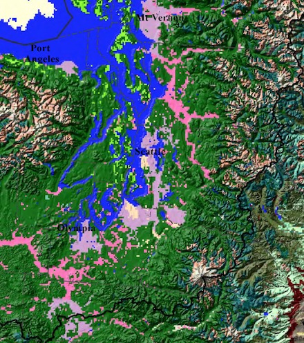
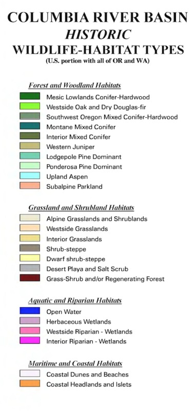
This image is displaying the vegetation in the Seattle area in 1999. As you can see looking at the key, Seattle is classified as Herbacious Wetlands and Westside Grasslands according to the Washington State Archive Historical Maps, Northwest Habitat Institute.
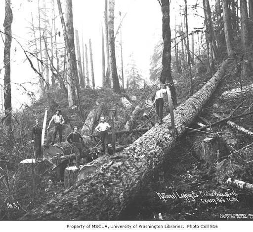
This is the National Lumber and Manufacturing Company in 1920, specifically the Bucking crew, found in the University of Washington Libraries, Special Collections Division.
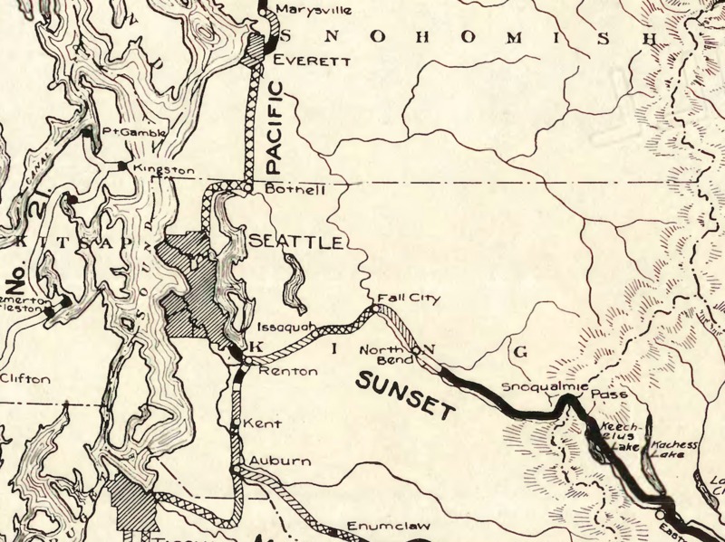
This is a Washington State Highway Map from 1915, providing an aerial view of the Seattle area. Visible are the surrounding mountain range and bodies of water that surround the city. Image by Rand McNally and Co, Washington State Highway Commission.
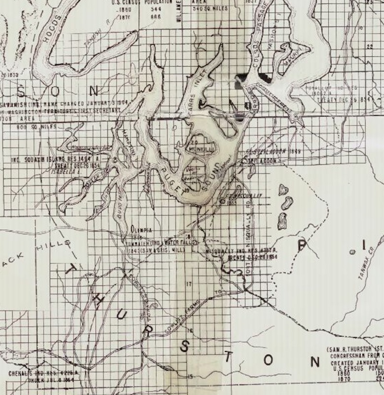
This is a map of the Washington Territory west of the Cascade Mountains, as of 1870. Created by Bechly, Ernst C, Washington State Archive Historical Maps.
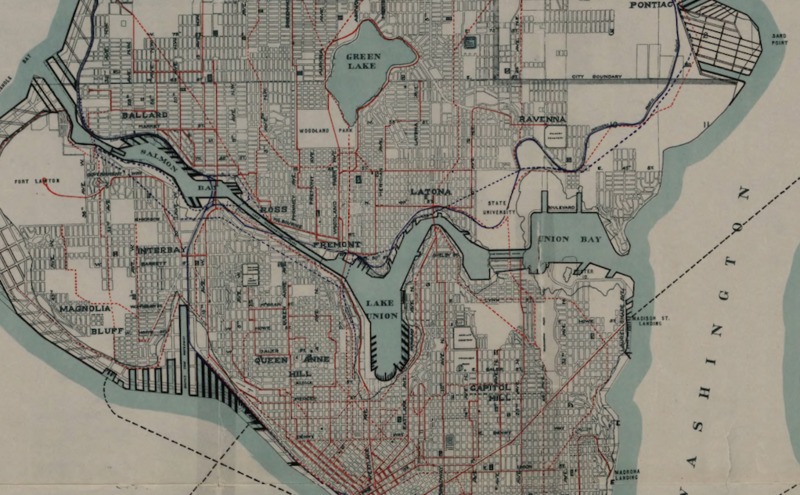
This image is displaying existing and proposed street and steam railways, waterfront developments, and proposed ferry routes in 1911. Image by the Seattle (Wash.). Municipal Plans Commission.
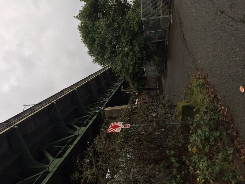
This is an image of the vegetation located under the University Bridge on block 32. Photo taken by Fiona Cromarty, 1/1/17.
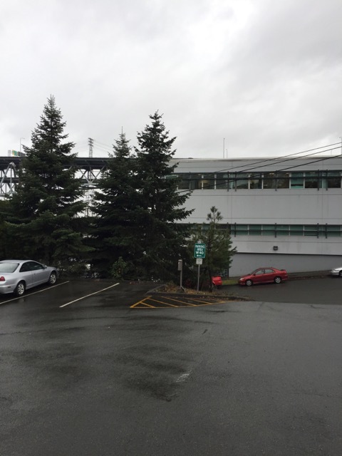
Evergreen trees standing tall on Block 32, Photo taken by Fiona Cromarty, 1/1/17.
The Pacific north west was inhibited by Native Americans around 40,000 to 10,000 BC. As colonies expanded and exploratory expeditions became popular, maps of the coast of the Northwest emerged, starting around 1800. As you can see by the first image to the left, the vegetation around the Seattle area specifically consisted of Herbaceous wetlands surrounded by Conifer-Hardwood, Oak and Douglas Fir. The location of this land proved to be essential for a sustainable lifestyle. Not only did the ecosystem provide plentiful resources, the adjacent body of water provided many other modes of incentive. The water ensured transportation, encouraging trade and access to this area. As the United States arose, train and highways were created to connect and prompt civilization to branch out, to take advantage of the land. As these railways and towns popped up, logging became a valuable source of income, employing many working men. An image of a logging corporation can be viewed to the left, from near the Seattle Area. The Cascades are a visible mountain range surrounding this area, ensuring a promising ecosystem for farming, shown on the topographical maps to the left. Individuals were able to note the advantages of living near the water, and Seattle began to become the popular city that it is today. As shown on the second to last image, one can clearly view the layout of the city, as of 1911. Bridges and streets popped up, and that is how Block 32 originated.
The natural environment surrounding my block has impacted the development of it in many ways. The Railroad was put in in the 1890's, which is currently the Burke Gilman Trail, and allowed easy access and encouraged further migration. The location was a big factor, as people migrated to this area the waterfront was a large attraction. The first non Native American migrants started showing up in 1851, and the population only continued to expand. There was increased shipping activity in this area as the railroad and ports expanded, and bridges such as the University Bridge were constructed. When the Yukon Territory of Canada was exploited to have a surplus of gold, thousands flocked to the greater Seattle area, houseboats popped up on the waterfront and by 1900, Seattles population had nearly doubled. Through all of this development, there are still many signs of vegetation native to the Pacific Northwest on every street through the city, as you can see bushes are untamed attempting to grow through the chain link fence under the University Bridge. At one time, before civilization overtook this land these bushes did grow freely, and although they are moderated as of today, they are still present. Trees and bushes are visible still all over the city, yet again in a much more moderated fashion. Specifically, in the last image evergreen trees that once covered the face of this acre of land still stand tall.
