Site Report 2

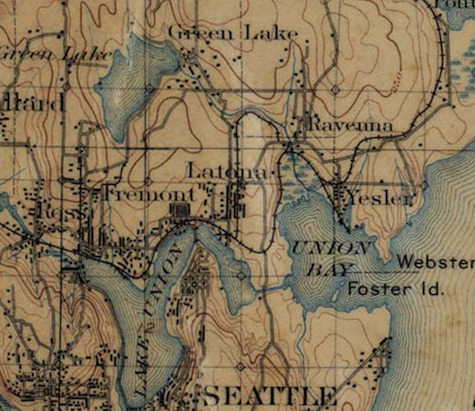
Topographic map of Seattle in 1894. University District (Seattle, WA). U.S. Geological Survey.

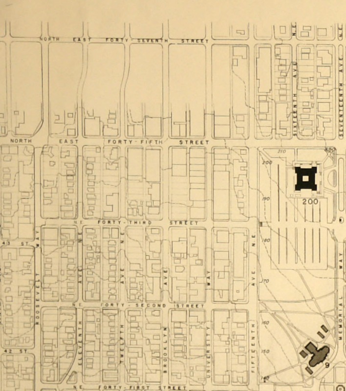
Topographic map of Seattle 1961. University District (Seattle, WA). Seattle Municipal Archives. Aug 1961.

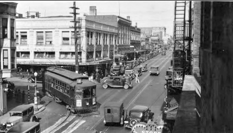
Looking north on University Way NE from NE 45th Street, 1940. University District (Seattle, WA). Courtesy of the UW Digital Collections.

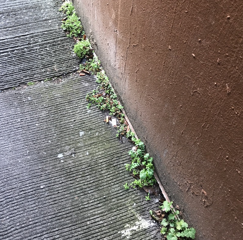
A photograph of plants growing in the cracks of a building in the alley way between Brooklyn Ave. and University Way. University District (Seattle, WA). Photographed by Michelle Kang on 02/03/17.
Evnironmental History
The U District was once a green forest with rivers and lakes. When the non-native settlers found this land, they logged the forest and blocked water ways to create the city it has become today. In the beginning, developers were focused on making the District into a industrial neighborhood rather than a neighbor of a state university.
In 1887, the railroad system in this new settlement was completed. It was a connection with Seattle and the District. This railroad is gone today and was renamed as the Burke Gilman trail in the 1970s. The trail is the only place where a very small portion of the forestry remains today. As the city was growing, it was decided in 1892 that a new electric trolley would be made (Dorpat). The station was built on Columbus Ave., currently University Way, and 42nd Avenue. This station quickly became busy, preparing to make the city the home of the University of Washington in 1895 (Wiki). Students began arriving then. Much of the land northwest of University Way and 45th st. was still undeveloped. The population was condensed around the university, south of 45th st. It was a neighborhood of restaurants, cafes, street fairs, farmer's market, inns, and hotels. More living spaces were available, attracting more people. Small businesses began to rise. The University Way was now a pedestrian shopping strip. A lot of the living necessities were fulfuilled within the District.
In the early 1900s, the Alaska-Yukon-Pacific Exposition transformed University Way into a commercial strip (Wiki). It soon became a cosmopolitan show-strip full of shops and diversity. It was called a "city within a city". This is also when University Way was nicknamed the "Ave". It wasn't until the early and mid 1900s that the University District expanded. You're able to see that most of this block wasn't developed until recently because through cracks and around the premises of the building, weeds and plants poke through and continute to grow, indicating that the building was built on top of recent soil. The tree's are all planted in this block to perfect dimensions. It's a sign that development is fairly new. Where it used to be another building of the Christ Episcopal Church, there is now a huge parking lot. There used to be a small yard and garden, however, urban development flipped the land and poured asphalt, creating a big flat space of pavement. The only sign of greenery are the few trees on University Way, which were precisely planned and hand planted. It's near impossible to find any remnant of the forest Seattle used to be not just in my block, but everywhere else around the block.
