Site Report 1

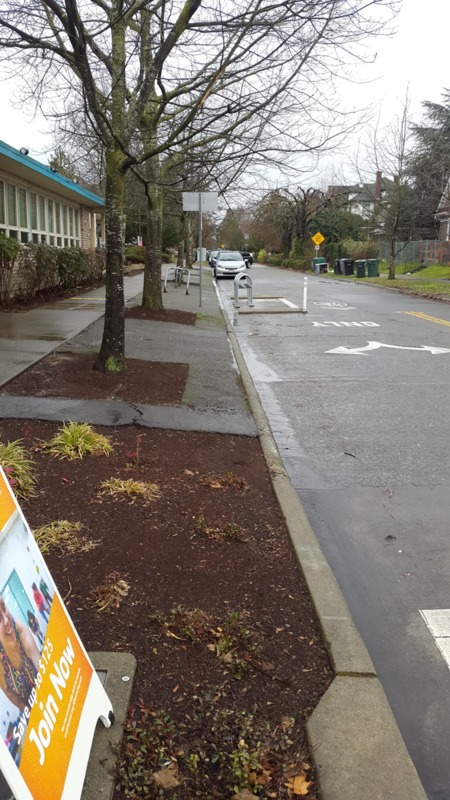
12th Ave from the corner of 50th, showing the bike infrastructure and YMCA on the left, along the residential street
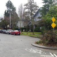
Block 63, or the block between 50th and 52nd Street and 11th and 12th Avenues, is a fairly sleepy block of the U District. 11th Avenue is the northbound pair of Roosevelt Avenue, carrying 2 lanes of traffic, a bike lane, and a bus stop. The street appeared to have been widened at some point in the past, and stands in stark contrast to 12th Ave, with its speed bumps and cars parked on one side, leaving a skinny area for cars to pass. This dichotomy between the residential and urban street design persists on the Streets as well, with 50th serving a more pivotal urban role than 52nd’s smaller use, with a roundabout.
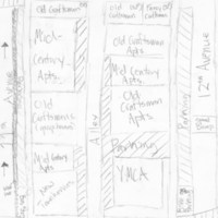
As such, Block 63 has a split personality, and serves as a sort of transitionary block between the low rise, single family blocks to the North and the high density apartments and commercial uses to the South. This dichotomy is present in the block’s most important building, the University Family YMCA on the corner of 50th and 12th. As the name implies, the center serves as a center for local families, which seems to run contrary to the common idea I had of the U District as a place for students and few else.
A block is usually best defined by its uses, and while there is no residential space, the residential uses are significantly variegated. Students still have an outsize role in the shaping of the block, as a majority of the buildings on 11th are Mid-Century apartment buildings and a few craftsman-era houses, most likely rented out to groups of tenants. However, the block shows more of its family character, as with the comparatively new townhouses on the corner of 50th and 11th, and in the single family homes on 52nd, most notably the grand, well kept 3 storey craftsman on 52nd and 12th. This house strikes me so because of how well kept up it is, with new paint and a swing on the porch, with well kept trees and sidewalk street tiles, in contrast to the drab, utilitarian apartments and streets that line most of the block.
In examining all of these surface details, I’ve come to question how my current block came to be what it is today. Most obvious, since most of the neighborhoods of Seattle are lined with craftsmen houses, what led my block to rapidly densify in the 50’s, 60’s, and 70’s? Since my block seems to be aimed at car centric uses, what existed and shaped my block before the car had ultimate dominance of our streets, and how specifically was it reshaped? And, since 50th and 52nd are on slight inclines, did they used to lead to a stream, and could that have shaped why my block is not developed beyond its current uses? To find out all of these answers, I will need to consult old maps, development plans, topographical records, census statistics, newspaper articles, and old rental classifieds to find out why my block has turned into what it is today, and how that history will shape it into the future.


