|
Jan 17, 2006
Log by Jennifer Glass
(lick on images for a larger look)
Fernandina
Island
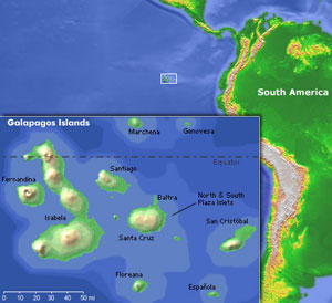
, the one I’m studying, is the westernmost island in the Galapagos. The NWFRZ comes right off its northwest corner.

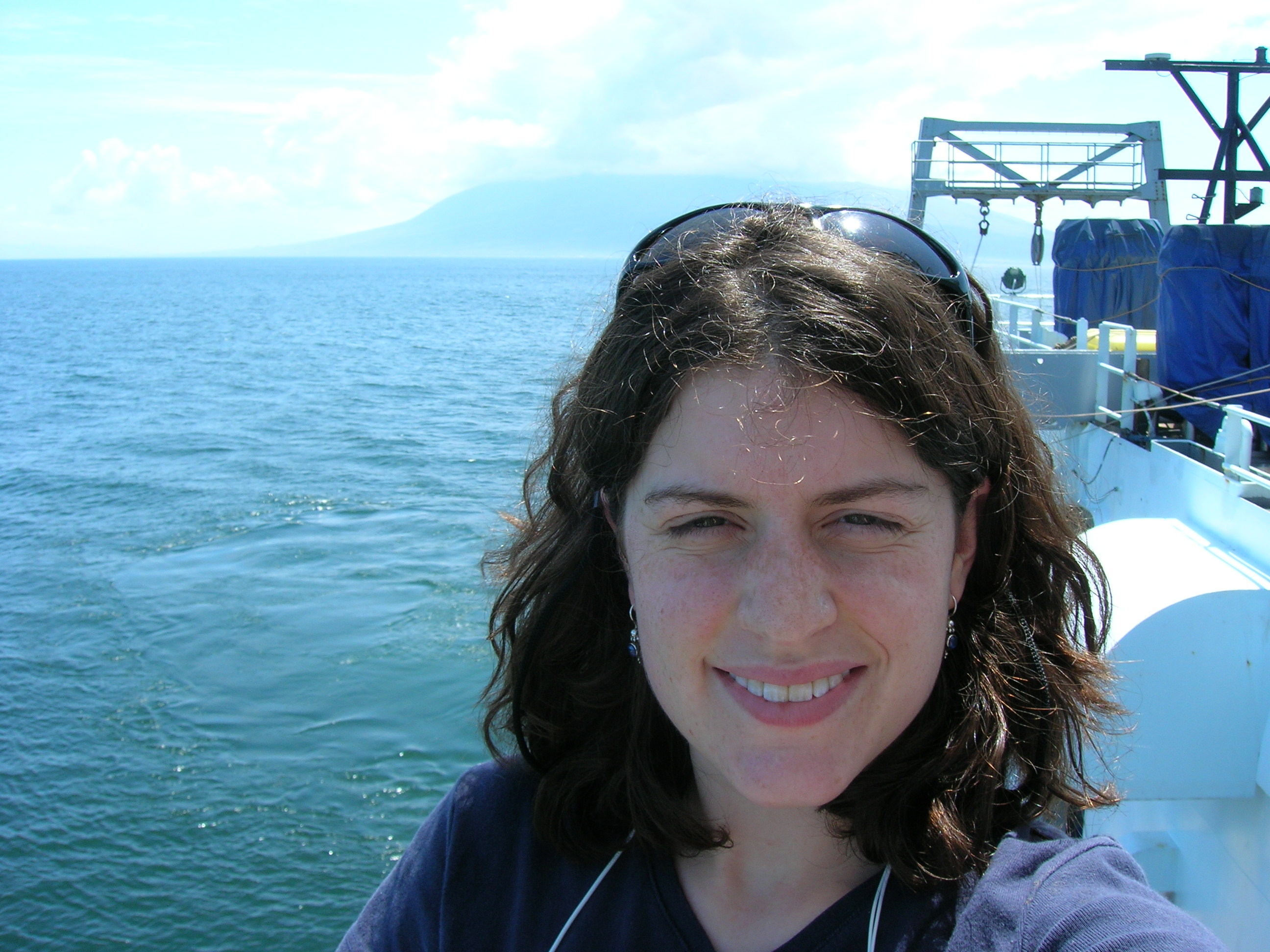
Me in front of
Fernandina
Island
.

Marine tech Rob Hagg has been a huge help on this project.
Advisor Mark Holmes with the brand-new magnetometer.
Mapping the seafloor is a bit like mowing the lawn.
Some tricky ship maneuvers were needed to execute these track lines. This maneuver is called the “Farmer’s Turn.” Can you guess why?
This map was produced about 10 years ago. It shows
Fernandina
Island
the NWFRZ, but is only 1000 meter scale.

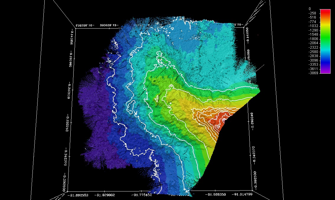
Here’s our brand-new map (generated Jan 17, 2006) with 100 meter contours and plotted at 45 meter resolution.

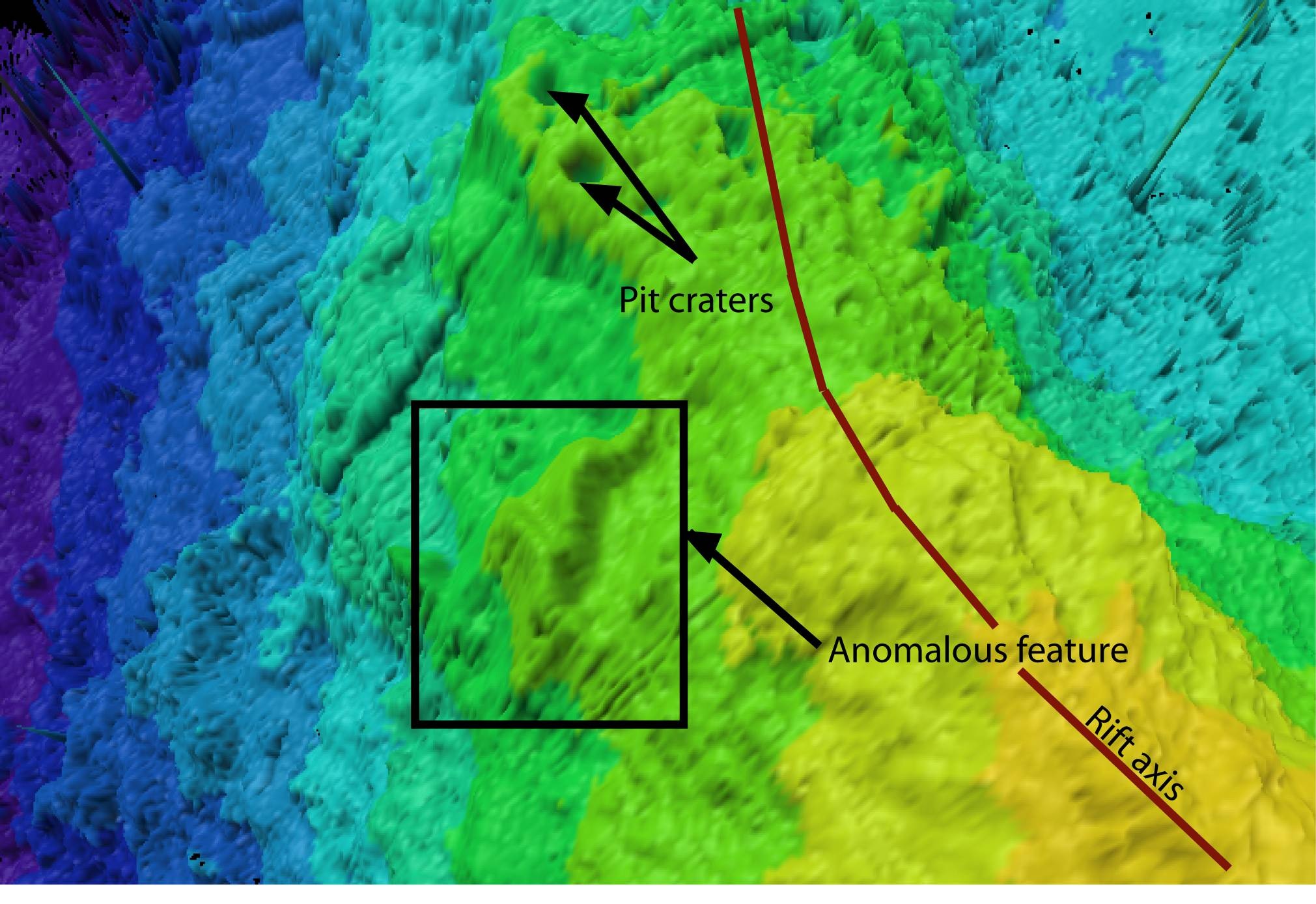
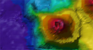
A close-up of the middle-deep section of the rift zone showing volcanic features we can identify and also those that are currently of unknown origin and need further study.
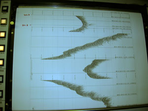
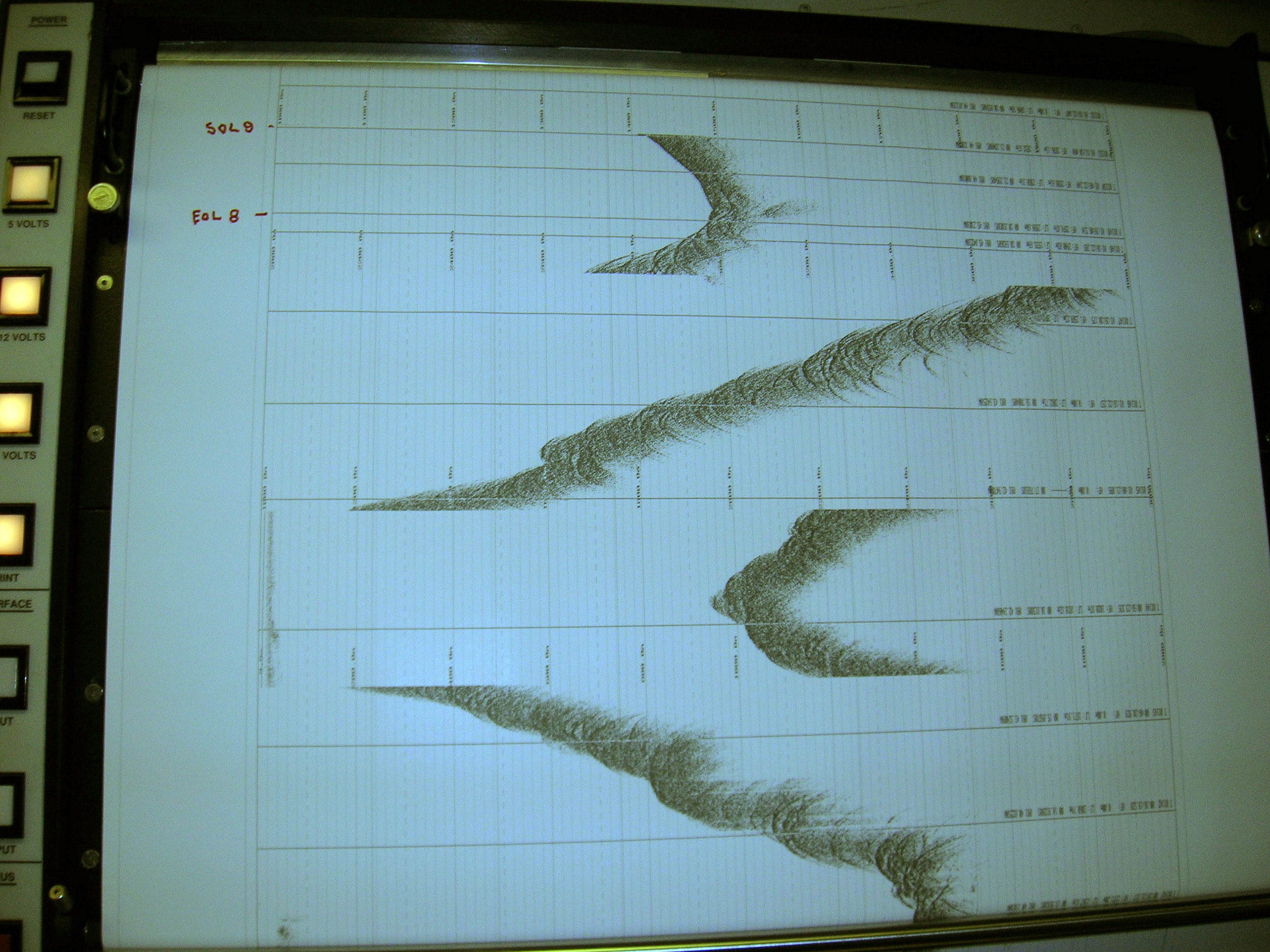
The sub-bottom profiler produced this detailed profile of the ridge axis.
|
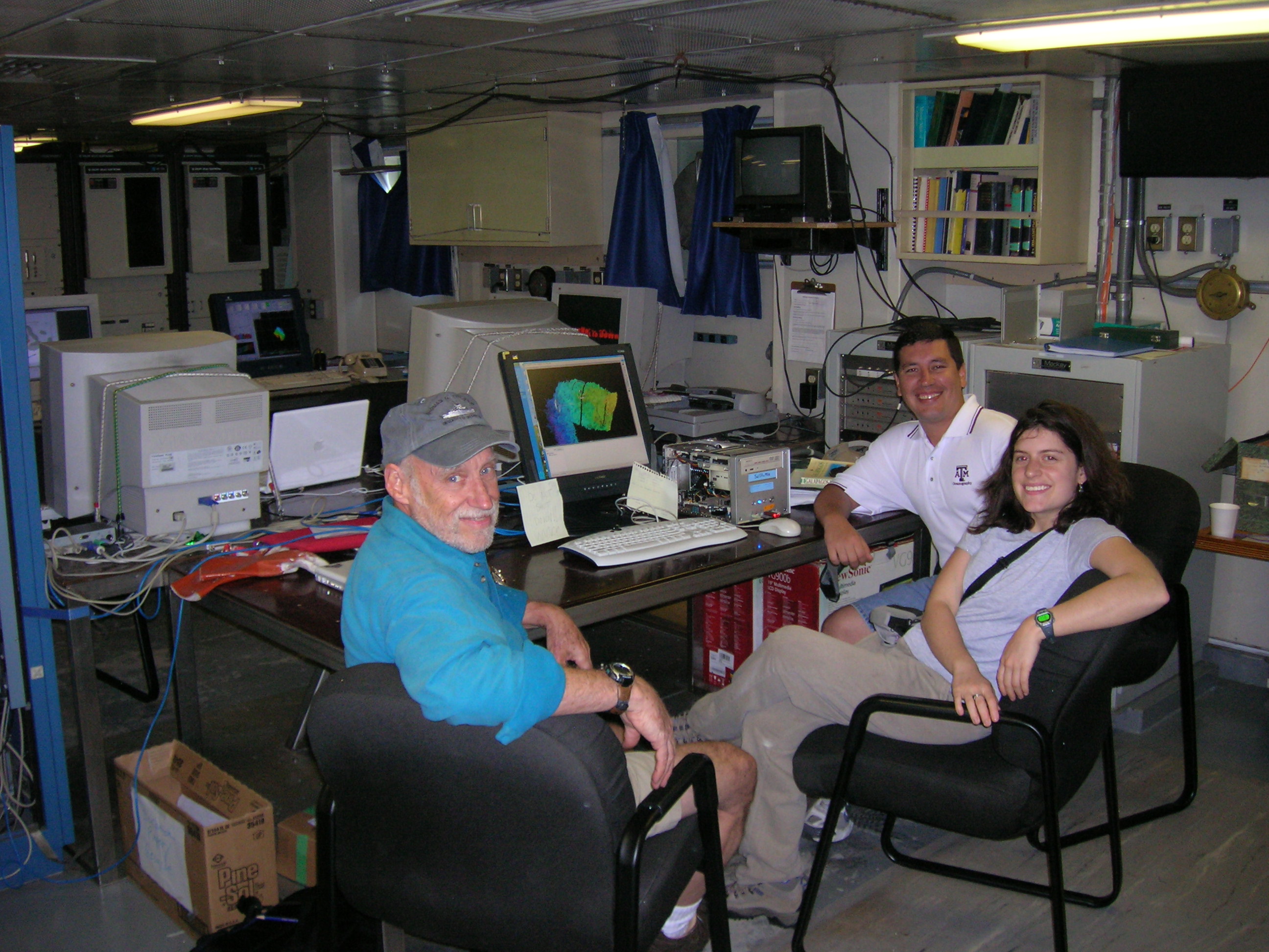
Hello and welcome to the UW Oceanography 444 Leg 1 cruise blog! My name is Jennifer Glass, and I’m a UW senior and double major in Earth and Space Sciences and Oceanography. January 17th was a busy day for me here on the Thompson in the Galapagos, because it was the day – after three months of waiting! – that I got a chance to collect data for my project. My project involves mapping a volcanic ridge off the northwestern corner of the westernmost island in the Galapagos, Fernandina. I’m lucky to have on board with me my UW advisor Mark Holmes and collaborator Giorgio de la Torre, a lieutenant in the Ecuadorian navy with a Master’s in geophysical mapping. Also essential to this project are the marine techs (who really do all the work while we get to sit at the computer screen and look at the cool maps!) and my Woods Hole Oceanographic Institution advisor, Daniel Fornari, an expert in submarine volcanic ridges.

Advisor Mark Holmes, Jen Glass and collaborator Giorgio de la Torre looking at Fledermaus files.
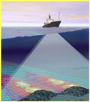
Why am I interested in mapping this ridge in particular? The “NW Fernandina Rift Zone” (or NWFRZ, the current acronym until we find a better name, see below for naming-contest details) is believed to be located right above the most active part of the Galapagos Hot Spot, the thermal anomaly in the Earth’s mantle and crust that creates this volcanic island chain. My goal is to generate a high-resolution map of this ridge and identify volcanic features that signal to me what stage of development the rift zone is currently undergoing.
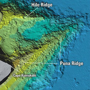
In order to understand what’s going on under the surface of the NWFRZ, it’s useful to compare this rift with better-studied examples around the world. Off of the eastern
shore
of
Kilauea
is a very long, straight ridge called the Puna Ridge, which has been well-studied by many scientists for the past 50 years. This ridge contains volcanic features like flat-topped submarine cones, thought to be related to long-lived lava flows with low gas contents. How does the NWFRZ compare with Puna Ridge? What can we learn from the bathymetry of this ridge about the volcanic processes operating under its surface?
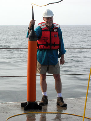
Additionally, we are quite lucky to have a brand-new magnetometer on the ship with us. This magnetometer, which is towed behind the ship only about 50 meters below the surface, is sensitive enough that it can measure the magnetic strength of the rocks thousands of meters below it. We’re using this magnetometer to ask the question: what does the magnetic signal of the lava tell us about the heat content of the rock?
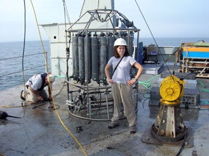
Me with CTD used to calibrate EM300 sound velocity.
After waking up at 4 am to start my scheduled watch on the ship (4-8 am and pm), I monitored data collection of a CTD cast down to 3250 m to collect a sound velocity profile in the region I was planning to map. On the ship we use a multi-beam sonar system called EM300 for submarine bathymetric mapping, but this needs to be calibrated with the correct sound velocity profile of the ocean because the data collection depends on accurate sound velocity measurements.
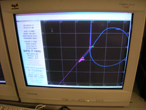
By 7:30 am we were underway on the tracks I had laid out to follow. In many ways, mapping the seafloor with the EM300 multibeam sonar is like mowing the lawn. As the ship moves over the seafloor, a swath of sonar is beamed out below it and collects bathymetry data. Just like mowing the lawn, it’s essential to make sure the swaths overlap as the ship returns on the next line. The captain and crew did an excellent job keeping the ship on target following the lines I’d laid out. They also executed complicated turning maneuvers to maximize the swath width of data we collected.
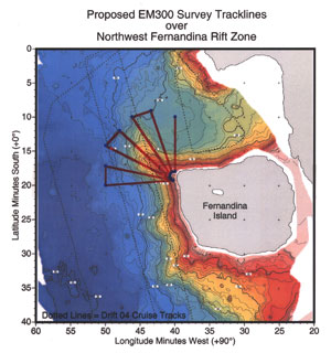
I laid my mapping tracks so that they would overlap as much as possible. This design turned out to be the most efficient.
By 10:30 pm we’d finally finished mowing the lawn (quite a large lawn, eh?). We were able to take the raw data the EM300 had collected and transfer it into another file type, called “.xyz” (only latitude, longitude and depth) and then import it into another software program called Fledermaus, which is a great interactive program for viewing bathymetric maps.
The resulting maps (mapped here at 45 meter resolution) are 20 x higher resolution than those constructed 10 years ago, and 2 x higher resolution than those constructed 5 years ago. Thanks to technology advantages, we are now getting higher and higher resolution images of the seafloor.
What do we see when we zoom in on the volcanic features of the ridge? There are abundant pit craters (volcanic cones with craters, or – less scientifically speaking – “pits” in the center) on the deeper portion of the rift. These are interpreted in most submarine volcanic ridge settings to have originated as vertical eruptive vents propagating upwards to the surface from a volcanic dike underlying the ridge. The dike which underlies NWFRZ likely came from the magma chamber under Fernandina Island, and the evidence of the presence of this dike indicates that the NWFRZ may be in the middle stages of rift zone formation, which the development of an intrusive core. There is another prominent feature about half-way down the ridge on the western side, which may be related to tectonic activity like faulting, but which currently is unidentified (anybody have any ideas? E-mail jglass@thompson.ocean.washington.edu (til Jan 20) or jglass@u.washington.edu thereafter).
Along with processing and analyzing the EM300 data, we monitored the data coming from the sub-bottom profiler on the ship and saw beautiful cross-sections of the ridge axis. We also collected the magnetometer data and noticed a general trend of lower magnetic strength (in nano-Teslas) on the axis of the rift zone compared to the deeper basin readings. This may indicate warmer rock on the axis than the surrounding area. Perhaps there has been fairly recent volcanism on the rift zone? This may well be, since the
island
of
Fernandina
is the most volcanically active in the Galapagos Archipelago and the NWFRZ is likely to be quite active.
What’s next? Well, first of all we need to name this rift – “NWFRZ” is boring! We’re having a contest onboard the ship to generate the best name – we’d like to name it something related to Galapagos geology or biology. Please help us!!! Send submissions by Jan 20 (Friday) mid-day to jglass@thompson.ocean.washington.edu. After we have a name and I’m back in
Seattle
, the data processing begins. Giorgio de la Torre (back in
Guayaquil
,
Ecuador
) and I will both be poring over the bathymetry, backscatter (a measure of the type of substrate, lava or sediment) and magnetometer data and we’ll try to learn as much as possible about this rift. Please visit my web-site (http://students.washington.edu/jglass) to see how I’m progressing.

Please join our naming contest to replace “NWFRZ” with a better name!!
|