Site Report #2: Environmental History

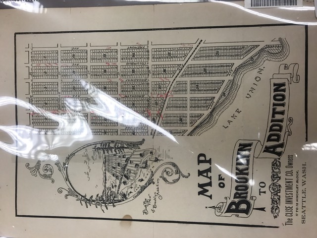
A topographical map from 1890 depicting the plans for the Brooklyn addition to the University District block structure. Published by Close Investment Company, created 1890(?).

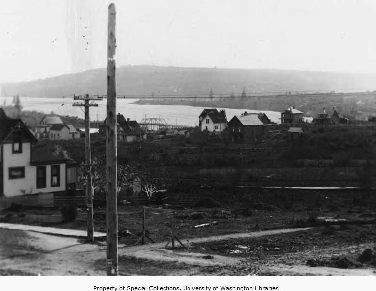
A photograph of the view looking south on 43rd St and Brooklyn avenue in 1905. The land looks undeveloped and Lake Union can be seen in the far background. From Seattle Photograph Collection, circa 1905.

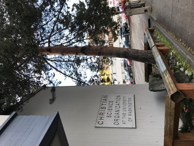
Tree growing steadily by the Christian Science Organization. Is it there as a preserved item from before urban development? Personal photograph by Alisa Kean, 2017.
![Plate 2/ use map [1923 zoning] Plate 2/ use map [1923 zoning]](http://courses.washington.edu/hstaa208/files/fullsize/f38b574235c85dda3124eb9f865a38df.jpg)
This topographical zoning map from 1923 displays an area of my block and looking at the legend provided it is clear that Block 23 had been used and considered part of the "Business District". Provided by Seattle Municipal Archives Map Index, from 1923.
I had a relatively hard time finding topographical maps of my block that gave away the key natural features of the area before urban development came into play. What I did find was a map from when there were plans to create the Brooklyn Street Addition to the University District and got a good look at the grid structure that currently exists at the cross sections streets by my block. I also consulted a larger overview of the entire University District topographical map that had a similar layout to the first topographical map. Based on the Univer-City reading by Nielsen, I have discovered that what is shown as Beacon St. on the map is the current NE 42nd street, and what is Federal St on the map is the current NE 41st street. Additionally, Broadway on the map is the current Brooklyn and Columbus is the current University Way (Nielsen, 8). In general, it looks like the blocks were created in a grid-like structure starting from Lake Union, and I wonder if the urban development was influenced by this natural feature being in existence at all. Were the shops there in a grid like structure to make for a retail area or suburban living? I wish I had a photograph from before the plans of further development so that I could take a look at why the urban structure is created this way around the lake.
I was taking a look at an intriguing photo from 1905 to see if there were any other hints to the natural state of my block before urban development began. What I found was a photo of 43rd street and Brooklyn Ave, looking south towards Lake Union. This street is not part of my block but taking a look at this photo, it is clear it is looking south towards my block. I’m not exactly sure what direction or angle this photograph aims at but from what I can see this looks like mostly residential living plus a lot of empty garden-looking land. My takeaway here is that before the urban planning of retail shops on my block began, it was a blank canvas of random houses and small land plots with nothing much on it. Establishing the street life later on would make sense here, as it is in close proximity to the University where students, faculty, and visitors alike would be present.
Taking a walk around my block it was somewhat difficult to pick out signs of the pre-urban landscape and current natural process. I believe the design and urban nature of this block has been paved and repaved multiple times, thus covering up anything that was evidence of pre-1900 landscape. There is, however, evidence of more recent natural elements making their way into the current urban picture. The brick wall that presently encompasses the Starbucks on University Way NE and NE 42nd street shows signs of grass and moss coming up through the cracks of the sidewalk and the wall. As expressed earlier, before urban planning occurred there was nothing but blank “backyard”-esque landscape. The elements of natural life can be seen fighting to appear in what is now a very urbanized building. Another aspect of the current natural process I discovered was a tree growing out of the rocks next to the Christian Science Organization building on University Way NE and NE 41st street. I’m unsure of the aging process of this tree – it could be a tree planted relatively recently. It seems to be preserved in a wooden fencing, though, which makes me think that there is something of significance to this tree. Could it be that its originations are from before the current Christian Science Organization was built and they are hoping to preserve it? Was the landscape of this block mostly trees prior to the establishment of many local businesses? Taking a look at various natural elements of the landscapes simply leads me to ask more questions about historical context of my block and is guiding the path towards other historical discoveries I will make in later Site Reports.
