Site Report 2

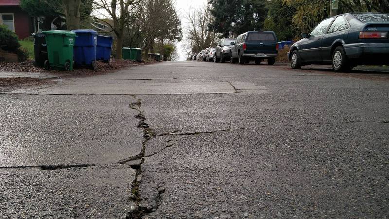
Crack along 12th Ave from tree roots pushing through and weather damage.

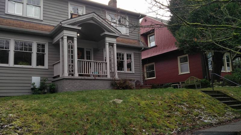
The U District is defined by many hills and as such there are many buildings built on top of uneven grounding. Here is an example of a house that preferred to build their house on top of the slope and using the height to separate their yard from the street, rather than flatten the land.

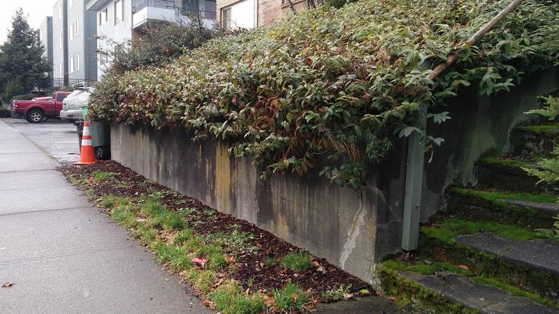
Similar to the previous image, this is a house on top of a piece of land that is elevated from the sidewalk which is in general at a higher elevation than the street across from it.
ENVIORNMENTAL HISTORY
-------
Seattle was officially founded in 1851 by the Denny Party who had just begun to explore and settle on the thin strip of land. According to UniverCity by Roy Nielsen the University District use to be a village names Brooklyn and that “the District was a lowland forest of giant trees. . . except on a little meadow just north of Lake Union. . . Except for many small ups and downs, the contour of the District probably was much as it is now” (1).
According to various maps between 1841 and late 1800’s (I was unable to find a topographical map of the region of where my block is because even the Greenlake area wasn’t surveyed until the late 1850’s so I took a general map of WA state and compared it with later maps to see differences) the area surrounded by block was uninhabited by settlers and was heavily forested. Running through the lower and Eastern University District was a small stream, but it did not run through my block. My block is set slightly higher than the areas surrounding it and along 12th has more young trees than along Brooklyn which might indicate that the surrounding land was very hilly and that it was slightly flattened to accommodate housing.
During the 1850’s the area my block is on was most likely inhabited by Native American as they settled further north once settlers came to Pioneer Square and filled in the pond/lake which was a source of their food. This natural topography of mild hills and thick trees might have made it difficult to build grid like houses on this area without flattening some of the land, though the trees would have provided ample material to build houses here or even begin a business as milling was a large part of the Seattle economy at this time. According to the 1890 Eshelman, Llewellyn & co. image, the Heights district was already built up and had small streets running through it which means that trees were cleared for materials and space as well. Aside from mass deforestation, there were no other effects on the natural landscape that I could find, however Greenlake was altered in order to maintain its water depth.
At the present site, there are no longer copious amounts of trees like there used to be. Most trees planted along the side walk seem to be around 50+ years old (not very old) and they can be found along 12th Ave. What is interesting is that on the other side of 12th, you will see much older trees that may be more than 100 years old. Much of the street on both 12th and 11th have large cracks from tree roots pushing up, and you can see various patched areas. On 11th, there is an especially large pot hole on the side of the road, and there are many vines and moss growing up the sides of old buildings. Most houses are also built above the street level and on hills of dirt where you have to walk up steps to arrive at the door. There are also various drains from differing companies along 12th and 11th, and the oldest electric pole seems to be around 2012. This is evidence of the natural state of he block because before late 1800's this land used to be hilled forests.
-------
Brief History of Seattle: https://www.seattle.gov/cityarchives/seattle-facts/brief-history-of-seattle
Seattle Greenlake History: http://www.seattlegreenlaker.com/history/