Site report 3

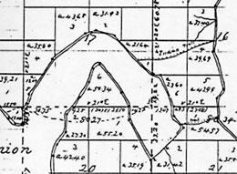
Survey map, dotted lines indicates the Indian trails that cross between the two lakes.

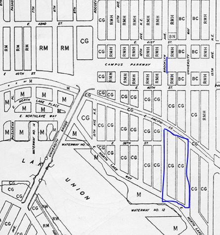
Zoning map from 1960
The first known people to live on my block Brooklyn Ave. NE and 15th Ave NE, NE Pacific St. and NE Boat St. were Native Indians, the portage bay was home to the hah-choo-ahbsh people. There was an Indian Trail that was located at Portage Bay water near Brooklyn Ave that was connected to Lake Union. The trail linked two Indian communities, these areas were used to gather food and important necessities.In 1883 the trail was torn in order to move logs through the body of water and later on for ships to be able to get through the lake. Not sure what happened to the Native Indians but the construction on my block destroyes their land. No artifacts or evidence of the Native have been found.
I do know prior to 1960 my block was a commercial, residential, and urbanized area. Because the amount of students attending this school was increasing the university’s development in the 1960’s planned to change this block for academic and service purposes to benefit the students. These changes were both sudden and gradual, some of these buildings were built a couple years after 1960 and some were built after 30 years. The Agua Verde Paddle Club was the one of the earliest buildings, constructed in 1936, the marine sciences (sea grant) building in 1966, ocean research building in 1996, and fisheries building in 1999. These were all constructed before 2001, although I couldn’t find what year the portage bay garage was constructed I know it was after 2001 so it is fairly new. Today there are no residential buildings, only academic along with a parking garage and parking lot.
