Site Report 2: Environmental History

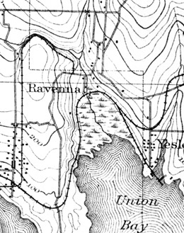
An 1894 topographical map of the Ravenna neighborhood, where the block between Roosevelt Way and 11th Avenue are located. This block was located on a gradual slope as indicated by the topography of 1894. Map of Ravenna (1894), Courtesy of Seattle Public Library.

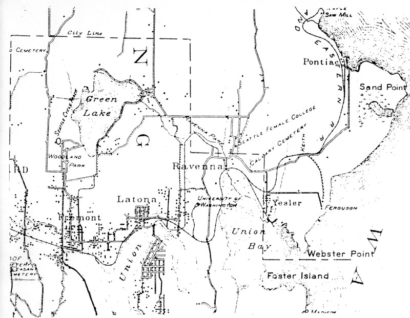
R.H. McKee's Correct Road Map of Seattle depicts the University District in 1894. The black dots are indicative of population clusters. Notice the Ravenna negihborhood is where the block of Roosevelt Way NE and 11th Ave NE, would be considered part of prior to the development of the Roosevelt neighborhood in the University District in the 1910s. (1894). Unversity of Washington Libraries, Maps Collection.

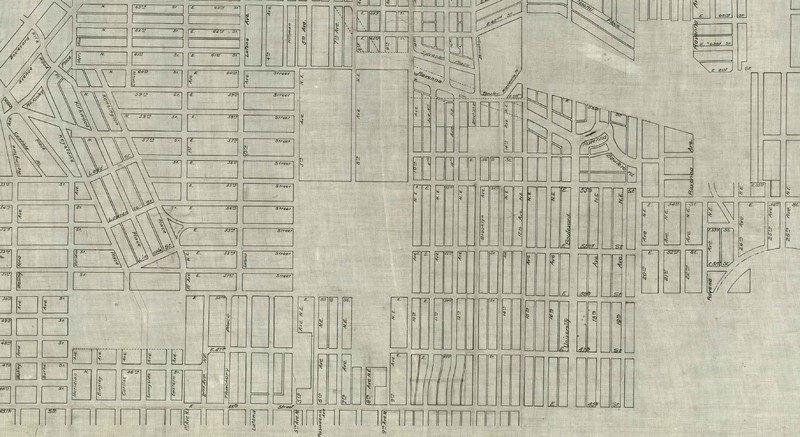
City Map of Northern Seattle in 1900. This shows the fast development of the University District in the immeditate aftermath of the University of Washington's move to the area in 1895. (1900), Courtesy of the Seattle Municipal Archives, Map Collection.

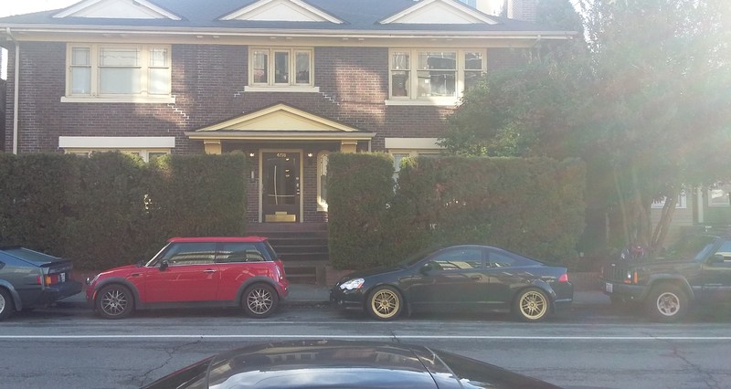
A view of a pair of large bushes in front of a residence on 11th Avenue NE, alongside a tree located directly southward. (January 22nd, 2017). Taken by Nicholas Kaley. Photograph.
It was not an easy task to discover the natural history of block 54 between Roosevelt Way NE and 11th Avenue NE, and from 50th Street NE to 47th St. NE, prior to 1850. I was unable to find any substantial environmental map of the area prior to 1894, but I did find some interesting information on the historical landscape of the University District before European-American settlement of Seattle in 1851. According to the Historic Survey Report of the U-District from the city of Seattle in 2002, the area of the University District was once heavily forested, with a little meadow just north of Lake Union[1] (Pg. 7). The topography as represented in the 1894 maps of Seattle, has remained almost exclusively the same, with no extensive regrading being done in the area even with the mass influx of population over the last century and a half, meanwhile there is a slight slope to the southwest[2] (Pg. 1). The lack of regrading is most likely due to the relatively flat nature of the neighborhood of Ravenna where my block is located in. Northwest of my block, there is a small hill that runs along 50th St. NE from Roosevelt towards 9th Ave. NE, but I have not found that this has relevancy towards the development of the block. There were trees in the area of block 54 before European-Americans settled in the U-District, the Maple and Evergreen trees that grew in the area, until they were presumably cut down sometime before 1884, which was the furthest back I could find infrastructure and buildings on the block[3] (Sanborn Fire Maps). Perhaps because of the lack of trees or a significant slope on the block, this was an ideal area for urban and commercial development to take place. According to Roy G. Nielsen, who did an extensive history of the University District in the 1980s, tells a fascinating tale of how in 1903 UW Professor Meany conducted an interview with the last of the Union Bay Indians who lived on Portage Bay, and they told him of the game such as “bear, elk and deer” in the area, as well as other sources indicating wolves, cougars among other animals inhabited the region naturally. The Natives also told Meany of “the common fern which gave them bread, and the black-berries, and salmonberries” that also grew in the area for food[4] (Nielsen, Pg. 2). Through urbanization and commercialization of the University District, came the large spread abandonment of these animals as well as the stifling of plant and food growth on a wide scale as there is no presence of berry bushes nor while animals on my block today.
With the influx of more people and businesses, came more development in the University District. Early property owners according to the same Historic Survey Report of the U-District in 2002, held 80 acres apiece north of what is now 45th street. These men were: Morton Hunter (1870), Thomas Emerson (1882), Edgar Bryan (1883), and Pope and Talbot (1866)[5] (Tobin/Sodt, Pg. 8). The major factor in the early development and urbanization of the University District, was the move of the University of Washington from its original downtown location to its current area east of 15th Ave and south of 45th street in 1895 along with the Alaska-Yukon-Pacific Exposition at UW in 1909. As shown by the map of 1900 in northern Seattle, in a span of 5 years the streets of the University District developed significantly, in particular the area north of 45th Street where my block resides. Meanwhile, I can assume that more of the natural environment, (soil, trees, brushes) that were located on the block was removed to make space for urban development.
Today, there are a set of bushes located in front of a residence on 11th avenue, and directly next to these tall, grassy bushes, is a tree – one of many that surround the entire block from 11th Ave to Roosevelt Way and all along 47th and 50th street – perhaps these are all evidence of the early and natural setting of the area before urbanization. These trees all appear to be significantly aged, and even if they are not from the period prior to settlement, they could have been planted in the early stages of the University District development. These bushes could be another example of an old residence with some long history on the block, and the bushes could have been around for just as long. The streets are paved and in quite good condition considering the amount of traffic and activity that takes place along the block. Overall, the “natural” state of the block has been long gone for quite some time, most likely since the start of the 20th century.
[1] Tobin, Caroline, and Sarah Sodt. University District Historic Survey Report. Rep. Seattle, WA: Seattle Department of Neighborhoods, 2002. Print.
[2] Nielsen, Roy G. UniverCity: A City within a City, the Story of the University District in Seattle. Seattle, WA: U Lions Foundation, 1986. Print.
[3] Microform. Sanborn Fire Insurance Maps 1884, 1904-1905 (1884, 1904-1905): reel 10.
[4] UniverCity, Nielsen. Pg. 2.
[5] University District Historic Survey Report. Pg. 8.
