Site Report 2: An Environmental History

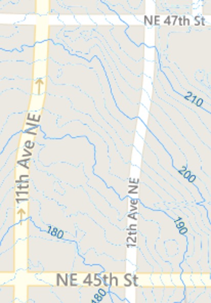
Figure 1: It appears that these topographical lines match the same lines of another map (reference Site Report 3, Figure 1). Thus the geological landscpare of my block has not changed over time. Seattle Department of Construction and Inspections. 2010.

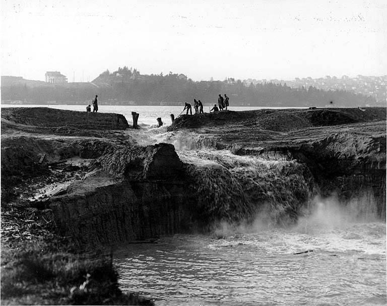
Figure 3: An image showing workers cutting away the cofferdam at the Montlake Cut between Lake Washington and Lake Union. University District (Seattle, WA). Taken 1913. University of Washington Libraries, Digital Collection (Seattle, WA)

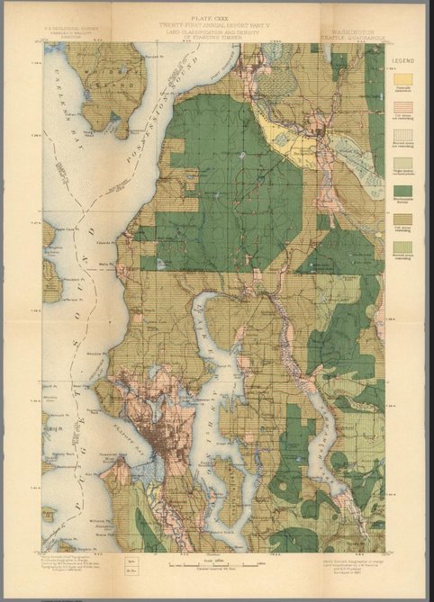
Figure 2: A topographical map of Puget Sound that higlights the type of forest on lands. Created by Gannett, Henry; Walcott, Charles D. David Rumsey Historical Map Collection. 1900.

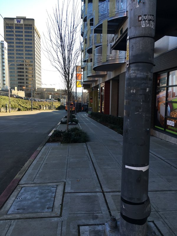
Figure 4: A view of the only green space on my block-- trees and shrubs on sidewalks. Photograph by author, 2-2-17
With vibrant greens, thick trees, flowing water, and beautiful views of multiple lakes, the University District of Seattle was once a dense forest, with abundant water sources. But overtime, the land was molded by non-native settlers. Before the 1850’s the University District was covered in lowland trees and inhabited by the Duwamish Tribe (Nielson, 1). However, in 1855, the governor of Washington signed a treaty with the Duwamish; transferring ownership land including the University District to the U.S. government. (Nielson, 2). As the city of Seattle grew, habitable areas needed to be created. The area of the University District was targeted for its proximity to water sources and Seattle. Around 1900, the clear-cut of the forest commenced (Figure 2). After the forest was removed, buildings and roads were constructed. However, at the time, there was a small river that ran from Green Lake to Union Bay. Infrastructure was erected adjacent to the river with bridges allowing people to cross. As the river entered Union Bay, wetlands formed along the bank. It appears that these wetlands and river were eventually filled and built upon. Since water transportation was pivotal to successful commerce, in 1913, the city decided to connect Lake Washington and Lake Union by digging a trench between the two bodies of water (Figure 3). This extension was known as the Montlake Cut and it allowed more travel between the far Eastside (Bellevue) and Seattle Harbors for trade and transport. These modifications of the land were pivotal to the sprawling growth of the University District in the following years.
Currently, I am unable to visibly notice the past landscape on my block. When the forest was cut and never restored, the land only became useful for construction and infrastructure thus it has been constantly developed on. My block is completely built upon with buildings or concrete. Despite being unable to identify the past natural history of my block and the area, I can scarcely identify current natural processes. There are planted trees and small shrubs tiny patches on the sidewalks (Figure 4). These sites are a small representation of the past natural landscape of my block. I do not know if they are native or not but they do reflect the forest history of the area. In addition, there are tiny grasses and bushes sprouting around a few empty buildings. This appears to be natural since the lots are empty and soon to be developed and shows the dirt is still fertile. To determine if there have been any extensive geological changes, I compared two topographical maps of my block. Both contour lines on the maps are very similar so there seems to be no intensive landscape shift on my block. Overall, the landscape of the University District has drastically shifted throughout the past 100 years due to urban growth.